Baxter elevation
Baxter (Iowa, Jasper County), United States elevation is 306 meters and Baxter elevation in feet is 1004 ft above sea level [src 1]. Baxter is a populated place (feature code) with elevation that is 27 meters (89 ft) bigger than average city elevation in United States.
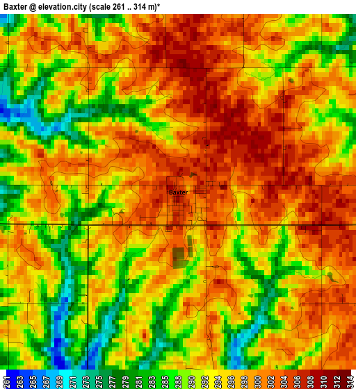
Below is the Elevation map of Baxter, which displays elevation range with different colors. Scale of the first map is from 261 to 314 m (856 to 1030 ft) with average elevation of 294.8 meters (=967 ft) [note 1]
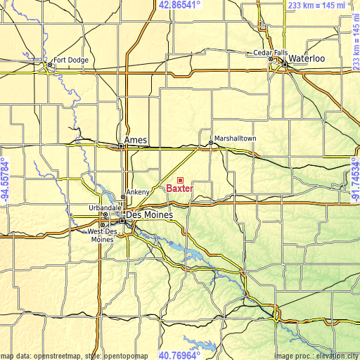
These maps also provides idea of topography and contour of this city, they are displayed at different zoom levels. More info about maps, scale and edge coordinates you can find below images.
| \ | Map #1 | Topo.Map |
| Scale [m] | 261..314 m | × |
| Scale [ft] | 856..1030 ft | × |
| Average | 294.8 m = 967 ft | × |
| Width | 7.28 km = 4.5 mi | 233 km = 144.8 mi |
| Height | 7.28 km = 4.5 mi | 233 km = 144.8 mi |
| ↑Max Latitude | 41.858838° | 42.86541° |
| Latitude at center | 41.8261° | 41.8261° |
| ↓Min Latitude | 41.793345° | 40.76964° |
| ← Min Longitude | -93.195535° | -94.55784° |
| Longitude center | -93.15159° | -93.15159° |
| →Max Longitude | -93.107645° | -91.74534° |
Nearby cities:
Cities around Baxter sort by population:
• Marshalltown elevation 289 m
32 km,  39°
39°
• Altoona 288 m
32.9 km,  232°
232°
• Newton 290 m
16.5 km,  148°
148°
• Grinnell 309 m
36.8 km,  104°
104°
• Nevada 307 m
33.1 km,  311°
311°
• Bondurant 294 m
29.3 km,  241°
241°
• Huxley 312 m
38 km,  281°
281°
• Mitchellville 293 m
24.5 km,  224°
224°
• Colfax 245 m
18.2 km,  205°
205°
• Monroe 280 m
34 km,  173°
173°
• Prairie City 279 m
26.1 km,  195°
195°
• State Center 328 m
21.2 km,  357°
357°
Multilingual:
 En español:
Baxter elevación 306 m.
 En France:
Baxter élévation 306 m.


Sources and notes:
- [note 1] Map square and city borders are not equal. Map elevation data is calculated only from area inside that square.
- [src 1] Elevation data from geonames database provided with same terms of usage.
- [src 2] The elevation map of Baxter is generated using elevation data from NASA's 3 arcsec (90m) resolution SRTM data.
- [src 3] Base (background) map © OpenStreetMap contributors tiles are generated by Geofabrik and OpenTopoMap.
Copyright & License:
This Baxter Elevation Map is licensed under CC BY-SA. You may reuse any part from this page, if you give a proper credit by linking to this URL:
 More info on terms of use page.