Windsor Locks elevation
Windsor Locks (Connecticut, Hartford County), United States elevation is 16 meters and Windsor Locks elevation in feet is 52 ft above sea level [src 1]. Windsor Locks is a populated place (feature code) with elevation that is 263 meters (863 ft) smaller than average city elevation in United States.
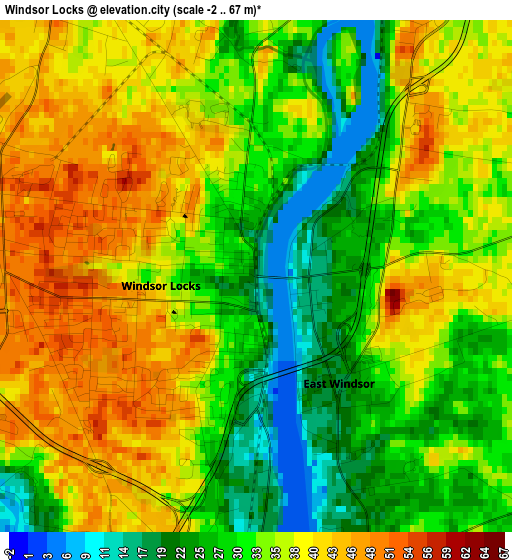
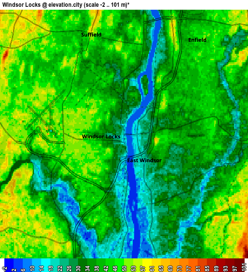
Below is the Elevation map of Windsor Locks, which displays elevation range with different colors. Scale of the first map is from -2 to 67 m (-7 to 220 ft) with average elevation of 34.2 meters (=112 ft) [note 1]
These maps also provides idea of topography and contour of this city, they are displayed at different zoom levels. More info about maps, scale and edge coordinates you can find below images.
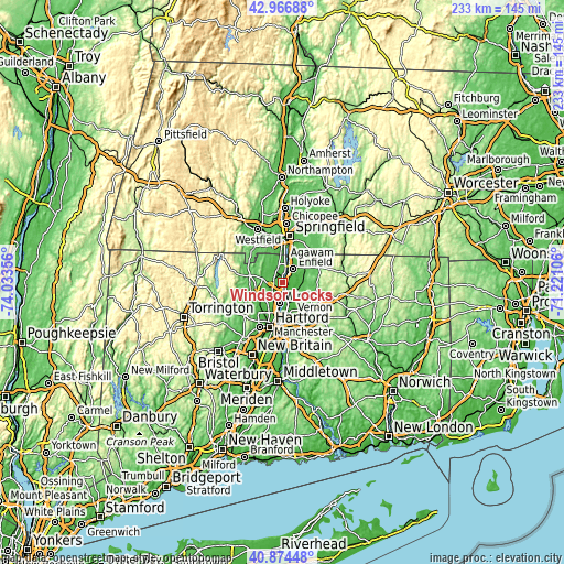
| \ | Map #1 | Map #2 | Topo.Map |
| Scale [m] | -2..67 m | -2..101 m | × |
| Scale [ft] | -7..220 ft | -7..331 ft | × |
| Average | 34.2 m = 112 ft | 38.9 m = 128 ft | × |
| Width | 7.27 km = 4.5 mi | 14.54 km = 9 mi | 232.7 km = 144.6 mi |
| Height | 7.27 km = 4.5 mi | 14.54 km = 9 mi | 232.6 km = 144.5 mi |
| ↑Max Latitude | 41.961946° | 41.994615° | 42.96688° |
| Latitude at center | 41.92926° | 41.92926° | 41.92926° |
| ↓Min Latitude | 41.896558° | 41.863838° | 40.87448° |
| ← Min Longitude | -72.671255° | -72.715201° | -74.03356° |
| Longitude center | -72.62731° | -72.62731° | -72.62731° |
| →Max Longitude | -72.583365° | -72.539419° | -71.22106° |
Nearby cities:
Cities around Windsor Locks sort by population:
• Enfield elevation 53 m
6 km,  29°
29°
• Windsor 18 m
8.6 km,  189°
189°
• South Windsor 18 m
11.7 km,  177°
177°
• Longmeadow 50 m
13.9 km,  15°
15°
• Ellington 80 m
13.3 km,  102°
102°
• Thompsonville 38 m
7.9 km, 17°
• Southwood Acres 44 m
5.9 km,  51°
51°
• Sherwood Manor 44 m
10.7 km, 29°
• Hazardville 54 m
9.4 km, 46°
• East Windsor 42 m
7.1 km,  105°
105°
• Suffield Depot 52 m
6.1 km,  342°
342°
• Tariffville 55 m
11.2 km,  258°
258°
Multilingual:
 En español:
Windsor Locks elevación 16 m.
 En France:
Windsor Locks élévation 16 m.
 Auf Deutsch:
Windsor Locks höhe über dem Meeresspiegel ist 16 m.

Sources and notes:
- [note 1] Map square and city borders are not equal. Map elevation data is calculated only from area inside that square.
- [src 1] Elevation data from geonames database provided with same terms of usage.
- [src 2] The elevation map of Windsor Locks is generated using elevation data from NASA's 3 arcsec (90m) resolution SRTM data.
- [src 3] Base (background) map © OpenStreetMap contributors tiles are generated by Geofabrik and OpenTopoMap.
Copyright & License:
This Windsor Locks Elevation Map is licensed under CC BY-SA. You may reuse any part from this page, if you give a proper credit by linking to this URL:
 More info on terms of use page.