Wethersfield elevation
Wethersfield (Connecticut, Hartford County), United States elevation is 19 meters and Wethersfield elevation in feet is 62 ft above sea level [src 1]. Wethersfield is a populated place (feature code) with elevation that is 260 meters (853 ft) smaller than average city elevation in United States.
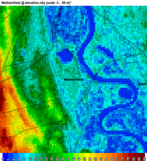
Below is the Elevation map of Wethersfield, which displays elevation range with different colors. Scale of the first map is from -3 to 89 m (-10 to 292 ft) with average elevation of 20.8 meters (=68 ft) [note 1]
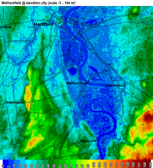
These maps also provides idea of topography and contour of this city, they are displayed at different zoom levels. More info about maps, scale and edge coordinates you can find below images.
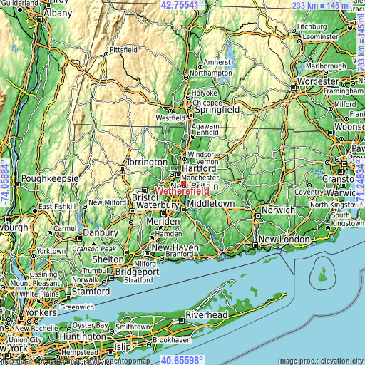
| \ | Map #1 | Map #2 | Topo.Map |
| Scale [m] | -3..89 m | -3..164 m | × |
| Scale [ft] | -10..292 ft | -10..538 ft | × |
| Average | 20.8 m = 68 ft | 35.4 m = 116 ft | × |
| Width | 7.29 km = 4.5 mi | 14.59 km = 9.1 mi | 233.4 km = 145 mi |
| Height | 7.29 km = 4.5 mi | 14.59 km = 9.1 mi | 233.4 km = 145 mi |
| ↑Max Latitude | 41.747066° | 41.779844° | 42.75541° |
| Latitude at center | 41.71427° | 41.71427° | 41.71427° |
| ↓Min Latitude | 41.681458° | 41.648629° | 40.65598° |
| ← Min Longitude | -72.696535° | -72.740481° | -74.05884° |
| Longitude center | -72.65259° | -72.65259° | -72.65259° |
| →Max Longitude | -72.608645° | -72.564699° | -71.24634° |
Nearby cities:
Cities around Wethersfield sort by population:
• Hartford elevation 27 m
6.1 km,  333°
333°
• New Britain 55 m
12.1 km,  240°
240°
• West Hartford 41 m
9.1 km,  305°
305°
• East Hartford 19 m
8.3 km,  23°
23°
• Glastonbury 19 m
3.7 km,  93°
93°
• Manchester 87 m
12.9 km,  57°
57°
• Newington 34 m
6.2 km,  252°
252°
• South Windsor 18 m
12.4 km,  12°
12°
• Cromwell 11 m
13.3 km,  177°
177°
• Kensington 26 m
13 km,  227°
227°
• Glastonbury Center 19 m
4.6 km,  108°
108°
• Blue Hills 45 m
11.6 km,  341°
341°
Multilingual:
 En español:
Wethersfield elevación 19 m.
 En France:
Wethersfield élévation 19 m.
 Auf Deutsch:
Wethersfield höhe über dem Meeresspiegel ist 19 m.

Sources and notes:
- [note 1] Map square and city borders are not equal. Map elevation data is calculated only from area inside that square.
- [src 1] Elevation data from geonames database provided with same terms of usage.
- [src 2] The elevation map of Wethersfield is generated using elevation data from NASA's 3 arcsec (90m) resolution SRTM data.
- [src 3] Base (background) map © OpenStreetMap contributors tiles are generated by Geofabrik and OpenTopoMap.
Copyright & License:
This Wethersfield Elevation Map is licensed under CC BY-SA. You may reuse any part from this page, if you give a proper credit by linking to this URL:
 More info on terms of use page.