Terryville elevation
Terryville (Connecticut, Litchfield County), United States elevation is 189 meters and Terryville elevation in feet is 620 ft above sea level [src 1]. Terryville is a populated place (feature code) with elevation that is 90 meters (295 ft) smaller than average city elevation in United States.
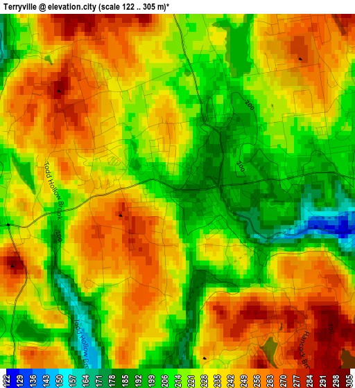
Below is the Elevation map of Terryville, which displays elevation range with different colors. Scale of the first map is from 122 to 305 m (400 to 1001 ft) with average elevation of 229.2 meters (=752 ft) [note 1]
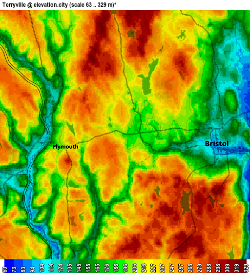
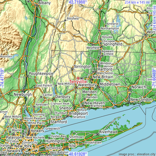
These maps also provides idea of topography and contour of this city, they are displayed at different zoom levels. More info about maps, scale and edge coordinates you can find below images.
| \ | Map #1 | Map #2 | Topo.Map |
| Scale [m] | 122..305 m | 63..329 m | × |
| Scale [ft] | 400..1001 ft | 207..1079 ft | × |
| Average | 229.2 m = 752 ft | 216.1 m = 709 ft | × |
| Width | 7.3 km = 4.5 mi | 14.6 km = 9.1 mi | 233.6 km = 145.2 mi |
| Height | 7.3 km = 4.5 mi | 14.6 km = 9.1 mi | 233.6 km = 145.2 mi |
| ↑Max Latitude | 41.710964° | 41.743761° | 42.71988° |
| Latitude at center | 41.67815° | 41.67815° | 41.67815° |
| ↓Min Latitude | 41.645319° | 41.612472° | 40.61928° |
| ← Min Longitude | -73.054885° | -73.098831° | -74.41719° |
| Longitude center | -73.01094° | -73.01094° | -73.01094° |
| →Max Longitude | -72.966995° | -72.923049° | -71.60469° |
Nearby cities:
Cities around Terryville sort by population:
• Waterbury elevation 84 m
13.8 km,  194°
194°
• Bristol 95 m
5.2 km,  97°
97°
• Torrington 169 m
16.4 km,  326°
326°
• Farmington 80 m
15.6 km,  72°
72°
• Plainville 59 m
12.7 km,  91°
91°
• Wolcott 201 m
8.7 km,  166°
166°
• Plymouth 213 m
3.5 km,  258°
258°
• Oakville 166 m
11.3 km,  213°
213°
• Watertown 181 m
12 km,  228°
228°
• Northwest Harwinton 295 m
12.4 km, 332°
• Bethlehem Village 275 m
16.5 km, 255°
• Thomaston 120 m
5.2 km, 264°
Multilingual:
 En español:
Terryville elevación 189 m.
 En France:
Terryville élévation 189 m.
 Auf Deutsch:
Terryville höhe über dem Meeresspiegel ist 189 m.

Sources and notes:
- [note 1] Map square and city borders are not equal. Map elevation data is calculated only from area inside that square.
- [src 1] Elevation data from geonames database provided with same terms of usage.
- [src 2] The elevation map of Terryville is generated using elevation data from NASA's 3 arcsec (90m) resolution SRTM data.
- [src 3] Base (background) map © OpenStreetMap contributors tiles are generated by Geofabrik and OpenTopoMap.
Copyright & License:
This Terryville Elevation Map is licensed under CC BY-SA. You may reuse any part from this page, if you give a proper credit by linking to this URL:
 More info on terms of use page.