Salem elevation
Salem (Connecticut, New London County), United States elevation is 110 meters and Salem elevation in feet is 361 ft above sea level [src 1]. Salem is a populated place (feature code) with elevation that is 169 meters (554 ft) smaller than average city elevation in United States.
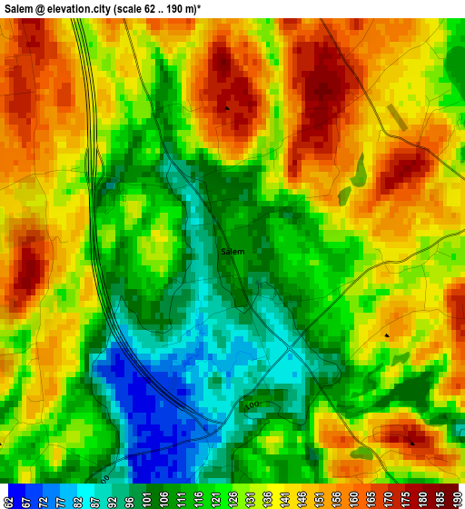
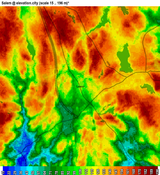
Below is the Elevation map of Salem, which displays elevation range with different colors. Scale of the first map is from 62 to 190 m (203 to 623 ft) with average elevation of 128.7 meters (=422 ft) [note 1]
These maps also provides idea of topography and contour of this city, they are displayed at different zoom levels. More info about maps, scale and edge coordinates you can find below images.
| \ | Map #1 | Map #2 | Topo.Map |
| Scale [m] | 62..190 m | 15..196 m | × |
| Scale [ft] | 203..623 ft | 49..643 ft | × |
| Average | 128.7 m = 422 ft | 125.4 m = 411 ft | × |
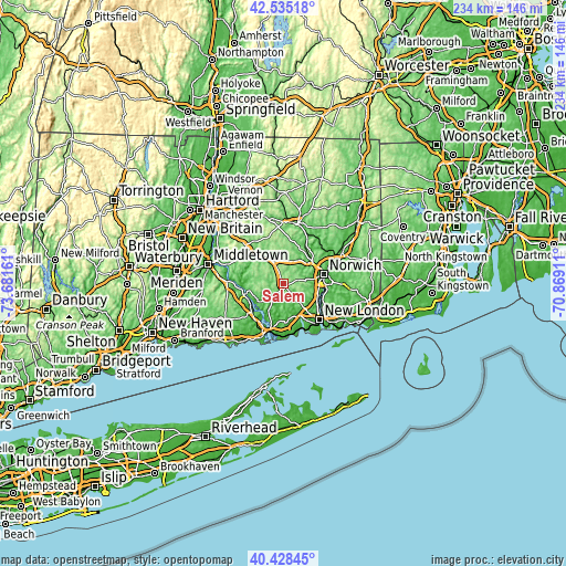
| Width | 7.32 km = 4.5 mi | 14.64 km = 9.1 mi | 234.2 km = 145.5 mi |
| Height | 7.32 km = 4.5 mi | 14.64 km = 9.1 mi | 234.2 km = 145.5 mi |
| ↑Max Latitude | 41.52329° | 41.556183° | 42.53518° |
| Latitude at center | 41.49038° | 41.49038° | 41.49038° |
| ↓Min Latitude | 41.457454° | 41.424511° | 40.42845° |
| ← Min Longitude | -72.319305° | -72.363251° | -73.68161° |
| Longitude center | -72.27536° | -72.27536° | -72.27536° |
| →Max Longitude | -72.231415° | -72.187469° | -70.86911° |
Nearby cities:
Cities around Salem sort by population:
• Norwich elevation 14 m
17 km,  77°
77°
• Montville Center 121 m
10.4 km,  96°
96°
• East Haddam 14 m
16 km,  255°
255°
• Colchester 146 m
10.6 km,  333°
333°
• Oxoboxo River 49 m
13.5 km,  112°
112°
• Niantic 11 m
19.6 km,  159°
159°
• Essex Village 21 m
17.8 km,  212°
212°
• Deep River Center 15 m
18.2 km,  228°
228°
• Chester Center 14 m
17.8 km,  236°
236°
• Uncasville 30 m
15.1 km, 114°
• Moodus 69 m
14.6 km,  275°
275°
• Gales Ferry 16 m
17.5 km, 112°
Multilingual:
 En español:
Salem elevación 110 m.
 En France:
Salem élévation 110 m.


Sources and notes:
- [note 1] Map square and city borders are not equal. Map elevation data is calculated only from area inside that square.
- [src 1] Elevation data from geonames database provided with same terms of usage.
- [src 2] The elevation map of Salem is generated using elevation data from NASA's 3 arcsec (90m) resolution SRTM data.
- [src 3] Base (background) map © OpenStreetMap contributors tiles are generated by Geofabrik and OpenTopoMap.
Copyright & License:
This Salem Elevation Map is licensed under CC BY-SA. You may reuse any part from this page, if you give a proper credit by linking to this URL:
 More info on terms of use page.