Old Mystic elevation
Old Mystic (Connecticut, New London County), United States elevation is 13 meters and Old Mystic elevation in feet is 43 ft above sea level [src 1]. Old Mystic is a populated place (feature code) with elevation that is 266 meters (873 ft) smaller than average city elevation in United States.
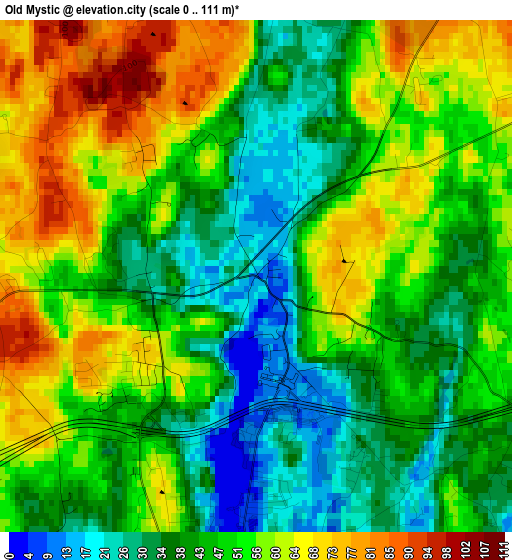
Below is the Elevation map of Old Mystic, which displays elevation range with different colors. Scale of the first map is from 0 to 111 m (0 to 364 ft) with average elevation of 48.8 meters (=160 ft) [note 1]
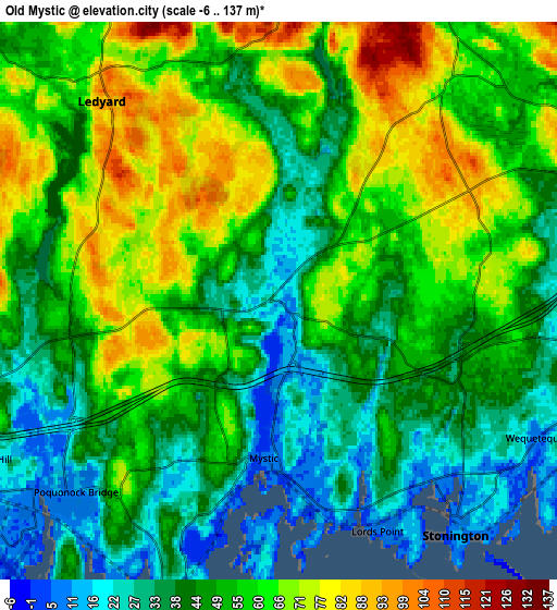
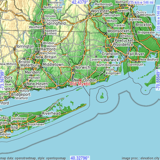
These maps also provides idea of topography and contour of this city, they are displayed at different zoom levels. More info about maps, scale and edge coordinates you can find below images.
| \ | Map #1 | Map #2 | Topo.Map |
| Scale [m] | 0..111 m | -6..137 m | × |
| Scale [ft] | 0..364 ft | -20..449 ft | × |
| Average | 48.8 m = 160 ft | 50.8 m = 167 ft | × |
| Width | 7.33 km = 4.6 mi | 14.66 km = 9.1 mi | 234.6 km = 145.8 mi |
| Height | 7.33 km = 4.6 mi | 14.66 km = 9.1 mi | 234.6 km = 145.8 mi |
| ↑Max Latitude | 41.42445° | 41.457393° | 42.4379° |
| Latitude at center | 41.39149° | 41.39149° | 41.39149° |
| ↓Min Latitude | 41.358513° | 41.32552° | 40.32796° |
| ← Min Longitude | -72.005685° | -72.049631° | -73.36799° |
| Longitude center | -71.96174° | -71.96174° | -71.96174° |
| →Max Longitude | -71.917795° | -71.873849° | -70.55549° |
Nearby cities:
Cities around Old Mystic sort by population:
• New London elevation 25 m
12.2 km,  250°
250°
• Westerly 17 m
11.3 km,  97°
97°
• Ledyard 100 m
6.9 km,  320°
320°
• Groton 28 m
10.8 km,  244°
244°
• Conning Towers-Nautilus Park 70 m
9 km,  265°
265°
• Pawcatuck 8 m
10.8 km, 98°
• Long Hill 14 m
8.6 km, 241°
• Mystic 6 m
4.2 km,  185°
185°
• Noank 16 m
7.5 km,  198°
198°
• Poquonock Bridge 9 m
7.4 km,  225°
225°
• Uncasville 30 m
13.2 km,  291°
291°
• Gales Ferry 16 m
10.9 km, 293°
Multilingual:
 En español:
Old Mystic elevación 13 m.
 En France:
Old Mystic élévation 13 m.
 Auf Deutsch:
Old Mystic höhe über dem Meeresspiegel ist 13 m.

Sources and notes:
- [note 1] Map square and city borders are not equal. Map elevation data is calculated only from area inside that square.
- [src 1] Elevation data from geonames database provided with same terms of usage.
- [src 2] The elevation map of Old Mystic is generated using elevation data from NASA's 3 arcsec (90m) resolution SRTM data.
- [src 3] Base (background) map © OpenStreetMap contributors tiles are generated by Geofabrik and OpenTopoMap.
Copyright & License:
This Old Mystic Elevation Map is licensed under CC BY-SA. You may reuse any part from this page, if you give a proper credit by linking to this URL:
 More info on terms of use page.