Glendale Heights elevation
Glendale Heights (Illinois, DuPage County), United States elevation is 227 meters and Glendale Heights elevation in feet is 745 ft above sea level [src 1]. Glendale Heights is a populated place (feature code) with elevation that is 52 meters (171 ft) smaller than average city elevation in United States.
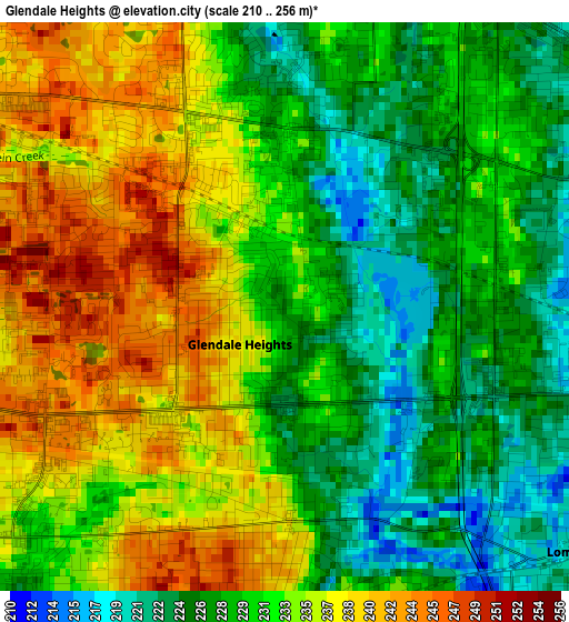
Below is the Elevation map of Glendale Heights, which displays elevation range with different colors. Scale of the first map is from 210 to 256 m (689 to 840 ft) with average elevation of 231.9 meters (=761 ft) [note 1]
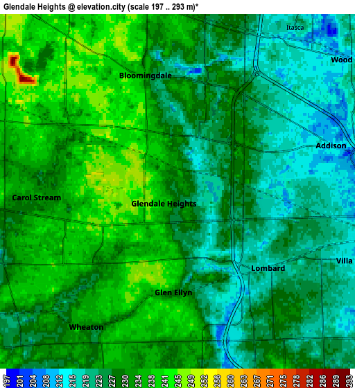
These maps also provides idea of topography and contour of this city, they are displayed at different zoom levels. More info about maps, scale and edge coordinates you can find below images.
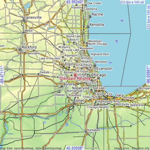
| \ | Map #1 | Map #2 | Topo.Map |
| Scale [m] | 210..256 m | 197..293 m | × |
| Scale [ft] | 689..840 ft | 646..961 ft | × |
| Average | 231.9 m = 761 ft | 229 m = 751 ft | × |
| Width | 7.27 km = 4.5 mi | 14.54 km = 9 mi | 232.7 km = 144.6 mi |
| Height | 7.27 km = 4.5 mi | 14.54 km = 9 mi | 232.7 km = 144.6 mi |
| ↑Max Latitude | 41.947293° | 41.97997° | 42.95246° |
| Latitude at center | 41.9146° | 41.9146° | 41.9146° |
| ↓Min Latitude | 41.88189° | 41.849163° | 40.85958° |
| ← Min Longitude | -88.108805° | -88.152751° | -89.47111° |
| Longitude center | -88.06486° | -88.06486° | -88.06486° |
| →Max Longitude | -88.020915° | -87.976969° | -86.65861° |
Nearby cities:
Cities around Glendale Heights sort by population:
• Wheaton elevation 233 m
6.4 km,  212°
212°
• Elmhurst 212 m
10.4 km,  99°
99°
• Lombard 224 m
6.1 km,  129°
129°
• Carol Stream 236 m
5.8 km,  267°
267°
• Addison 212 m
6.6 km,  73°
73°
• Glen Ellyn 227 m
4.1 km,  182°
182°
• Roselle 236 m
7.9 km,  351°
351°
• Bloomingdale 236 m
5 km,  344°
344°
• Villa Park 215 m
6.9 km,  113°
113°
• Wood Dale 211 m
8.9 km,  52°
52°
• Winfield 239 m
9.9 km,  233°
233°
• Itasca 218 m
8.2 km,  35°
35°
Multilingual:
 En español:
Glendale Heights elevación 227 m.
 En France:
Glendale Heights élévation 227 m.
 Auf Deutsch:
Glendale Heights höhe über dem Meeresspiegel ist 227 m.

Sources and notes:
- [note 1] Map square and city borders are not equal. Map elevation data is calculated only from area inside that square.
- [src 1] Elevation data from geonames database provided with same terms of usage.
- [src 2] The elevation map of Glendale Heights is generated using elevation data from NASA's 3 arcsec (90m) resolution SRTM data.
- [src 3] Base (background) map © OpenStreetMap contributors tiles are generated by Geofabrik and OpenTopoMap.
Copyright & License:
This Glendale Heights Elevation Map is licensed under CC BY-SA. You may reuse any part from this page, if you give a proper credit by linking to this URL:
 More info on terms of use page.