Stafford elevation
Stafford (Virginia, Stafford County), United States elevation is 57 meters and Stafford elevation in feet is 187 ft above sea level [src 1]. Stafford is a seat of a second-order administrative division (feature code) with elevation that is 222 meters (728 ft) smaller than average city elevation in United States.
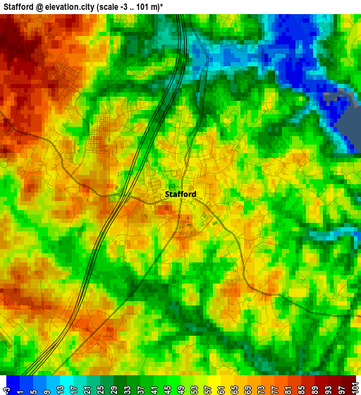
Below is the Elevation map of Stafford, which displays elevation range with different colors. Scale of the first map is from -3 to 101 m (-10 to 331 ft) with average elevation of 50.9 meters (=167 ft) [note 1]
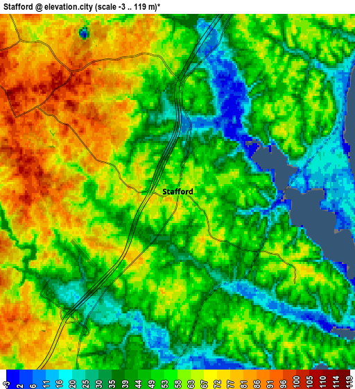
These maps also provides idea of topography and contour of this city, they are displayed at different zoom levels. More info about maps, scale and edge coordinates you can find below images.
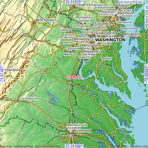
| \ | Map #1 | Map #2 | Topo.Map |
| Scale [m] | -3..101 m | -3..119 m | × |
| Scale [ft] | -10..331 ft | -10..390 ft | × |
| Average | 50.9 m = 167 ft | 53.9 m = 177 ft | × |
| Width | 7.66 km = 4.8 mi | 15.31 km = 9.5 mi | 245 km = 152.2 mi |
| Height | 7.66 km = 4.8 mi | 15.31 km = 9.5 mi | 245 km = 152.2 mi |
| ↑Max Latitude | 38.456491° | 38.490895° | 39.51538° |
| Latitude at center | 38.42207° | 38.42207° | 38.42207° |
| ↓Min Latitude | 38.387633° | 38.353179° | 37.31196° |
| ← Min Longitude | -77.452265° | -77.496211° | -78.81457° |
| Longitude center | -77.40832° | -77.40832° | -77.40832° |
| →Max Longitude | -77.364375° | -77.320429° | -76.00207° |
Nearby cities:
Cities around Stafford sort by population:
• Fredericksburg elevation 20 m
14 km,  199°
199°
• Montclair 45 m
21.8 km,  15°
15°
• Cherry Hill 18 m
20.5 km,  36°
36°
• Triangle 34 m
15.2 km, 24°
• Independent Hill 129 m
23.9 km,  353°
353°
• Aquia Harbour 10 m
4.8 km, 20°
• Dumfries 16 m
17.6 km, 23°
• Quantico Station 44 m
13.7 km, 35°
• Falmouth 16 m
12.1 km,  205°
205°
• Southern Gateway 76 m
11.9 km,  224°
224°
• Boswell's Corner 31 m
9.8 km, 18°
• Passapatanzy 63 m
16.1 km,  149°
149°
Multilingual:
 En español:
Stafford elevación 57 m.
 En France:
Stafford élévation 57 m.


Sources and notes:
- [note 1] Map square and city borders are not equal. Map elevation data is calculated only from area inside that square.
- [src 1] Elevation data from geonames database provided with same terms of usage.
- [src 2] The elevation map of Stafford is generated using elevation data from NASA's 3 arcsec (90m) resolution SRTM data.
- [src 3] Base (background) map © OpenStreetMap contributors tiles are generated by Geofabrik and OpenTopoMap.
Copyright & License:
This Stafford Elevation Map is licensed under CC BY-SA. You may reuse any part from this page, if you give a proper credit by linking to this URL:
 More info on terms of use page.