Huntington elevation
Huntington (Virginia, Fairfax County), United States elevation is 18 meters and Huntington elevation in feet is 59 ft above sea level [src 1]. Huntington is a populated place (feature code) with elevation that is 261 meters (856 ft) smaller than average city elevation in United States.
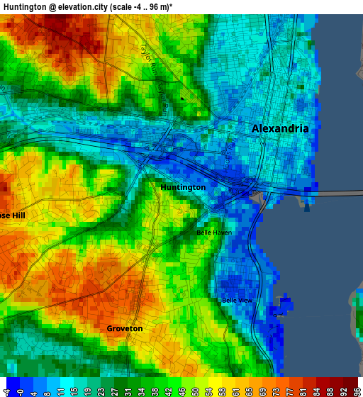
Below is the Elevation map of Huntington, which displays elevation range with different colors. Scale of the first map is from -4 to 96 m (-13 to 315 ft) with average elevation of 36 meters (=118 ft) [note 1]
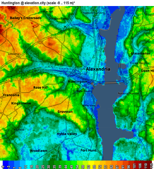
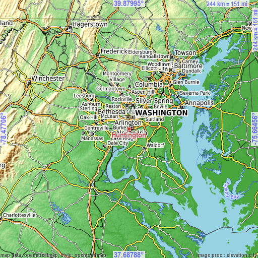
These maps also provides idea of topography and contour of this city, they are displayed at different zoom levels. More info about maps, scale and edge coordinates you can find below images.
| \ | Map #1 | Map #2 | Topo.Map |
| Scale [m] | -4..96 m | -8..115 m | × |
| Scale [ft] | -13..315 ft | -26..377 ft | × |
| Average | 36 m = 118 ft | 38.1 m = 125 ft | × |
| Width | 7.62 km = 4.7 mi | 15.23 km = 9.5 mi | 243.7 km = 151.4 mi |
| Height | 7.62 km = 4.7 mi | 15.23 km = 9.5 mi | 243.7 km = 151.4 mi |
| ↑Max Latitude | 38.826584° | 38.860811° | 39.87995° |
| Latitude at center | 38.79234° | 38.79234° | 38.79234° |
| ↓Min Latitude | 38.75808° | 38.723803° | 37.68788° |
| ← Min Longitude | -77.114755° | -77.158701° | -78.47706° |
| Longitude center | -77.07081° | -77.07081° | -77.07081° |
| →Max Longitude | -77.026865° | -76.982919° | -75.66456° |
Nearby cities:
Cities around Huntington sort by population:
• Alexandria elevation 15 m
2.5 km,  56°
56°
• Lincolnia 74 m
6.9 km,  294°
294°
• Rose Hill 70 m
3.7 km,  263°
263°
• Franconia 79 m
6.6 km, 260°
• Oxon Hill 57 m
7.1 km,  80°
80°
• Glassmanor 21 m
6.9 km, 64°
• Fort Hunt 16 m
6.7 km,  170°
170°
• Hybla Valley 10 m
5.1 km,  192°
192°
• Groveton 65 m
3 km,  203°
203°
• Belle Haven 44 m
1 km,  138°
138°
• National Harbor 15 m
5 km,  102°
102°
• Forest Heights 55 m
6.6 km,  73°
73°
Multilingual:
 En español:
Huntington elevación 18 m.
 En France:
Huntington élévation 18 m.
 Auf Deutsch:
Huntington höhe über dem Meeresspiegel ist 18 m.

Sources and notes:
- [note 1] Map square and city borders are not equal. Map elevation data is calculated only from area inside that square.
- [src 1] Elevation data from geonames database provided with same terms of usage.
- [src 2] The elevation map of Huntington is generated using elevation data from NASA's 3 arcsec (90m) resolution SRTM data.
- [src 3] Base (background) map © OpenStreetMap contributors tiles are generated by Geofabrik and OpenTopoMap.
Copyright & License:
This Huntington Elevation Map is licensed under CC BY-SA. You may reuse any part from this page, if you give a proper credit by linking to this URL:
 More info on terms of use page.