Culpeper elevation
Culpeper (Virginia, Culpeper County), United States elevation is 128 meters and Culpeper elevation in feet is 420 ft above sea level [src 1]. Culpeper is a seat of a second-order administrative division (feature code) with elevation that is 151 meters (495 ft) smaller than average city elevation in United States.
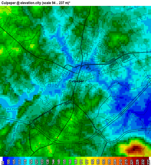
Below is the Elevation map of Culpeper, which displays elevation range with different colors. Scale of the first map is from 94 to 237 m (308 to 778 ft) with average elevation of 131.8 meters (=432 ft) [note 1]
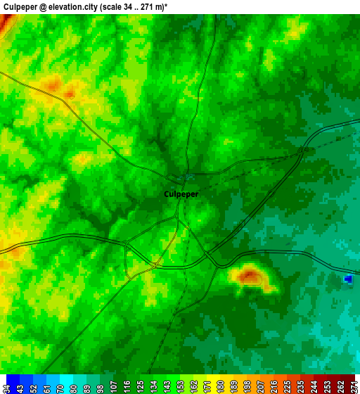
These maps also provides idea of topography and contour of this city, they are displayed at different zoom levels. More info about maps, scale and edge coordinates you can find below images.
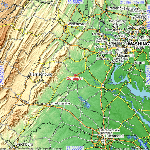
| \ | Map #1 | Map #2 | Topo.Map |
| Scale [m] | 94..237 m | 34..271 m | × |
| Scale [ft] | 308..778 ft | 112..889 ft | × |
| Average | 131.8 m = 432 ft | 129.9 m = 426 ft | × |
| Width | 7.65 km = 4.8 mi | 15.3 km = 9.5 mi | 244.8 km = 152.1 mi |
| Height | 7.65 km = 4.8 mi | 15.3 km = 9.5 mi | 244.8 km = 152.1 mi |
| ↑Max Latitude | 38.507577° | 38.541957° | 39.5657° |
| Latitude at center | 38.47318° | 38.47318° | 38.47318° |
| ↓Min Latitude | 38.438767° | 38.404338° | 37.36385° |
| ← Min Longitude | -78.040605° | -78.084551° | -79.40291° |
| Longitude center | -77.99666° | -77.99666° | -77.99666° |
| →Max Longitude | -77.952715° | -77.908769° | -76.59041° |
Nearby cities:
Cities around Culpeper sort by population:
• Warrenton elevation 196 m
31.9 km,  33°
33°
• New Baltimore 152 m
40.2 km,  35°
35°
• Orange 165 m
27.2 km,  201°
201°
• Bealeton 88 m
23 km,  61°
61°
• Merrimac 182 m
7.5 km,  252°
252°
• Gordonsville 149 m
40.9 km, 204°
• Nokesville 79 m
44.1 km, 55°
• Ruckersville 189 m
42 km,  230°
230°
• Brightwood 179 m
18.1 km, 251°
• Stanardsville 202 m
43.3 km,  243°
243°
• Madison 184 m
25 km, 245°
• Washington 209 m
30.2 km,  332°
332°
Multilingual:
 En español:
Culpeper elevación 128 m.
 En France:
Culpeper élévation 128 m.
 Auf Deutsch:
Culpeper höhe über dem Meeresspiegel ist 128 m.

Sources and notes:
- [note 1] Map square and city borders are not equal. Map elevation data is calculated only from area inside that square.
- [src 1] Elevation data from geonames database provided with same terms of usage.
- [src 2] The elevation map of Culpeper is generated using elevation data from NASA's 3 arcsec (90m) resolution SRTM data.
- [src 3] Base (background) map © OpenStreetMap contributors tiles are generated by Geofabrik and OpenTopoMap.
Copyright & License:
This Culpeper Elevation Map is licensed under CC BY-SA. You may reuse any part from this page, if you give a proper credit by linking to this URL:
 More info on terms of use page.