Burke elevation
Burke (Virginia, Fairfax County), United States elevation is 78 meters and Burke elevation in feet is 256 ft above sea level [src 1]. Burke is a populated place (feature code) with elevation that is 201 meters (659 ft) smaller than average city elevation in United States.
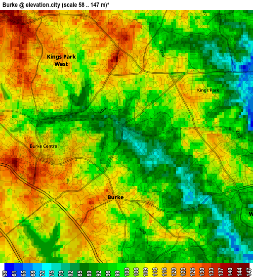
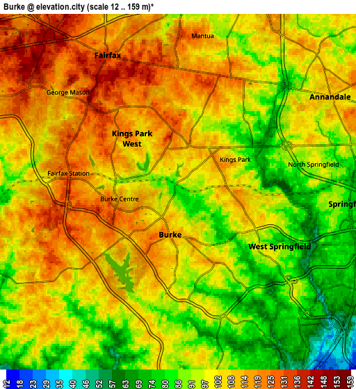
Below is the Elevation map of Burke, which displays elevation range with different colors. Scale of the first map is from 58 to 147 m (190 to 482 ft) with average elevation of 104.8 meters (=344 ft) [note 1]
These maps also provides idea of topography and contour of this city, they are displayed at different zoom levels. More info about maps, scale and edge coordinates you can find below images.
| \ | Map #1 | Map #2 | Topo.Map |
| Scale [m] | 58..147 m | 12..159 m | × |
| Scale [ft] | 190..482 ft | 39..522 ft | × |
| Average | 104.8 m = 344 ft | 100.9 m = 331 ft | × |
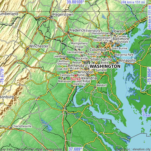
| Width | 7.62 km = 4.7 mi | 15.23 km = 9.5 mi | 243.7 km = 151.4 mi |
| Height | 7.62 km = 4.7 mi | 15.23 km = 9.5 mi | 243.7 km = 151.4 mi |
| ↑Max Latitude | 38.827693° | 38.86192° | 39.88105° |
| Latitude at center | 38.79345° | 38.79345° | 38.79345° |
| ↓Min Latitude | 38.75919° | 38.724914° | 37.689° |
| ← Min Longitude | -77.315595° | -77.359541° | -78.6779° |
| Longitude center | -77.27165° | -77.27165° | -77.27165° |
| →Max Longitude | -77.227705° | -77.183759° | -75.8654° |
Nearby cities:
Cities around Burke sort by population:
• Annandale elevation 110 m
7.7 km,  57°
57°
• Springfield 77 m
7.3 km,  93°
93°
• Fairfax 135 m
6.6 km,  332°
332°
• West Springfield 92 m
5 km,  117°
117°
• Kings Park West 122 m
3.1 km,  318°
318°
• Fairfax Station 121 m
4.7 km,  280°
280°
• Woodburn 91 m
6.7 km,  27°
27°
• North Springfield 96 m
5.9 km,  78°
78°
• Mantua 120 m
6.8 km,  8°
8°
• Laurel Hill 68 m
9.1 km,  160°
160°
• Kings Park 105 m
2.8 km, 59°
• Ravensworth 80 m
4.6 km, 75°
Multilingual:
 En español:
Burke elevación 78 m.
 En France:
Burke élévation 78 m.


Sources and notes:
- [note 1] Map square and city borders are not equal. Map elevation data is calculated only from area inside that square.
- [src 1] Elevation data from geonames database provided with same terms of usage.
- [src 2] The elevation map of Burke is generated using elevation data from NASA's 3 arcsec (90m) resolution SRTM data.
- [src 3] Base (background) map © OpenStreetMap contributors tiles are generated by Geofabrik and OpenTopoMap.
Copyright & License:
This Burke Elevation Map is licensed under CC BY-SA. You may reuse any part from this page, if you give a proper credit by linking to this URL:
 More info on terms of use page.