Whitehouse elevation
Whitehouse (Texas, Smith County), United States elevation is 148 meters and Whitehouse elevation in feet is 486 ft above sea level [src 1]. Whitehouse is a populated place (feature code) with elevation that is 131 meters (430 ft) smaller than average city elevation in United States.
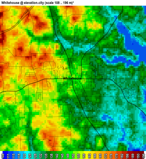
Below is the Elevation map of Whitehouse, which displays elevation range with different colors. Scale of the first map is from 108 to 196 m (354 to 643 ft) with average elevation of 146.2 meters (=480 ft) [note 1]
These maps also provides idea of topography and contour of this city, they are displayed at different zoom levels. More info about maps, scale and edge coordinates you can find below images.
| \ | Map #1 | Map #2 | Topo.Map |
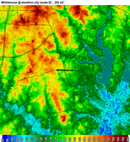
| Scale [m] | 108..196 m | 92..202 m | × |
| Scale [ft] | 354..643 ft | 302..663 ft | × |
| Average | 146.2 m = 480 ft | 142.4 m = 467 ft | × |
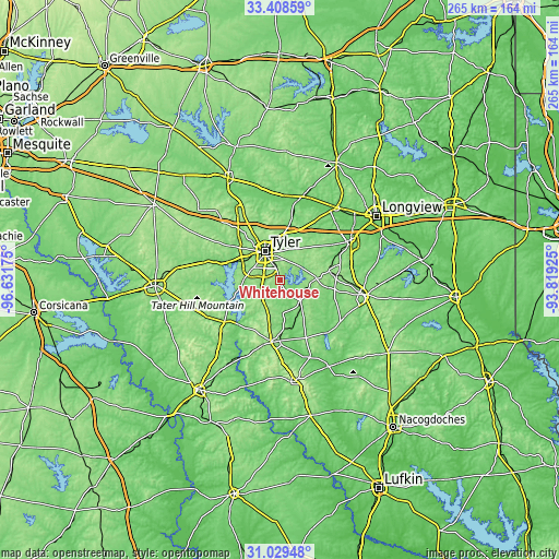
| Width | 8.27 km = 5.1 mi | 16.53 km = 10.3 mi | 264.5 km = 164.4 mi |
| Height | 8.27 km = 5.1 mi | 16.53 km = 10.3 mi | 264.5 km = 164.4 mi |
| ↑Max Latitude | 32.263988° | 32.30114° | 33.40859° |
| Latitude at center | 32.22682° | 32.22682° | 32.22682° |
| ↓Min Latitude | 32.189637° | 32.152439° | 31.02948° |
| ← Min Longitude | -95.269445° | -95.313391° | -96.63175° |
| Longitude center | -95.2255° | -95.2255° | -95.2255° |
| →Max Longitude | -95.181555° | -95.137609° | -93.81925° |
Nearby cities:
Cities around Whitehouse sort by population:
• Tyler elevation 174 m
15.6 km,  332°
332°
• Jacksonville 160 m
29.6 km,  188°
188°
• Lindale 174 m
36.5 km, 331°
• Hideaway 148 m
36.5 km,  323°
323°
• Chandler 125 m
25.6 km,  290°
290°
• Bullard 158 m
13.1 km,  222°
222°
• Overton 155 m
23.8 km,  77°
77°
• Liberty City 123 m
35.6 km,  46°
46°
• Troup 143 m
13.5 km,  132°
132°
• Frankston 133 m
32.8 km,  233°
233°
• New Summerfield 148 m
30 km,  155°
155°
• Berryville 121 m
27.8 km,  236°
236°
Multilingual:
 En español:
Whitehouse elevación 148 m.
 En France:
Whitehouse élévation 148 m.
 Auf Deutsch:
Whitehouse höhe über dem Meeresspiegel ist 148 m.

Sources and notes:
- [note 1] Map square and city borders are not equal. Map elevation data is calculated only from area inside that square.
- [src 1] Elevation data from geonames database provided with same terms of usage.
- [src 2] The elevation map of Whitehouse is generated using elevation data from NASA's 3 arcsec (90m) resolution SRTM data.
- [src 3] Base (background) map © OpenStreetMap contributors tiles are generated by Geofabrik and OpenTopoMap.
Copyright & License:
This Whitehouse Elevation Map is licensed under CC BY-SA. You may reuse any part from this page, if you give a proper credit by linking to this URL:
 More info on terms of use page.