Uhland elevation
Uhland (Texas, Caldwell County), United States elevation is 168 meters and Uhland elevation in feet is 551 ft above sea level [src 1]. Uhland is a populated place (feature code) with elevation that is 111 meters (364 ft) smaller than average city elevation in United States.
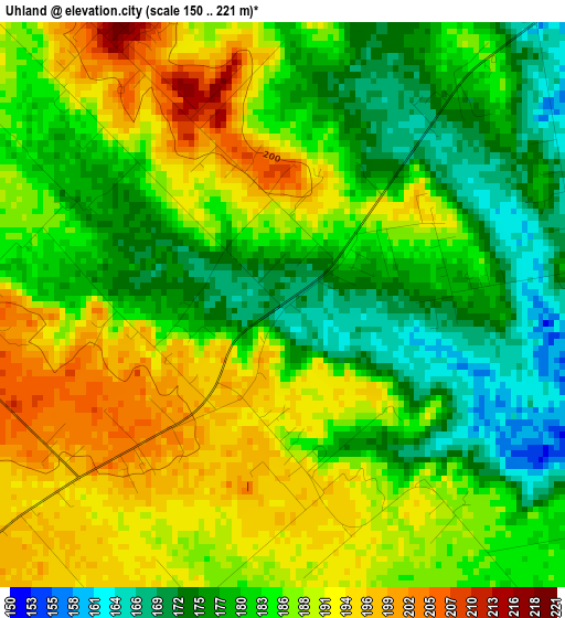
Below is the Elevation map of Uhland, which displays elevation range with different colors. Scale of the first map is from 150 to 221 m (492 to 725 ft) with average elevation of 184.3 meters (=605 ft) [note 1]
These maps also provides idea of topography and contour of this city, they are displayed at different zoom levels. More info about maps, scale and edge coordinates you can find below images.

| \ | Map #1 | Topo.Map |
| Scale [m] | 150..221 m | × |
| Scale [ft] | 492..725 ft | × |
| Average | 184.3 m = 605 ft | × |
| Width | 8.47 km = 5.3 mi | 270.9 km = 168.3 mi |
| Height | 8.47 km = 5.3 mi | 270.9 km = 168.3 mi |
| ↑Max Latitude | 29.995787° | 31.16856° |
| Latitude at center | 29.95772° | 29.95772° |
| ↓Min Latitude | 29.919639° | 28.73195° |
| ← Min Longitude | -97.830055° | -99.19236° |
| Longitude center | -97.78611° | -97.78611° |
| →Max Longitude | -97.742165° | -96.37986° |
Nearby cities:
Cities around Uhland sort by population:
• San Marcos elevation 194 m
17.1 km,  241°
241°
• Kyle 224 m
9.4 km,  291°
291°
• Buda 220 m
15.1 km,  339°
339°
• Lockhart 160 m
13.8 km,  125°
125°
• Luling 129 m
33.6 km,  156°
156°
• Shady Hollow 234 m
24.2 km, 342°
• Redwood 171 m
20.4 km,  216°
216°
• Wimberley 267 m
30.4 km,  278°
278°
• Onion Creek 184 m
19.9 km,  0°
0°
• Woodcreek 301 m
32.3 km, 284°
• Martindale 166 m
13.5 km,  202°
202°
• Manchaca 220 m
20.8 km,  347°
347°
Multilingual:
 En español:
Uhland elevación 168 m.
 En France:
Uhland élévation 168 m.


Sources and notes:
- [note 1] Map square and city borders are not equal. Map elevation data is calculated only from area inside that square.
- [src 1] Elevation data from geonames database provided with same terms of usage.
- [src 2] The elevation map of Uhland is generated using elevation data from NASA's 3 arcsec (90m) resolution SRTM data.
- [src 3] Base (background) map © OpenStreetMap contributors tiles are generated by Geofabrik and OpenTopoMap.
Copyright & License:
This Uhland Elevation Map is licensed under CC BY-SA. You may reuse any part from this page, if you give a proper credit by linking to this URL:
 More info on terms of use page.