The Colony elevation
The Colony (Texas, Denton County), United States elevation is 182 meters and The Colony elevation in feet is 597 ft above sea level [src 1]. The Colony is a populated place (feature code) with elevation that is 97 meters (318 ft) smaller than average city elevation in United States.
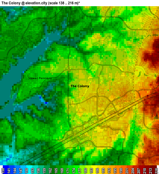
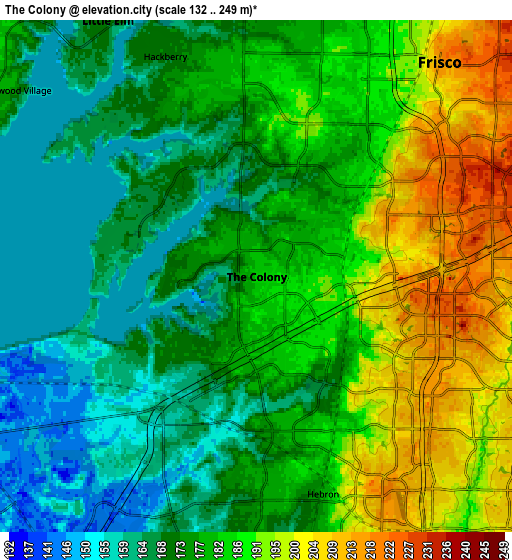
Below is the Elevation map of The Colony, which displays elevation range with different colors. Scale of the first map is from 138 to 216 m (453 to 709 ft) with average elevation of 174.8 meters (=573 ft) [note 1]
These maps also provides idea of topography and contour of this city, they are displayed at different zoom levels. More info about maps, scale and edge coordinates you can find below images.
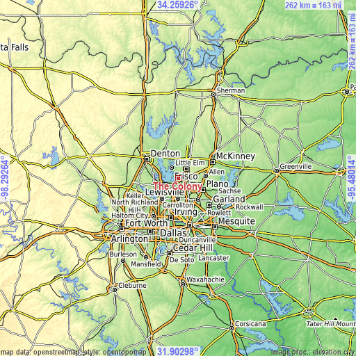
| \ | Map #1 | Map #2 | Topo.Map |
| Scale [m] | 138..216 m | 132..249 m | × |
| Scale [ft] | 453..709 ft | 433..817 ft | × |
| Average | 174.8 m = 573 ft | 179 m = 587 ft | × |
| Width | 8.19 km = 5.1 mi | 16.38 km = 10.2 mi | 262 km = 162.8 mi |
| Height | 8.19 km = 5.1 mi | 16.38 km = 10.2 mi | 262 km = 162.8 mi |
| ↑Max Latitude | 33.125821° | 33.162616° | 34.25926° |
| Latitude at center | 33.08901° | 33.08901° | 33.08901° |
| ↓Min Latitude | 33.052184° | 33.015342° | 31.90298° |
| ← Min Longitude | -96.930335° | -96.974281° | -98.29264° |
| Longitude center | -96.88639° | -96.88639° | -96.88639° |
| →Max Longitude | -96.842445° | -96.798499° | -95.48014° |
Nearby cities:
Cities around The Colony sort by population:
• Frisco elevation 216 m
9 km,  40°
40°
• Carrollton 163 m
15 km,  181°
181°
• Lewisville 161 m
11.1 km,  244°
244°
• Little Elm 169 m
9.5 km,  329°
329°
• Highland Village 174 m
14.9 km,  271°
271°
• Addison 196 m
15.1 km,  159°
159°
• Lake Dallas 181 m
13.4 km,  284°
284°
• Hickory Creek 180 m
15.1 km, 284°
• Oak Point 186 m
14.9 km,  318°
318°
• Savannah 178 m
15.4 km,  352°
352°
• Paloma Creek South 170 m
14.4 km,  341°
341°
• Hackberry 171 m
7.6 km, 337°
Multilingual:
 En español:
The Colony elevación 182 m.
 En France:
The Colony élévation 182 m.
 Auf Deutsch:
The Colony höhe über dem Meeresspiegel ist 182 m.

Sources and notes:
- [note 1] Map square and city borders are not equal. Map elevation data is calculated only from area inside that square.
- [src 1] Elevation data from geonames database provided with same terms of usage.
- [src 2] The elevation map of The Colony is generated using elevation data from NASA's 3 arcsec (90m) resolution SRTM data.
- [src 3] Base (background) map © OpenStreetMap contributors tiles are generated by Geofabrik and OpenTopoMap.
Copyright & License:
This The Colony Elevation Map is licensed under CC BY-SA. You may reuse any part from this page, if you give a proper credit by linking to this URL:
 More info on terms of use page.