Pilot Point elevation
Pilot Point (Texas, Denton County), United States elevation is 223 meters and Pilot Point elevation in feet is 732 ft above sea level [src 1]. Pilot Point is a populated place (feature code) with elevation that is 56 meters (184 ft) smaller than average city elevation in United States.
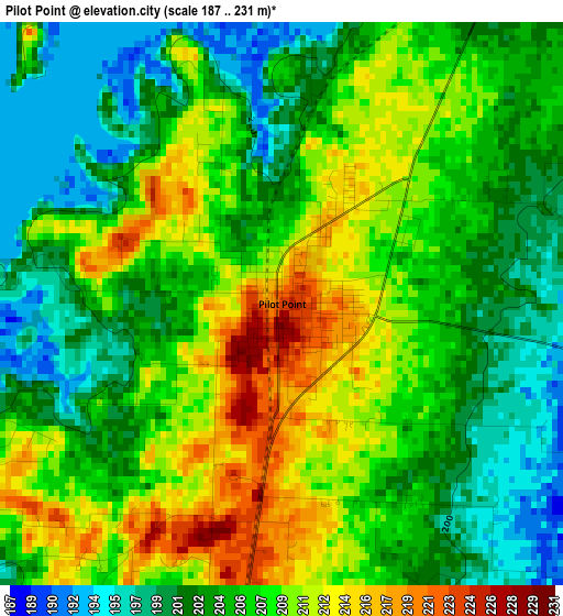
Below is the Elevation map of Pilot Point, which displays elevation range with different colors. Scale of the first map is from 187 to 231 m (614 to 758 ft) with average elevation of 206.1 meters (=676 ft) [note 1]
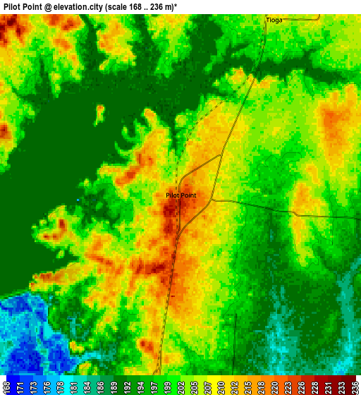
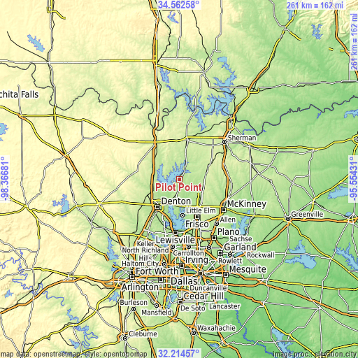
These maps also provides idea of topography and contour of this city, they are displayed at different zoom levels. More info about maps, scale and edge coordinates you can find below images.
| \ | Map #1 | Map #2 | Topo.Map |
| Scale [m] | 187..231 m | 168..236 m | × |
| Scale [ft] | 614..758 ft | 551..774 ft | × |
| Average | 206.1 m = 676 ft | 200 m = 656 ft | × |
| Width | 8.16 km = 5.1 mi | 16.32 km = 10.1 mi | 261.1 km = 162.2 mi |
| Height | 8.16 km = 5.1 mi | 16.32 km = 10.1 mi | 261.1 km = 162.2 mi |
| ↑Max Latitude | 33.433181° | 33.469847° | 34.56258° |
| Latitude at center | 33.3965° | 33.3965° | 33.3965° |
| ↓Min Latitude | 33.359803° | 33.323091° | 32.21457° |
| ← Min Longitude | -97.004505° | -97.048451° | -98.36681° |
| Longitude center | -96.96056° | -96.96056° | -96.96056° |
| →Max Longitude | -96.916615° | -96.872669° | -95.55431° |
Nearby cities:
Cities around Pilot Point sort by population:
• Sanger elevation 209 m
20.2 km,  259°
259°
• Celina 217 m
18.2 km,  116°
116°
• Providence 180 m
18.1 km,  180°
180°
• Aubrey 216 m
10.5 km,  193°
193°
• Oak Point 186 m
23.1 km, 187°
• Savannah 178 m
19.6 km,  165°
165°
• Paloma Creek South 170 m
20.7 km, 173°
• Paloma Creek 170 m
19.2 km, 173°
• Lake Kiowa 218 m
20.7 km,  346°
346°
• Collinsville 234 m
18.9 km,  14°
14°
• Krugerville 220 m
13.1 km, 192°
• Gunter 217 m
20.6 km,  73°
73°
Multilingual:
 En español:
Pilot Point elevación 223 m.
 En France:
Pilot Point élévation 223 m.
 Auf Deutsch:
Pilot Point höhe über dem Meeresspiegel ist 223 m.

Sources and notes:
- [note 1] Map square and city borders are not equal. Map elevation data is calculated only from area inside that square.
- [src 1] Elevation data from geonames database provided with same terms of usage.
- [src 2] The elevation map of Pilot Point is generated using elevation data from NASA's 3 arcsec (90m) resolution SRTM data.
- [src 3] Base (background) map © OpenStreetMap contributors tiles are generated by Geofabrik and OpenTopoMap.
Copyright & License:
This Pilot Point Elevation Map is licensed under CC BY-SA. You may reuse any part from this page, if you give a proper credit by linking to this URL:
 More info on terms of use page.