Nurillo elevation
Nurillo (Texas, Hidalgo County), United States elevation is 31 meters and Nurillo elevation in feet is 102 ft above sea level [src 1]. Nurillo is a populated place (feature code) with elevation that is 248 meters (814 ft) smaller than average city elevation in United States.
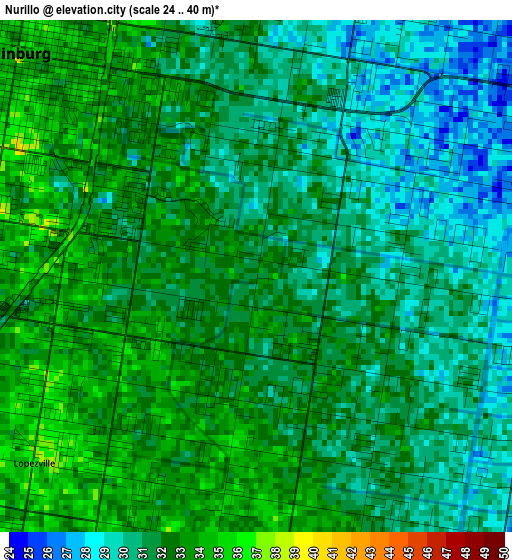
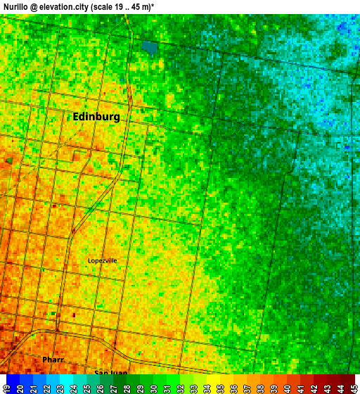
Below is the Elevation map of Nurillo, which displays elevation range with different colors. Scale of the first map is from 24 to 40 m (79 to 131 ft) with average elevation of 31.3 meters (=103 ft) [note 1]
These maps also provides idea of topography and contour of this city, they are displayed at different zoom levels. More info about maps, scale and edge coordinates you can find below images.
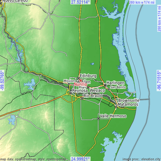
| \ | Map #1 | Map #2 | Topo.Map |
| Scale [m] | 24..40 m | 19..45 m | × |
| Scale [ft] | 79..131 ft | 62..148 ft | × |
| Average | 31.3 m = 103 ft | 30.8 m = 101 ft | × |
| Width | 8.76 km = 5.4 mi | 17.53 km = 10.9 mi | 280.4 km = 174.2 mi |
| Height | 8.76 km = 5.4 mi | 17.53 km = 10.9 mi | 280.4 km = 174.2 mi |
| ↑Max Latitude | 26.306421° | 26.345808° | 27.52114° |
| Latitude at center | 26.26702° | 26.26702° | 26.26702° |
| ↓Min Latitude | 26.227606° | 26.188178° | 24.99921° |
| ← Min Longitude | -98.165345° | -98.209291° | -99.52765° |
| Longitude center | -98.1214° | -98.1214° | -98.1214° |
| →Max Longitude | -98.077455° | -98.033509° | -96.71515° |
Nearby cities:
Cities around Nurillo sort by population:
• Edinburg elevation 35 m
5.7 km,  312°
312°
• Pharr 38 m
10.1 km,  217°
217°
• San Juan 36 m
9.3 km,  201°
201°
• Alamo 35 m
9.3 km,  181°
181°
• Murillo Colonia 33 m
1.4 km,  145°
145°
• Lopezville 36 m
5 km,  229°
229°
• North Alamo 34 m
5.6 km,  187°
187°
• San Carlos 27 m
5.9 km,  57°
57°
• Doolittle 29 m
9.6 km,  2°
2°
• La Blanca 25 m
8.8 km,  70°
70°
• César Chávez 27 m
4.1 km,  8°
8°
• Muniz 30 m
3.4 km,  110°
110°
Multilingual:
 En español:
Nurillo elevación 31 m.
 En France:
Nurillo élévation 31 m.


Sources and notes:
- [note 1] Map square and city borders are not equal. Map elevation data is calculated only from area inside that square.
- [src 1] Elevation data from geonames database provided with same terms of usage.
- [src 2] The elevation map of Nurillo is generated using elevation data from NASA's 3 arcsec (90m) resolution SRTM data.
- [src 3] Base (background) map © OpenStreetMap contributors tiles are generated by Geofabrik and OpenTopoMap.
Copyright & License:
This Nurillo Elevation Map is licensed under CC BY-SA. You may reuse any part from this page, if you give a proper credit by linking to this URL:
 More info on terms of use page.