Marble Falls elevation
Marble Falls (Texas, Burnet County), United States elevation is 248 meters and Marble Falls elevation in feet is 814 ft above sea level [src 1]. Marble Falls is a populated place (feature code) with elevation that is 31 meters (102 ft) smaller than average city elevation in United States.
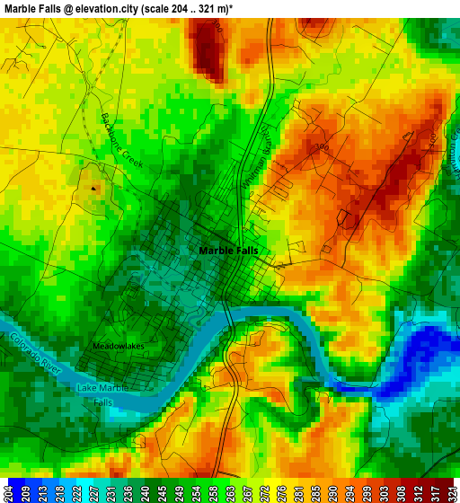
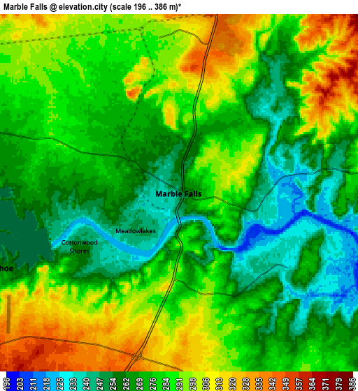
Below is the Elevation map of Marble Falls, which displays elevation range with different colors. Scale of the first map is from 204 to 321 m (669 to 1053 ft) with average elevation of 262.7 meters (=862 ft) [note 1]
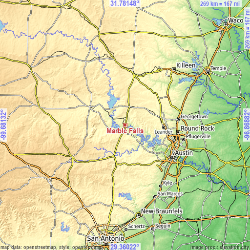
These maps also provides idea of topography and contour of this city, they are displayed at different zoom levels. More info about maps, scale and edge coordinates you can find below images.
| \ | Map #1 | Map #2 | Topo.Map |
| Scale [m] | 204..321 m | 196..386 m | × |
| Scale [ft] | 669..1053 ft | 643..1266 ft | × |
| Average | 262.7 m = 862 ft | 279.4 m = 917 ft | × |
| Width | 8.41 km = 5.2 mi | 16.83 km = 10.5 mi | 269.2 km = 167.3 mi |
| Height | 8.41 km = 5.2 mi | 16.83 km = 10.5 mi | 269.2 km = 167.3 mi |
| ↑Max Latitude | 30.616237° | 30.654048° | 31.78148° |
| Latitude at center | 30.57841° | 30.57841° | 30.57841° |
| ↓Min Latitude | 30.540569° | 30.502712° | 29.36022° |
| ← Min Longitude | -98.319015° | -98.362961° | -99.68132° |
| Longitude center | -98.27507° | -98.27507° | -98.27507° |
| →Max Longitude | -98.231125° | -98.187179° | -96.86882° |
Nearby cities:
Cities around Marble Falls sort by population:
• Lago Vista elevation 245 m
30.4 km,  115°
115°
• Burnet 396 m
20.5 km,  12°
12°
• Kingsland 258 m
18.2 km,  299°
299°
• Granite Shoals 271 m
10.5 km,  276°
276°
• Horseshoe Bay 275 m
10.2 km,  248°
248°
• Jonestown 253 m
34.9 km,  105°
105°
• Meadowlakes 249 m
2.9 km,  231°
231°
• Buchanan Dam 324 m
23.4 km,  320°
320°
• Briarcliff 236 m
29.1 km,  130°
130°
• Bertram 391 m
27.9 km,  48°
48°
• Liberty Hill 313 m
35.1 km,  74°
74°
• Cottonwood Shores 257 m
5.3 km,  241°
241°
Multilingual:
 En español:
Marble Falls elevación 248 m.
 En France:
Marble Falls élévation 248 m.
 Auf Deutsch:
Marble Falls höhe über dem Meeresspiegel ist 248 m.

Sources and notes:
- [note 1] Map square and city borders are not equal. Map elevation data is calculated only from area inside that square.
- [src 1] Elevation data from geonames database provided with same terms of usage.
- [src 2] The elevation map of Marble Falls is generated using elevation data from NASA's 3 arcsec (90m) resolution SRTM data.
- [src 3] Base (background) map © OpenStreetMap contributors tiles are generated by Geofabrik and OpenTopoMap.
Copyright & License:
This Marble Falls Elevation Map is licensed under CC BY-SA. You may reuse any part from this page, if you give a proper credit by linking to this URL:
 More info on terms of use page.