Llano Grande elevation
Llano Grande (Texas, Hidalgo County), United States elevation is 28 meters and Llano Grande elevation in feet is 92 ft above sea level [src 1]. Llano Grande is a populated place (feature code) with elevation that is 251 meters (823 ft) smaller than average city elevation in United States.
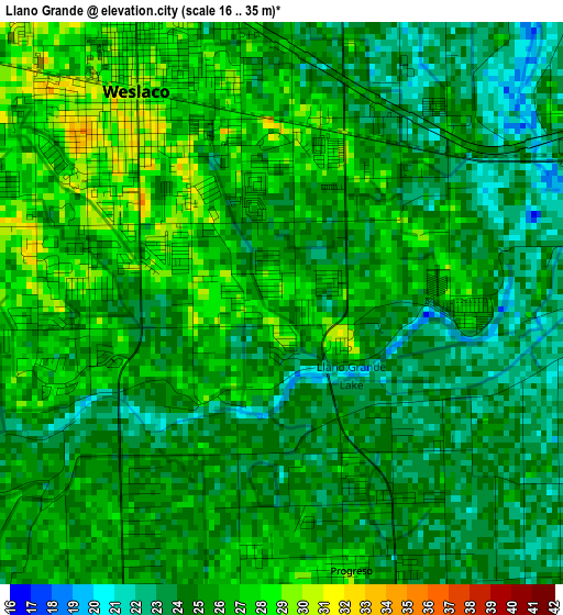
Below is the Elevation map of Llano Grande, which displays elevation range with different colors. Scale of the first map is from 16 to 35 m (52 to 115 ft) with average elevation of 24.9 meters (=82 ft) [note 1]
These maps also provides idea of topography and contour of this city, they are displayed at different zoom levels. More info about maps, scale and edge coordinates you can find below images.
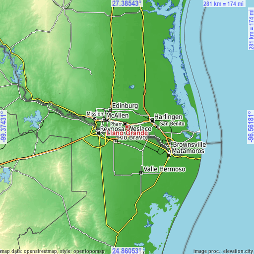
| \ | Map #1 | Topo.Map |
| Scale [m] | 16..35 m | × |
| Scale [ft] | 52..115 ft | × |
| Average | 24.9 m = 82 ft | × |
| Width | 8.77 km = 5.4 mi | 280.7 km = 174.4 mi |
| Height | 8.77 km = 5.4 mi | 280.8 km = 174.5 mi |
| ↑Max Latitude | 26.169247° | 27.38543° |
| Latitude at center | 26.1298° | 26.1298° |
| ↓Min Latitude | 26.090339° | 24.86053° |
| ← Min Longitude | -98.012005° | -99.37431° |
| Longitude center | -97.96806° | -97.96806° |
| →Max Longitude | -97.924115° | -96.56181° |
Nearby cities:
Cities around Llano Grande sort by population:
• Weslaco elevation 29 m
4 km,  325°
325°
• Mercedes 26 m
5.9 km,  67°
67°
• Donna 32 m
9.5 km,  298°
298°
• Mila Doce 23 m
10.8 km,  4°
4°
• Progreso 27 m
4.3 km,  165°
165°
• Midway North 27 m
8.1 km,  322°
322°
• Olivarez 27 m
11.2 km,  347°
347°
• South Alamo 33 m
14.4 km,  282°
282°
• Scissors 28 m
8.6 km, 277°
• Indian Hills 26 m
10.6 km,  29°
29°
• Midway South 26 m
6 km, 300°
• Heidelberg 23 m
11.5 km,  49°
49°
Multilingual:
 En español:
Llano Grande elevación 28 m.
 En France:
Llano Grande élévation 28 m.
 Auf Deutsch:
Llano Grande höhe über dem Meeresspiegel ist 28 m.

Sources and notes:
- [note 1] Map square and city borders are not equal. Map elevation data is calculated only from area inside that square.
- [src 1] Elevation data from geonames database provided with same terms of usage.
- [src 2] The elevation map of Llano Grande is generated using elevation data from NASA's 3 arcsec (90m) resolution SRTM data.
- [src 3] Base (background) map © OpenStreetMap contributors tiles are generated by Geofabrik and OpenTopoMap.
Copyright & License:
This Llano Grande Elevation Map is licensed under CC BY-SA. You may reuse any part from this page, if you give a proper credit by linking to this URL:
 More info on terms of use page.