Jollyville elevation
Jollyville (Texas, Williamson County), United States elevation is 291 meters and Jollyville elevation in feet is 955 ft above sea level [src 1]. Jollyville is a populated place (feature code) with elevation that is 12 meters (39 ft) bigger than average city elevation in United States.
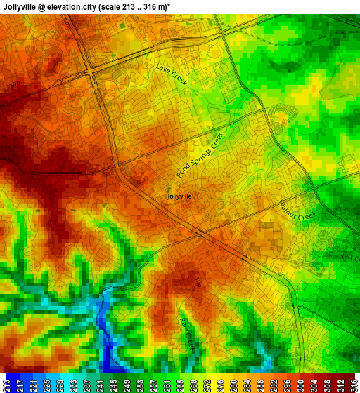
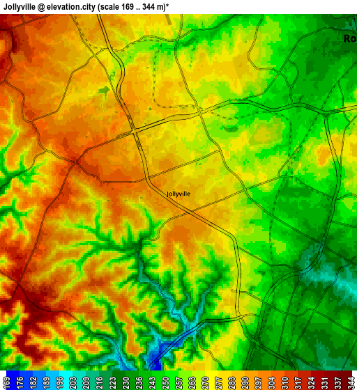
Below is the Elevation map of Jollyville, which displays elevation range with different colors. Scale of the first map is from 213 to 316 m (699 to 1037 ft) with average elevation of 275.9 meters (=905 ft) [note 1]
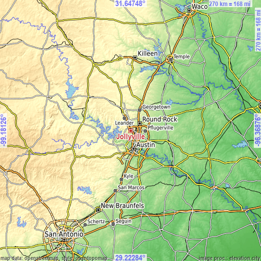
These maps also provides idea of topography and contour of this city, they are displayed at different zoom levels. More info about maps, scale and edge coordinates you can find below images.
| \ | Map #1 | Map #2 | Topo.Map |
| Scale [m] | 213..316 m | 169..344 m | × |
| Scale [ft] | 699..1037 ft | 554..1129 ft | × |
| Average | 275.9 m = 905 ft | 267.9 m = 879 ft | × |
| Width | 8.43 km = 5.2 mi | 16.85 km = 10.5 mi | 269.6 km = 167.5 mi |
| Height | 8.43 km = 5.2 mi | 16.85 km = 10.5 mi | 269.6 km = 167.5 mi |
| ↑Max Latitude | 30.480579° | 30.518444° | 31.64748° |
| Latitude at center | 30.4427° | 30.4427° | 30.4427° |
| ↓Min Latitude | 30.404806° | 30.366897° | 29.22284° |
| ← Min Longitude | -97.818955° | -97.862901° | -99.18126° |
| Longitude center | -97.77501° | -97.77501° | -97.77501° |
| →Max Longitude | -97.731065° | -97.687119° | -96.36876° |
Nearby cities:
Cities around Jollyville sort by population:
• Round Rock elevation 226 m
11.7 km,  51°
51°
• Cedar Park 278 m
8.2 km,  328°
328°
• Pflugerville 224 m
14.9 km,  91°
91°
• Leander 301 m
16.9 km, 333°
• Brushy Creek 258 m
8.6 km,  23°
23°
• Wells Branch 256 m
9.2 km, 87°
• Anderson Mill 296 m
3.3 km,  294°
294°
• Lost Creek 257 m
17.7 km,  202°
202°
• West Lake Hills 252 m
16.3 km,  189°
189°
• Hudson Bend 237 m
15.1 km,  259°
259°
• Jonestown 253 m
15.4 km, 292°
• Windemere 234 m
12.2 km,  81°
81°
Multilingual:
 En español:
Jollyville elevación 291 m.
 En France:
Jollyville élévation 291 m.
 Auf Deutsch:
Jollyville höhe über dem Meeresspiegel ist 291 m.

Sources and notes:
- [note 1] Map square and city borders are not equal. Map elevation data is calculated only from area inside that square.
- [src 1] Elevation data from geonames database provided with same terms of usage.
- [src 2] The elevation map of Jollyville is generated using elevation data from NASA's 3 arcsec (90m) resolution SRTM data.
- [src 3] Base (background) map © OpenStreetMap contributors tiles are generated by Geofabrik and OpenTopoMap.
Copyright & License:
This Jollyville Elevation Map is licensed under CC BY-SA. You may reuse any part from this page, if you give a proper credit by linking to this URL:
 More info on terms of use page.