Fresno elevation
Fresno (Texas, Fort Bend County), United States elevation is 27 meters and Fresno elevation in feet is 89 ft above sea level [src 1]. Fresno is a populated place (feature code) with elevation that is 252 meters (827 ft) smaller than average city elevation in United States.
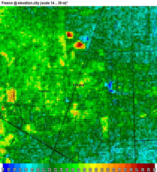
Below is the Elevation map of Fresno, which displays elevation range with different colors. Scale of the first map is from 14 to 39 m (46 to 128 ft) with average elevation of 22.8 meters (=75 ft) [note 1]
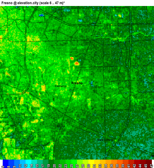
These maps also provides idea of topography and contour of this city, they are displayed at different zoom levels. More info about maps, scale and edge coordinates you can find below images.
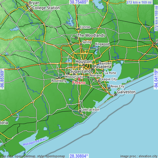
| \ | Map #1 | Map #2 | Topo.Map |
| Scale [m] | 14..39 m | 6..47 m | × |
| Scale [ft] | 46..128 ft | 20..154 ft | × |
| Average | 22.8 m = 75 ft | 22 m = 72 ft | × |
| Width | 8.5 km = 5.3 mi | 17 km = 10.6 mi | 272.1 km = 169.1 mi |
| Height | 8.5 km = 5.3 mi | 17 km = 10.6 mi | 272.1 km = 169.1 mi |
| ↑Max Latitude | 29.577076° | 29.615288° | 30.75485° |
| Latitude at center | 29.53885° | 29.53885° | 29.53885° |
| ↓Min Latitude | 29.500609° | 29.462354° | 28.30804° |
| ← Min Longitude | -95.491385° | -95.535331° | -96.85369° |
| Longitude center | -95.44744° | -95.44744° | -95.44744° |
| →Max Longitude | -95.403495° | -95.359549° | -94.04119° |
Nearby cities:
Cities around Fresno sort by population:
• Pearland elevation 17 m
15.9 km,  80°
80°
• Missouri City 26 m
12.4 km,  315°
315°
• Bellaire 22 m
18.6 km,  356°
356°
• Stafford 28 m
13.7 km,  308°
308°
• Sienna Plantation 28 m
8.3 km,  224°
224°
• Manvel 21 m
12.1 km,  134°
134°
• Meadows Place 27 m
18.5 km, 312°
• Fifth Street 28 m
12 km,  303°
303°
• Southside Place 21 m
18.6 km,  3°
3°
• Arcola 22 m
5.1 km,  200°
200°
• Brookside Village 20 m
13 km,  65°
65°
• Iowa Colony 20 m
7 km,  153°
153°
Multilingual:
 En español:
Fresno elevación 27 m.
 En France:
Fresno élévation 27 m.


Sources and notes:
- [note 1] Map square and city borders are not equal. Map elevation data is calculated only from area inside that square.
- [src 1] Elevation data from geonames database provided with same terms of usage.
- [src 2] The elevation map of Fresno is generated using elevation data from NASA's 3 arcsec (90m) resolution SRTM data.
- [src 3] Base (background) map © OpenStreetMap contributors tiles are generated by Geofabrik and OpenTopoMap.
Copyright & License:
This Fresno Elevation Map is licensed under CC BY-SA. You may reuse any part from this page, if you give a proper credit by linking to this URL:
 More info on terms of use page.