Cisco elevation
Cisco (Texas, Eastland County), United States elevation is 500 meters and Cisco elevation in feet is 1640 ft above sea level [src 1]. Cisco is a populated place (feature code) with elevation that is 221 meters (725 ft) bigger than average city elevation in United States.
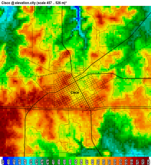
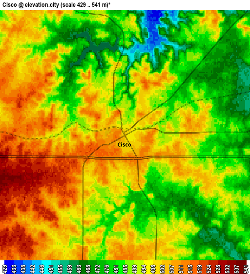
Below is the Elevation map of Cisco, which displays elevation range with different colors. Scale of the first map is from 457 to 526 m (1499 to 1726 ft) with average elevation of 497.1 meters (=1631 ft) [note 1]
These maps also provides idea of topography and contour of this city, they are displayed at different zoom levels. More info about maps, scale and edge coordinates you can find below images.
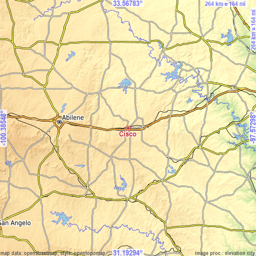
| \ | Map #1 | Map #2 | Topo.Map |
| Scale [m] | 457..526 m | 429..541 m | × |
| Scale [ft] | 1499..1726 ft | 1407..1775 ft | × |
| Average | 497.1 m = 1631 ft | 492.1 m = 1615 ft | × |
| Width | 8.25 km = 5.1 mi | 16.5 km = 10.3 mi | 264.1 km = 164.1 mi |
| Height | 8.25 km = 5.1 mi | 16.5 km = 10.3 mi | 264.1 km = 164.1 mi |
| ↑Max Latitude | 32.425291° | 32.462378° | 33.56783° |
| Latitude at center | 32.38819° | 32.38819° | 32.38819° |
| ↓Min Latitude | 32.351073° | 32.313941° | 31.19294° |
| ← Min Longitude | -99.023175° | -99.067121° | -100.38548° |
| Longitude center | -98.97923° | -98.97923° | -98.97923° |
| →Max Longitude | -98.935285° | -98.891339° | -97.57298° |
Nearby cities:
Cities around Cisco sort by population:
• Breckenridge elevation 372 m
41.5 km,  10°
10°
• Comanche 421 m
65 km,  147°
147°
• Eastland 440 m
15.3 km,  84°
84°
• Clyde 608 m
48.3 km,  272°
272°
• Dublin 453 m
68.8 km,  119°
119°
• Potosi 557 m
63.9 km,  264°
264°
• Ranger 443 m
29.6 km,  72°
72°
• De Leon 396 m
51.8 km,  126°
126°
• Albany 434 m
47.7 km,  321°
321°
• Lake Brownwood 446 m
61.5 km,  182°
182°
• Baird 524 m
39 km, 270°
• Gorman 444 m
34.9 km, 123°
Multilingual:
 En español:
Cisco elevación 500 m.
 En France:
Cisco élévation 500 m.


Sources and notes:
- [note 1] Map square and city borders are not equal. Map elevation data is calculated only from area inside that square.
- [src 1] Elevation data from geonames database provided with same terms of usage.
- [src 2] The elevation map of Cisco is generated using elevation data from NASA's 3 arcsec (90m) resolution SRTM data.
- [src 3] Base (background) map © OpenStreetMap contributors tiles are generated by Geofabrik and OpenTopoMap.
Copyright & License:
This Cisco Elevation Map is licensed under CC BY-SA. You may reuse any part from this page, if you give a proper credit by linking to this URL:
 More info on terms of use page.