Calvert elevation
Calvert (Texas, Robertson County), United States elevation is 104 meters and Calvert elevation in feet is 341 ft above sea level [src 1]. Calvert is a populated place (feature code) with elevation that is 175 meters (574 ft) smaller than average city elevation in United States.
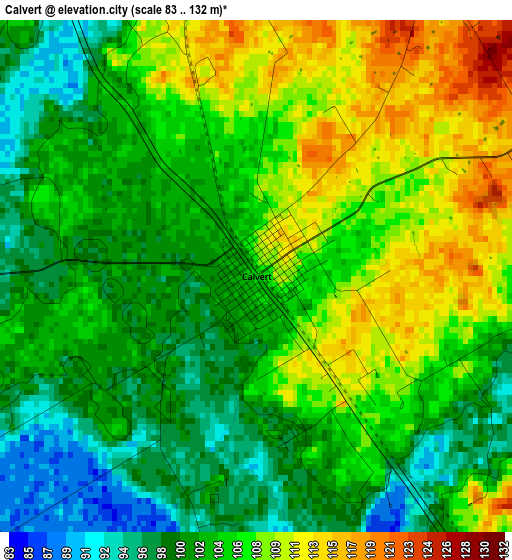
Below is the Elevation map of Calvert, which displays elevation range with different colors. Scale of the first map is from 83 to 132 m (272 to 433 ft) with average elevation of 104.1 meters (=342 ft) [note 1]
These maps also provides idea of topography and contour of this city, they are displayed at different zoom levels. More info about maps, scale and edge coordinates you can find below images.
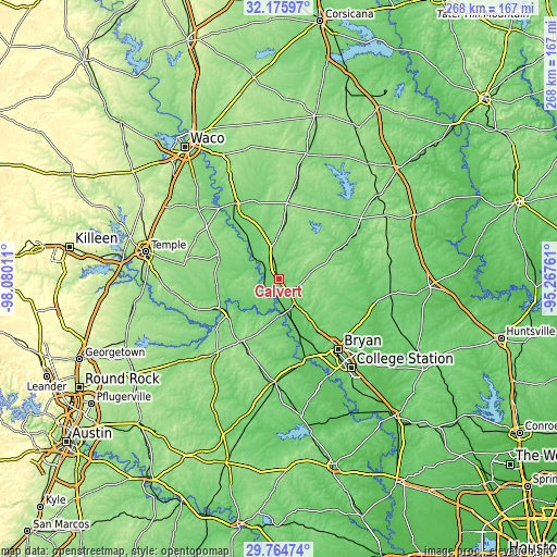
| \ | Map #1 | Topo.Map |
| Scale [m] | 83..132 m | × |
| Scale [ft] | 272..433 ft | × |
| Average | 104.1 m = 342 ft | × |
| Width | 8.38 km = 5.2 mi | 268.1 km = 166.6 mi |
| Height | 8.38 km = 5.2 mi | 268.1 km = 166.6 mi |
| ↑Max Latitude | 31.01564° | 32.17597° |
| Latitude at center | 30.97797° | 30.97797° |
| ↓Min Latitude | 30.940285° | 29.76474° |
| ← Min Longitude | -96.717805° | -98.08011° |
| Longitude center | -96.67386° | -96.67386° |
| →Max Longitude | -96.629915° | -95.26761° |
Nearby cities:
Cities around Calvert sort by population:
• College Station elevation 107 m
50.6 km,  140°
140°
• Bryan 116 m
44.5 km, 139°
• Marlin 126 m
42.3 km,  329°
329°
• Rockdale 146 m
47.6 km,  221°
221°
• Cameron 127 m
32.1 km,  244°
244°
• Hearne 92 m
13.5 km,  145°
145°
• Caldwell 123 m
49.7 km,  182°
182°
• Franklin 137 m
18.8 km,  73°
73°
• Rosebud 126 m
30.9 km,  289°
289°
• Rogers 169 m
53 km,  264°
264°
• Hilltop Lakes 146 m
46.2 km,  75°
75°
• Riesel 158 m
60.1 km,  336°
336°
Multilingual:
 En español:
Calvert elevación 104 m.
 En France:
Calvert élévation 104 m.


Sources and notes:
- [note 1] Map square and city borders are not equal. Map elevation data is calculated only from area inside that square.
- [src 1] Elevation data from geonames database provided with same terms of usage.
- [src 2] The elevation map of Calvert is generated using elevation data from NASA's 3 arcsec (90m) resolution SRTM data.
- [src 3] Base (background) map © OpenStreetMap contributors tiles are generated by Geofabrik and OpenTopoMap.
Copyright & License:
This Calvert Elevation Map is licensed under CC BY-SA. You may reuse any part from this page, if you give a proper credit by linking to this URL:
 More info on terms of use page.