Atascocita elevation
Atascocita (Texas, Harris County), United States elevation is 25 meters and Atascocita elevation in feet is 82 ft above sea level [src 1]. Atascocita is a populated place (feature code) with elevation that is 254 meters (833 ft) smaller than average city elevation in United States.
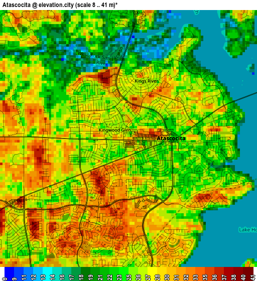
Below is the Elevation map of Atascocita, which displays elevation range with different colors. Scale of the first map is from 8 to 41 m (26 to 135 ft) with average elevation of 24.9 meters (=82 ft) [note 1]
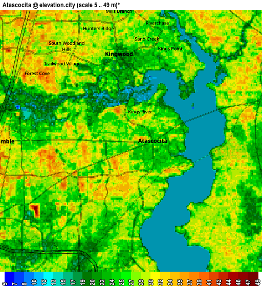
These maps also provides idea of topography and contour of this city, they are displayed at different zoom levels. More info about maps, scale and edge coordinates you can find below images.
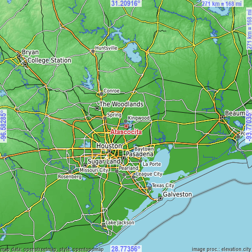
| \ | Map #1 | Map #2 | Topo.Map |
| Scale [m] | 8..41 m | 5..49 m | × |
| Scale [ft] | 26..135 ft | 16..161 ft | × |
| Average | 24.9 m = 82 ft | 25.5 m = 84 ft | × |
| Width | 8.46 km = 5.3 mi | 16.93 km = 10.5 mi | 270.8 km = 168.3 mi |
| Height | 8.46 km = 5.3 mi | 16.93 km = 10.5 mi | 270.8 km = 168.3 mi |
| ↑Max Latitude | 30.036881° | 30.074917° | 31.20916° |
| Latitude at center | 29.99883° | 29.99883° | 29.99883° |
| ↓Min Latitude | 29.960764° | 29.922684° | 28.77356° |
| ← Min Longitude | -95.220545° | -95.264491° | -96.58285° |
| Longitude center | -95.1766° | -95.1766° | -95.1766° |
| →Max Longitude | -95.132655° | -95.088709° | -93.77035° |
Nearby cities:
Cities around Atascocita sort by population:
• Kingwood Area elevation 24 m
9 km,  295°
295°
• Cloverleaf 13 m
24.5 km,  178°
178°
• Aldine 27 m
21 km,  249°
249°
• Humble 34 m
8.2 km,  270°
270°
• Highlands 15 m
23.1 km,  149°
149°
• Barrett 18 m
17.2 km,  140°
140°
• Crosby 19 m
14.7 km,  131°
131°
• Sheldon 15 m
15.3 km,  162°
162°
• Roman Forest 38 m
20.1 km,  3°
3°
• Porter Heights 40 m
22 km,  320°
320°
• Patton Village 33 m
21.6 km, 1°
• Woodbranch 38 m
20.3 km,  356°
356°
Multilingual:
 En español:
Atascocita elevación 25 m.
 En France:
Atascocita élévation 25 m.
 Auf Deutsch:
Atascocita höhe über dem Meeresspiegel ist 25 m.

Sources and notes:
- [note 1] Map square and city borders are not equal. Map elevation data is calculated only from area inside that square.
- [src 1] Elevation data from geonames database provided with same terms of usage.
- [src 2] The elevation map of Atascocita is generated using elevation data from NASA's 3 arcsec (90m) resolution SRTM data.
- [src 3] Base (background) map © OpenStreetMap contributors tiles are generated by Geofabrik and OpenTopoMap.
Copyright & License:
This Atascocita Elevation Map is licensed under CC BY-SA. You may reuse any part from this page, if you give a proper credit by linking to this URL:
 More info on terms of use page.