Sumter elevation
Sumter (South Carolina, Sumter County), United States elevation is 54 meters and Sumter elevation in feet is 177 ft above sea level [src 1]. Sumter is a seat of a second-order administrative division (feature code) with elevation that is 225 meters (738 ft) smaller than average city elevation in United States.
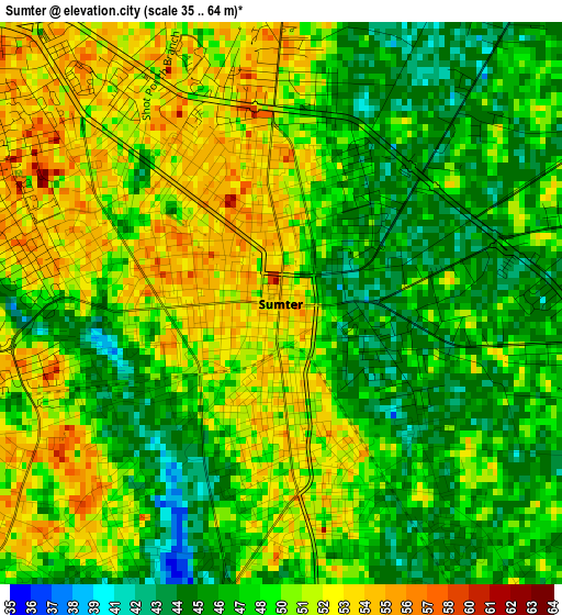
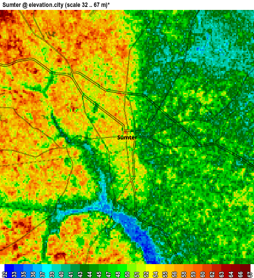
Below is the Elevation map of Sumter, which displays elevation range with different colors. Scale of the first map is from 35 to 64 m (115 to 210 ft) with average elevation of 48.9 meters (=160 ft) [note 1]
These maps also provides idea of topography and contour of this city, they are displayed at different zoom levels. More info about maps, scale and edge coordinates you can find below images.
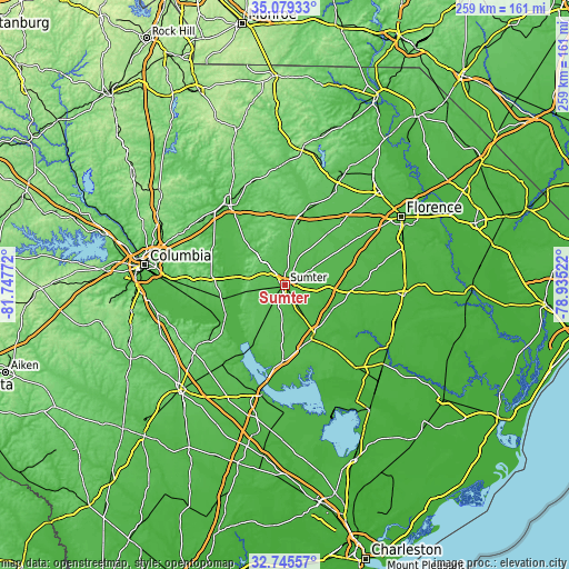
| \ | Map #1 | Map #2 | Topo.Map |
| Scale [m] | 35..64 m | 32..67 m | × |
| Scale [ft] | 115..210 ft | 105..220 ft | × |
| Average | 48.9 m = 160 ft | 49.1 m = 161 ft | × |
| Width | 8.11 km = 5 mi | 16.22 km = 10.1 mi | 259.5 km = 161.2 mi |
| Height | 8.11 km = 5 mi | 16.22 km = 10.1 mi | 259.5 km = 161.2 mi |
| ↑Max Latitude | 33.956899° | 33.993342° | 35.07933° |
| Latitude at center | 33.92044° | 33.92044° | 33.92044° |
| ↓Min Latitude | 33.883966° | 33.847476° | 32.74557° |
| ← Min Longitude | -80.385415° | -80.429361° | -81.74772° |
| Longitude center | -80.34147° | -80.34147° | -80.34147° |
| →Max Longitude | -80.297525° | -80.253579° | -78.93522° |
Nearby cities:
Cities around Sumter sort by population:
• Manning elevation 42 m
27.8 km,  154°
154°
• Dalzell 67 m
13.5 km,  322°
322°
• Lakewood 54 m
8.2 km,  185°
185°
• Cherryvale 65 m
11.5 km,  290°
290°
• South Sumter 53 m
1.7 km, 194°
• Privateer 57 m
11.8 km,  214°
214°
• Wedgewood 62 m
16.3 km,  255°
255°
• Wedgefield 77 m
16.6 km, 259°
• Stateburg 96 m
18.3 km,  283°
283°
• East Sumter 45 m
4.2 km,  82°
82°
• Oakland 104 m
15.2 km,  297°
297°
• Cane Savannah 53 m
10.3 km, 258°
Multilingual:
 En español:
Sumter elevación 54 m.
 En France:
Sumter élévation 54 m.


Sources and notes:
- [note 1] Map square and city borders are not equal. Map elevation data is calculated only from area inside that square.
- [src 1] Elevation data from geonames database provided with same terms of usage.
- [src 2] The elevation map of Sumter is generated using elevation data from NASA's 3 arcsec (90m) resolution SRTM data.
- [src 3] Base (background) map © OpenStreetMap contributors tiles are generated by Geofabrik and OpenTopoMap.
Copyright & License:
This Sumter Elevation Map is licensed under CC BY-SA. You may reuse any part from this page, if you give a proper credit by linking to this URL:
 More info on terms of use page.