Simpsonville elevation
Simpsonville (South Carolina, Greenville County), United States elevation is 268 meters and Simpsonville elevation in feet is 879 ft above sea level [src 1]. Simpsonville is a populated place (feature code) with elevation that is 11 meters (36 ft) smaller than average city elevation in United States.
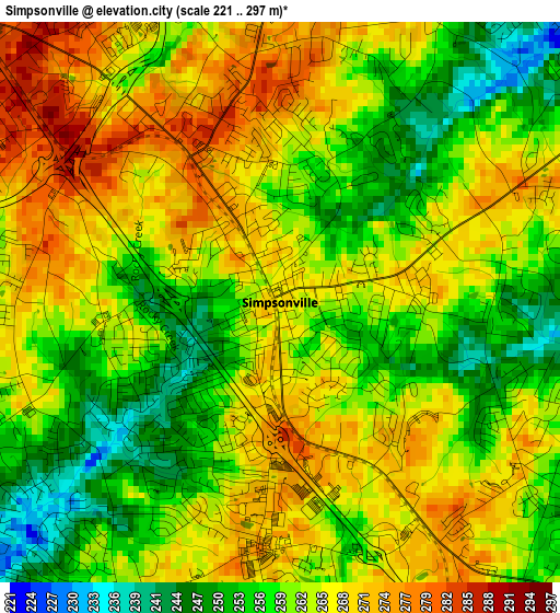
Below is the Elevation map of Simpsonville, which displays elevation range with different colors. Scale of the first map is from 221 to 297 m (725 to 974 ft) with average elevation of 262.3 meters (=861 ft) [note 1]
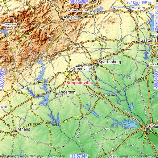
These maps also provides idea of topography and contour of this city, they are displayed at different zoom levels. More info about maps, scale and edge coordinates you can find below images.
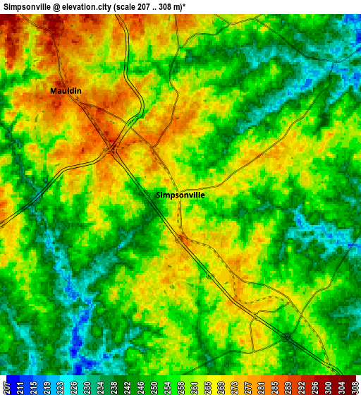
| \ | Map #1 | Map #2 | Topo.Map |
| Scale [m] | 221..297 m | 207..308 m | × |
| Scale [ft] | 725..974 ft | 679..1010 ft | × |
| Average | 262.3 m = 861 ft | 256 m = 840 ft | × |
| Width | 8.03 km = 5 mi | 16.06 km = 10 mi | 257 km = 159.7 mi |
| Height | 8.03 km = 5 mi | 16.06 km = 10 mi | 257 km = 159.7 mi |
| ↑Max Latitude | 34.773165° | 34.809255° | 35.88456° |
| Latitude at center | 34.73706° | 34.73706° | 34.73706° |
| ↓Min Latitude | 34.700939° | 34.664802° | 33.5734° |
| ← Min Longitude | -82.298225° | -82.342171° | -83.66053° |
| Longitude center | -82.25428° | -82.25428° | -82.25428° |
| →Max Longitude | -82.210335° | -82.166389° | -80.84803° |
Nearby cities:
Cities around Simpsonville sort by population:
• Greenville elevation 307 m
18.1 km,  315°
315°
• Mauldin 289 m
6.9 km,  312°
312°
• Wade Hampton 313 m
19.9 km,  338°
338°
• Gantt 302 m
17 km,  294°
294°
• Five Forks 268 m
7.9 km,  16°
16°
• Fountain Inn 266 m
7.6 km,  134°
134°
• Welcome 301 m
19.6 km,  300°
300°
• Piedmont 240 m
19.6 km,  258°
258°
• Woodruff 243 m
19.9 km,  89°
89°
• Dunean 299 m
18 km, 302°
• Golden Grove 269 m
17.3 km,  268°
268°
• Judson 301 m
19.1 km, 304°
Multilingual:
 En español:
Simpsonville elevación 268 m.
 En France:
Simpsonville élévation 268 m.
 Auf Deutsch:
Simpsonville höhe über dem Meeresspiegel ist 268 m.

Sources and notes:
- [note 1] Map square and city borders are not equal. Map elevation data is calculated only from area inside that square.
- [src 1] Elevation data from geonames database provided with same terms of usage.
- [src 2] The elevation map of Simpsonville is generated using elevation data from NASA's 3 arcsec (90m) resolution SRTM data.
- [src 3] Base (background) map © OpenStreetMap contributors tiles are generated by Geofabrik and OpenTopoMap.
Copyright & License:
This Simpsonville Elevation Map is licensed under CC BY-SA. You may reuse any part from this page, if you give a proper credit by linking to this URL:
 More info on terms of use page.