Mount Pleasant elevation
Mount Pleasant (South Carolina, Charleston County), United States elevation is 9 meters and Mount Pleasant elevation in feet is 30 ft above sea level [src 1]. Mount Pleasant is a populated place (feature code) with elevation that is 270 meters (886 ft) smaller than average city elevation in United States.
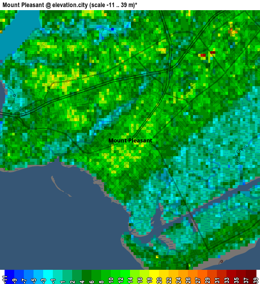
Below is the Elevation map of Mount Pleasant, which displays elevation range with different colors. Scale of the first map is from -11 to 39 m (-36 to 128 ft) with average elevation of 6.1 meters (=20 ft) [note 1]
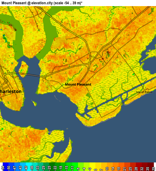
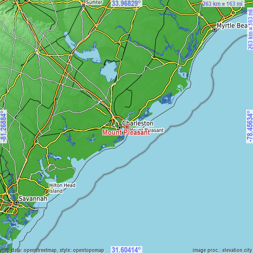
These maps also provides idea of topography and contour of this city, they are displayed at different zoom levels. More info about maps, scale and edge coordinates you can find below images.
| \ | Map #1 | Map #2 | Topo.Map |
| Scale [m] | -11..39 m | -54..39 m | × |
| Scale [ft] | -36..128 ft | -177..128 ft | × |
| Average | 6.1 m = 20 ft | 5.2 m = 17 ft | × |
| Width | 8.21 km = 5.1 mi | 16.43 km = 10.2 mi | 262.9 km = 163.4 mi |
| Height | 8.22 km = 5.1 mi | 16.43 km = 10.2 mi | 262.9 km = 163.4 mi |
| ↑Max Latitude | 32.831004° | 32.867922° | 33.96829° |
| Latitude at center | 32.79407° | 32.79407° | 32.79407° |
| ↓Min Latitude | 32.757121° | 32.720156° | 31.60414° |
| ← Min Longitude | -79.906535° | -79.950481° | -81.26884° |
| Longitude center | -79.86259° | -79.86259° | -79.86259° |
| →Max Longitude | -79.818645° | -79.774699° | -78.45634° |
Nearby cities:
Cities around Mount Pleasant sort by population:
• Charleston elevation 13 m
6.7 km,  253°
253°
• North Charleston 4 m
12.5 km,  302°
302°
• Goose Creek 12 m
26.2 km,  322°
322°
• Hanahan 18 m
20.3 km,  312°
312°
• Ladson 17 m
31.4 km, 312°
• James Island 4 m
12.2 km,  230°
230°
• Isle of Palms 0 m
6.4 km,  97°
97°
• Shell Point 6 m
22.8 km,  268°
268°
• Folly Beach 5 m
17.1 km,  205°
205°
• Sullivans Island 7 m
4.2 km,  144°
144°
• Kiawah Island 3 m
29.3 km, 225°
• Awendaw 7 m
35.7 km,  40°
40°
Multilingual:
 En español:
Mount Pleasant elevación 9 m.
 En France:
Mount Pleasant élévation 9 m.
 Auf Deutsch:
Mount Pleasant höhe über dem Meeresspiegel ist 9 m.

Sources and notes:
- [note 1] Map square and city borders are not equal. Map elevation data is calculated only from area inside that square.
- [src 1] Elevation data from geonames database provided with same terms of usage.
- [src 2] The elevation map of Mount Pleasant is generated using elevation data from NASA's 3 arcsec (90m) resolution SRTM data.
- [src 3] Base (background) map © OpenStreetMap contributors tiles are generated by Geofabrik and OpenTopoMap.
Copyright & License:
This Mount Pleasant Elevation Map is licensed under CC BY-SA. You may reuse any part from this page, if you give a proper credit by linking to this URL:
 More info on terms of use page.