Aiken elevation
Aiken (South Carolina, Aiken County), United States elevation is 161 meters and Aiken elevation in feet is 528 ft above sea level [src 1]. Aiken is a seat of a second-order administrative division (feature code) with elevation that is 118 meters (387 ft) smaller than average city elevation in United States.
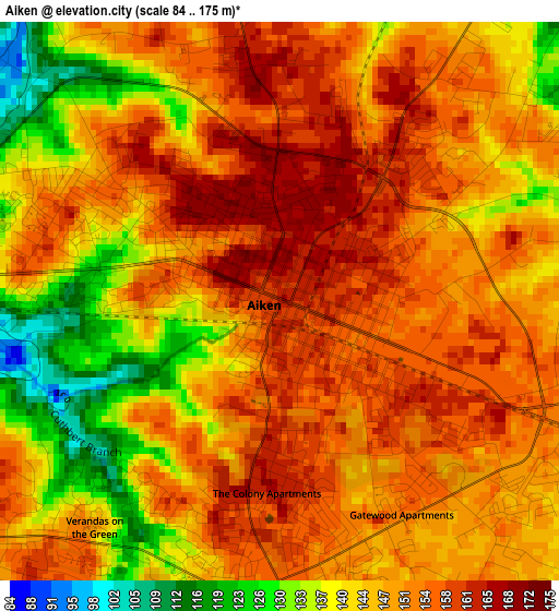
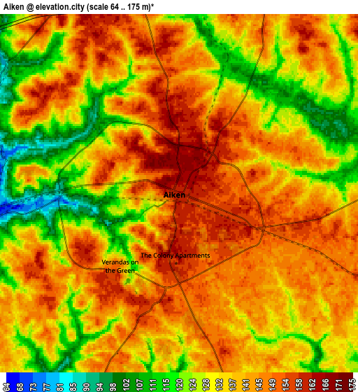
Below is the Elevation map of Aiken, which displays elevation range with different colors. Scale of the first map is from 84 to 175 m (276 to 574 ft) with average elevation of 147.8 meters (=485 ft) [note 1]
These maps also provides idea of topography and contour of this city, they are displayed at different zoom levels. More info about maps, scale and edge coordinates you can find below images.
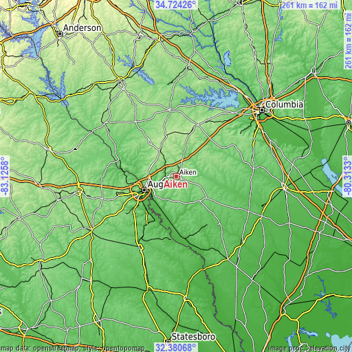
| \ | Map #1 | Map #2 | Topo.Map |
| Scale [m] | 84..175 m | 64..175 m | × |
| Scale [ft] | 276..574 ft | 210..574 ft | × |
| Average | 147.8 m = 485 ft | 137 m = 449 ft | × |
| Width | 8.14 km = 5.1 mi | 16.29 km = 10.1 mi | 260.6 km = 161.9 mi |
| Height | 8.14 km = 5.1 mi | 16.29 km = 10.1 mi | 260.6 km = 161.9 mi |
| ↑Max Latitude | 33.597032° | 33.633628° | 34.72426° |
| Latitude at center | 33.56042° | 33.56042° | 33.56042° |
| ↓Min Latitude | 33.523792° | 33.487149° | 32.38068° |
| ← Min Longitude | -81.763495° | -81.807441° | -83.1258° |
| Longitude center | -81.71955° | -81.71955° | -81.71955° |
| →Max Longitude | -81.675605° | -81.631659° | -80.3133° |
Nearby cities:
Cities around Aiken sort by population:
• Augusta elevation 44 m
25.7 km,  247°
247°
• North Augusta 122 m
23.7 km, 254°
• Belvedere 149 m
21.1 km,  261°
261°
• Clearwater 46 m
17.5 km, 246°
• Gloverville 64 m
10.9 km, 249°
• Burnettown 58 m
13 km, 247°
• Graniteville 75 m
8.2 km,  272°
272°
• New Ellenton 127 m
15.8 km,  168°
168°
• Jackson 65 m
26.9 km,  193°
193°
• Langley 63 m
12.5 km, 247°
• Murphys Estates 177 m
21.3 km,  282°
282°
• Warrenville 78 m
7.9 km, 262°
Multilingual:
 En español:
Aiken elevación 161 m.
 En France:
Aiken élévation 161 m.


Sources and notes:
- [note 1] Map square and city borders are not equal. Map elevation data is calculated only from area inside that square.
- [src 1] Elevation data from geonames database provided with same terms of usage.
- [src 2] The elevation map of Aiken is generated using elevation data from NASA's 3 arcsec (90m) resolution SRTM data.
- [src 3] Base (background) map © OpenStreetMap contributors tiles are generated by Geofabrik and OpenTopoMap.
Copyright & License:
This Aiken Elevation Map is licensed under CC BY-SA. You may reuse any part from this page, if you give a proper credit by linking to this URL:
 More info on terms of use page.