Rush Springs elevation
Rush Springs (Oklahoma, Grady County), United States elevation is 412 meters and Rush Springs elevation in feet is 1352 ft above sea level [src 1]. Rush Springs is a populated place (feature code) with elevation that is 133 meters (436 ft) bigger than average city elevation in United States.
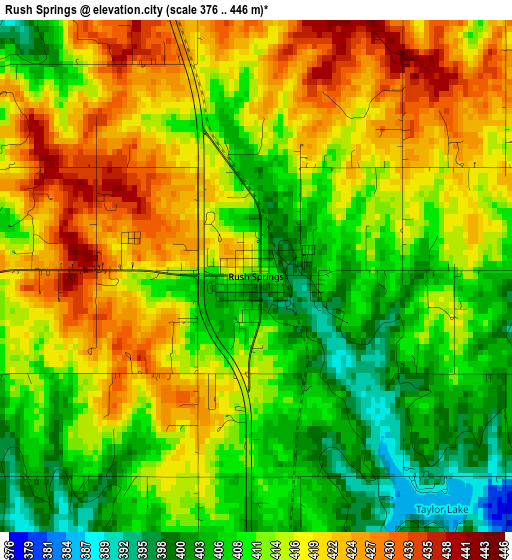
Below is the Elevation map of Rush Springs, which displays elevation range with different colors. Scale of the first map is from 376 to 446 m (1234 to 1463 ft) with average elevation of 413.9 meters (=1358 ft) [note 1]
These maps also provides idea of topography and contour of this city, they are displayed at different zoom levels. More info about maps, scale and edge coordinates you can find below images.
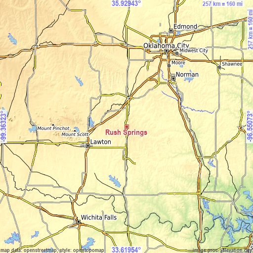
| \ | Map #1 | Topo.Map |
| Scale [m] | 376..446 m | × |
| Scale [ft] | 1234..1463 ft | × |
| Average | 413.9 m = 1358 ft | × |
| Width | 8.03 km = 5 mi | 256.8 km = 159.6 mi |
| Height | 8.03 km = 5 mi | 256.8 km = 159.6 mi |
| ↑Max Latitude | 34.818655° | 35.92943° |
| Latitude at center | 34.78257° | 34.78257° |
| ↓Min Latitude | 34.746469° | 33.61954° |
| ← Min Longitude | -98.000925° | -99.36323° |
| Longitude center | -97.95698° | -97.95698° |
| →Max Longitude | -97.913035° | -96.55073° |
Nearby cities:
Cities around Rush Springs sort by population:
• Duncan elevation 348 m
31.2 km,  180°
180°
• Chickasha 337 m
30.1 km,  3°
3°
• Marlow 403 m
14.9 km, 180°
• Marlow 393 m
21.4 km, 179°
• Elgin 398 m
30.6 km,  269°
269°
• Lindsay 302 m
32.9 km,  79°
79°
• Apache 396 m
39.3 km,  288°
288°
• Bray 386 m
20.5 km,  141°
141°
• Central High 362 m
21.5 km,  214°
214°
• Fletcher 422 m
26.6 km,  279°
279°
• Cyril 418 m
25.6 km,  299°
299°
• Ninnekah 344 m
18.6 km,  9°
9°
Multilingual:
 En español:
Rush Springs elevación 412 m.
 En France:
Rush Springs élévation 412 m.
 Auf Deutsch:
Rush Springs höhe über dem Meeresspiegel ist 412 m.

Sources and notes:
- [note 1] Map square and city borders are not equal. Map elevation data is calculated only from area inside that square.
- [src 1] Elevation data from geonames database provided with same terms of usage.
- [src 2] The elevation map of Rush Springs is generated using elevation data from NASA's 3 arcsec (90m) resolution SRTM data.
- [src 3] Base (background) map © OpenStreetMap contributors tiles are generated by Geofabrik and OpenTopoMap.
Copyright & License:
This Rush Springs Elevation Map is licensed under CC BY-SA. You may reuse any part from this page, if you give a proper credit by linking to this URL:
 More info on terms of use page.