Moore elevation
Moore (Oklahoma, Cleveland County), United States elevation is 385 meters and Moore elevation in feet is 1263 ft above sea level [src 1]. Moore is a populated place (feature code) with elevation that is 106 meters (348 ft) bigger than average city elevation in United States.
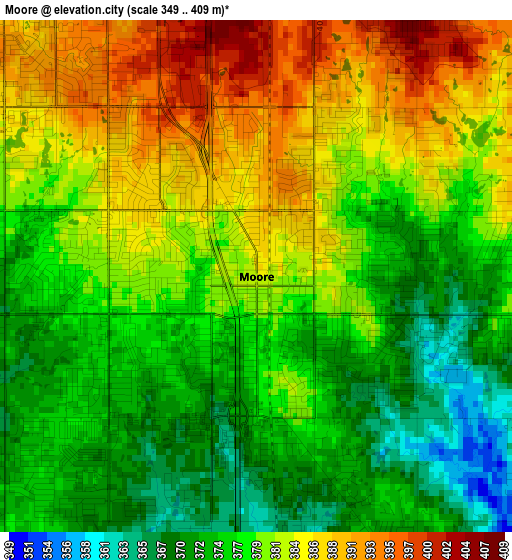
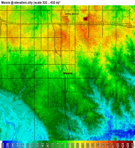
Below is the Elevation map of Moore, which displays elevation range with different colors. Scale of the first map is from 349 to 409 m (1145 to 1342 ft) with average elevation of 379.2 meters (=1244 ft) [note 1]
These maps also provides idea of topography and contour of this city, they are displayed at different zoom levels. More info about maps, scale and edge coordinates you can find below images.
| \ | Map #1 | Map #2 | Topo.Map |
| Scale [m] | 349..409 m | 332..432 m | × |
| Scale [ft] | 1145..1342 ft | 1089..1417 ft | × |
| Average | 379.2 m = 1244 ft | 374.7 m = 1229 ft | × |
| Width | 7.97 km = 5 mi | 15.94 km = 9.9 mi | 255.1 km = 158.5 mi |
| Height | 7.97 km = 5 mi | 15.94 km = 9.9 mi | 255.1 km = 158.5 mi |
| ↑Max Latitude | 35.37535° | 35.411174° | 36.47846° |
| Latitude at center | 35.33951° | 35.33951° | 35.33951° |
| ↓Min Latitude | 35.303654° | 35.267782° | 34.18427° |
| ← Min Longitude | -97.530645° | -97.574591° | -98.89295° |
| Longitude center | -97.4867° | -97.4867° | -97.4867° |
| →Max Longitude | -97.442755° | -97.398809° | -96.08045° |
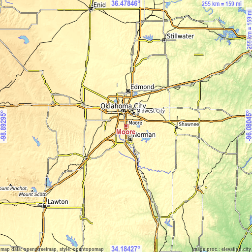
Nearby cities:
Cities around Moore sort by population:
• Oklahoma City elevation 395 m
14.5 km,  349°
349°
• Norman 361 m
13.7 km,  161°
161°
• Midwest City 386 m
14.7 km,  33°
33°
• Del City 372 m
12.1 km,  20°
20°
• Mustang 416 m
22.1 km,  282°
282°
• Warr Acres 406 m
23.6 km,  329°
329°
• Newcastle 372 m
14.5 km,  225°
225°
• Spencer 367 m
22.7 km, 25°
• Nicoma Park 373 m
22.5 km,  41°
41°
• Goldsby 354 m
22.1 km,  177°
177°
• Hall Park 366 m
13.5 km,  147°
147°
• Forest Park 376 m
18.7 km,  11°
11°
Multilingual:
 En español:
Moore elevación 385 m.
 En France:
Moore élévation 385 m.


Sources and notes:
- [note 1] Map square and city borders are not equal. Map elevation data is calculated only from area inside that square.
- [src 1] Elevation data from geonames database provided with same terms of usage.
- [src 2] The elevation map of Moore is generated using elevation data from NASA's 3 arcsec (90m) resolution SRTM data.
- [src 3] Base (background) map © OpenStreetMap contributors tiles are generated by Geofabrik and OpenTopoMap.
Copyright & License:
This Moore Elevation Map is licensed under CC BY-SA. You may reuse any part from this page, if you give a proper credit by linking to this URL:
 More info on terms of use page.