Marietta elevation
Marietta (Ohio, Washington County), United States elevation is 190 meters and Marietta elevation in feet is 623 ft above sea level [src 1]. Marietta is a seat of a second-order administrative division (feature code) with elevation that is 89 meters (292 ft) smaller than average city elevation in United States.
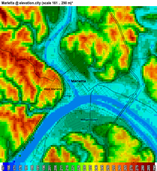
Below is the Elevation map of Marietta, which displays elevation range with different colors. Scale of the first map is from 161 to 290 m (528 to 951 ft) with average elevation of 214.7 meters (=704 ft) [note 1]
These maps also provides idea of topography and contour of this city, they are displayed at different zoom levels. More info about maps, scale and edge coordinates you can find below images.
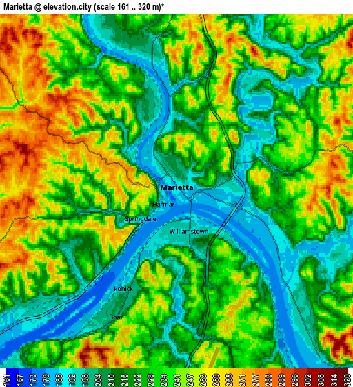
| \ | Map #1 | Map #2 | Topo.Map |
| Scale [m] | 161..290 m | 161..320 m | × |
| Scale [ft] | 528..951 ft | 528..1050 ft | × |
| Average | 214.7 m = 704 ft | 228.1 m = 748 ft | × |
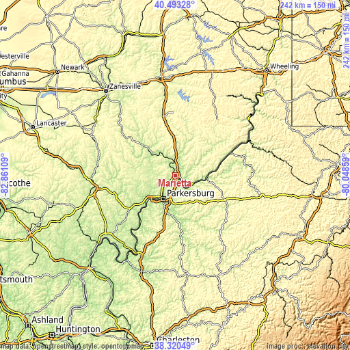
| Width | 7.55 km = 4.7 mi | 15.1 km = 9.4 mi | 241.6 km = 150.1 mi |
| Height | 7.55 km = 4.7 mi | 15.1 km = 9.4 mi | 241.6 km = 150.1 mi |
| ↑Max Latitude | 39.449292° | 39.483218° | 40.49328° |
| Latitude at center | 39.41535° | 39.41535° | 39.41535° |
| ↓Min Latitude | 39.381391° | 39.347416° | 38.32049° |
| ← Min Longitude | -81.498785° | -81.542731° | -82.86109° |
| Longitude center | -81.45484° | -81.45484° | -81.45484° |
| →Max Longitude | -81.410895° | -81.366949° | -80.04859° |
Nearby cities:
Cities around Marietta sort by population:
• Parkersburg elevation 199 m
18.9 km,  209°
209°
• Vienna 196 m
12.7 km,  219°
219°
• Belpre 188 m
18.7 km, 212°
• Blennerhassett 237 m
22.6 km, 221°
• Williamstown 192 m
1.7 km,  160°
160°
• Devola 208 m
6.8 km,  342°
342°
• Saint Marys 190 m
21.6 km,  96°
96°
• Lubeck 232 m
25.1 km, 217°
• Beverly 199 m
21.6 km,  312°
312°
• Boaz 196 m
7.2 km, 214°
• Reno 197 m
6.9 km,  132°
132°
• Newport 195 m
19.8 km, 97°
Multilingual:
 En español:
Marietta elevación 190 m.
 En France:
Marietta élévation 190 m.
 Auf Deutsch:
Marietta höhe über dem Meeresspiegel ist 190 m.

Sources and notes:
- [note 1] Map square and city borders are not equal. Map elevation data is calculated only from area inside that square.
- [src 1] Elevation data from geonames database provided with same terms of usage.
- [src 2] The elevation map of Marietta is generated using elevation data from NASA's 3 arcsec (90m) resolution SRTM data.
- [src 3] Base (background) map © OpenStreetMap contributors tiles are generated by Geofabrik and OpenTopoMap.
Copyright & License:
This Marietta Elevation Map is licensed under CC BY-SA. You may reuse any part from this page, if you give a proper credit by linking to this URL:
 More info on terms of use page.