Folsom elevation
Folsom (New Jersey, Atlantic County), United States elevation is 32 meters and Folsom elevation in feet is 105 ft above sea level [src 1]. Folsom is a populated place (feature code) with elevation that is 247 meters (810 ft) smaller than average city elevation in United States.
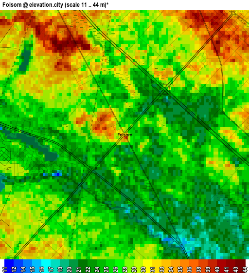
Below is the Elevation map of Folsom, which displays elevation range with different colors. Scale of the first map is from 11 to 44 m (36 to 144 ft) with average elevation of 27.2 meters (=89 ft) [note 1]
These maps also provides idea of topography and contour of this city, they are displayed at different zoom levels. More info about maps, scale and edge coordinates you can find below images.
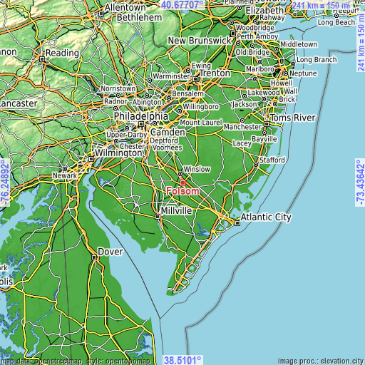
| \ | Map #1 | Topo.Map |
| Scale [m] | 11..44 m | × |
| Scale [ft] | 36..144 ft | × |
| Average | 27.2 m = 89 ft | × |
| Width | 7.53 km = 4.7 mi | 240.9 km = 149.7 mi |
| Height | 7.53 km = 4.7 mi | 240.9 km = 149.7 mi |
| ↑Max Latitude | 39.635911° | 40.67707° |
| Latitude at center | 39.60206° | 39.60206° |
| ↓Min Latitude | 39.568192° | 38.5101° |
| ← Min Longitude | -74.886615° | -76.24892° |
| Longitude center | -74.84267° | -74.84267° |
| →Max Longitude | -74.798725° | -73.43642° |
Nearby cities:
Cities around Folsom sort by population:
• Sicklerville elevation 43 m
16.8 km,  319°
319°
• Williamstown 45 m
16.1 km,  305°
305°
• Hammonton 31 m
5.2 km,  42°
42°
• Atco 48 m
19 km,  348°
348°
• Buena 34 m
12.1 km,  215°
215°
• Florence 47 m
16.1 km,  336°
336°
• Egg Harbor City 19 m
18.6 km,  116°
116°
• Victory Lakes 39 m
11.1 km,  288°
288°
• Collings Lakes 24 m
3.4 km,  257°
257°
• Chesilhurst 54 m
14.9 km, 347°
• Newfield 41 m
16.9 km,  248°
248°
• Elwood 30 m
11.2 km,  104°
104°
Multilingual:
 En español:
Folsom elevación 32 m.
 En France:
Folsom élévation 32 m.


Sources and notes:
- [note 1] Map square and city borders are not equal. Map elevation data is calculated only from area inside that square.
- [src 1] Elevation data from geonames database provided with same terms of usage.
- [src 2] The elevation map of Folsom is generated using elevation data from NASA's 3 arcsec (90m) resolution SRTM data.
- [src 3] Base (background) map © OpenStreetMap contributors tiles are generated by Geofabrik and OpenTopoMap.
Copyright & License:
This Folsom Elevation Map is licensed under CC BY-SA. You may reuse any part from this page, if you give a proper credit by linking to this URL:
 More info on terms of use page.