Moravian Falls elevation
Moravian Falls (North Carolina, Wilkes County), United States elevation is 364 meters and Moravian Falls elevation in feet is 1194 ft above sea level [src 1]. Moravian Falls is a populated place (feature code) with elevation that is 85 meters (279 ft) bigger than average city elevation in United States.
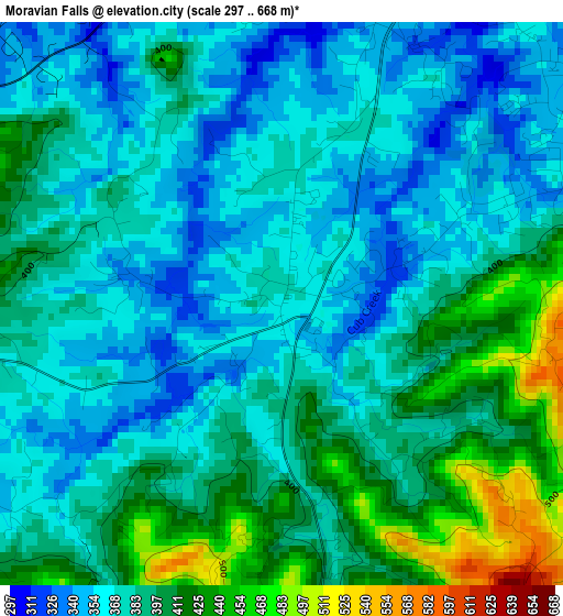
Below is the Elevation map of Moravian Falls, which displays elevation range with different colors. Scale of the first map is from 297 to 668 m (974 to 2192 ft) with average elevation of 384.1 meters (=1260 ft) [note 1]
These maps also provides idea of topography and contour of this city, they are displayed at different zoom levels. More info about maps, scale and edge coordinates you can find below images.
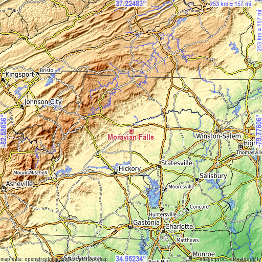
| \ | Map #1 | Topo.Map |
| Scale [m] | 297..668 m | × |
| Scale [ft] | 974..2192 ft | × |
| Average | 384.1 m = 1260 ft | × |
| Width | 7.9 km = 4.9 mi | 252.7 km = 157 mi |
| Height | 7.9 km = 4.9 mi | 252.7 km = 157 mi |
| ↑Max Latitude | 36.132301° | 37.22483° |
| Latitude at center | 36.0968° | 36.0968° |
| ↓Min Latitude | 36.061283° | 34.95234° |
| ← Min Longitude | -81.226255° | -82.58856° |
| Longitude center | -81.18231° | -81.18231° |
| →Max Longitude | -81.138365° | -79.77606° |
Nearby cities:
Cities around Moravian Falls sort by population:
• North Wilkesboro elevation 299 m
7.5 km,  24°
24°
• Bethlehem 345 m
32.2 km,  200°
200°
• Elkin 272 m
34.2 km,  61°
61°
• Wilkesboro 311 m
5.8 km, 19°
• Mulberry 401 m
15.9 km,  0°
0°
• Jonesville 282 m
34.2 km, 62°
• Fairplains 391 m
11.6 km,  13°
13°
• Millers Creek 430 m
11.4 km,  334°
334°
• Taylorsville 377 m
19.5 km,  178°
178°
• Cricket 384 m
8.4 km,  352°
352°
• Hays 412 m
18 km, 19°
• Stony Point 323 m
28.6 km,  154°
154°
Multilingual:
 En español:
Moravian Falls elevación 364 m.
 En France:
Moravian Falls élévation 364 m.
 Auf Deutsch:
Moravian Falls höhe über dem Meeresspiegel ist 364 m.

Sources and notes:
- [note 1] Map square and city borders are not equal. Map elevation data is calculated only from area inside that square.
- [src 1] Elevation data from geonames database provided with same terms of usage.
- [src 2] The elevation map of Moravian Falls is generated using elevation data from NASA's 3 arcsec (90m) resolution SRTM data.
- [src 3] Base (background) map © OpenStreetMap contributors tiles are generated by Geofabrik and OpenTopoMap.
Copyright & License:
This Moravian Falls Elevation Map is licensed under CC BY-SA. You may reuse any part from this page, if you give a proper credit by linking to this URL:
 More info on terms of use page.