Gorman elevation
Gorman (North Carolina, Durham County), United States elevation is 111 meters and Gorman elevation in feet is 364 ft above sea level [src 1]. Gorman is a populated place (feature code) with elevation that is 168 meters (551 ft) smaller than average city elevation in United States.
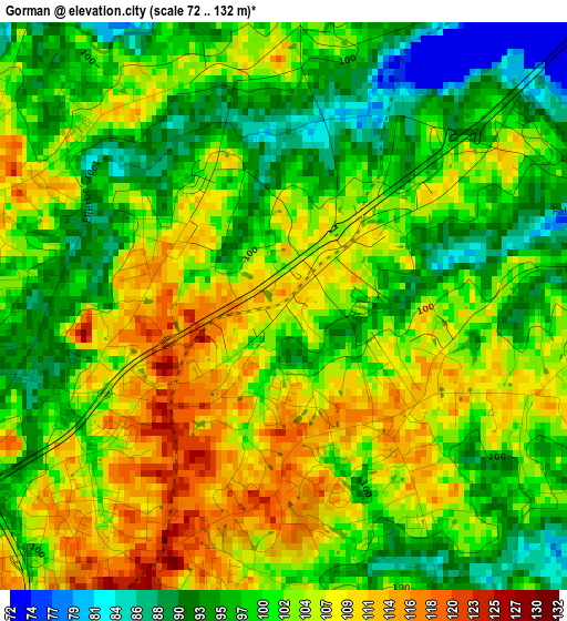
Below is the Elevation map of Gorman, which displays elevation range with different colors. Scale of the first map is from 72 to 132 m (236 to 433 ft) with average elevation of 101.8 meters (=334 ft) [note 1]
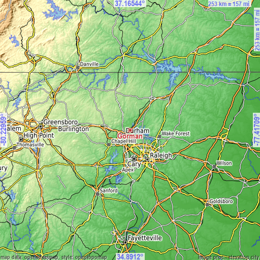
These maps also provides idea of topography and contour of this city, they are displayed at different zoom levels. More info about maps, scale and edge coordinates you can find below images.
| \ | Map #1 | Topo.Map |
| Scale [m] | 72..132 m | × |
| Scale [ft] | 236..433 ft | × |
| Average | 101.8 m = 334 ft | × |
| Width | 7.9 km = 4.9 mi | 252.9 km = 157.1 mi |
| Height | 7.9 km = 4.9 mi | 252.9 km = 157.1 mi |
| ↑Max Latitude | 36.072058° | 37.16544° |
| Latitude at center | 36.03653° | 36.03653° |
| ↓Min Latitude | 36.000986° | 34.8912° |
| ← Min Longitude | -78.867285° | -80.22959° |
| Longitude center | -78.82334° | -78.82334° |
| →Max Longitude | -78.779395° | -77.41709° |
Nearby cities:
Cities around Gorman sort by population:
• West Raleigh elevation 124 m
31.3 km,  152°
152°
• Durham 121 m
8.3 km,  235°
235°
• Cary 152 m
27.5 km,  172°
172°
• Chapel Hill 149 m
25 km, 236°
• Wake Forest 120 m
28.9 km,  102°
102°
• Morrisville 92 m
23.7 km,  180°
180°
• Carrboro 141 m
26.7 km, 238°
• Butner 113 m
12.2 km,  29°
29°
• Hillsborough 167 m
25.2 km,  279°
279°
• Creedmoor 116 m
15.6 km,  52°
52°
• Green Level 103 m
29.2 km,  194°
194°
• Youngsville 144 m
31.4 km,  92°
92°
Multilingual:
 En español:
Gorman elevación 111 m.
 En France:
Gorman élévation 111 m.


Sources and notes:
- [note 1] Map square and city borders are not equal. Map elevation data is calculated only from area inside that square.
- [src 1] Elevation data from geonames database provided with same terms of usage.
- [src 2] The elevation map of Gorman is generated using elevation data from NASA's 3 arcsec (90m) resolution SRTM data.
- [src 3] Base (background) map © OpenStreetMap contributors tiles are generated by Geofabrik and OpenTopoMap.
Copyright & License:
This Gorman Elevation Map is licensed under CC BY-SA. You may reuse any part from this page, if you give a proper credit by linking to this URL:
 More info on terms of use page.