Eastover elevation
Eastover (North Carolina, Cumberland County), United States elevation is 32 meters and Eastover elevation in feet is 105 ft above sea level [src 1]. Eastover is a populated place (feature code) with elevation that is 247 meters (810 ft) smaller than average city elevation in United States.
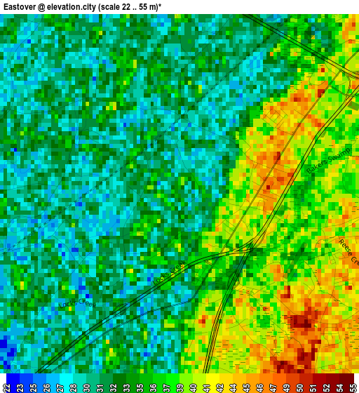
Below is the Elevation map of Eastover, which displays elevation range with different colors. Scale of the first map is from 22 to 55 m (72 to 180 ft) with average elevation of 34.3 meters (=113 ft) [note 1]
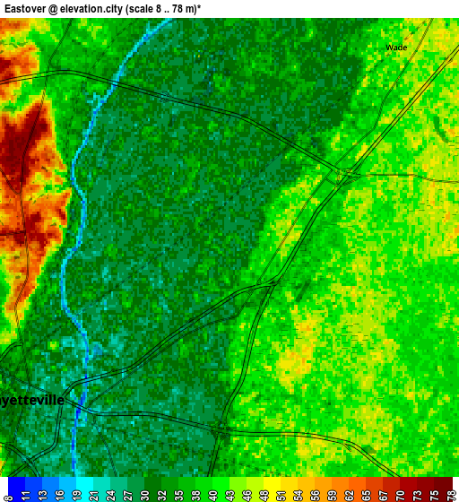
These maps also provides idea of topography and contour of this city, they are displayed at different zoom levels. More info about maps, scale and edge coordinates you can find below images.
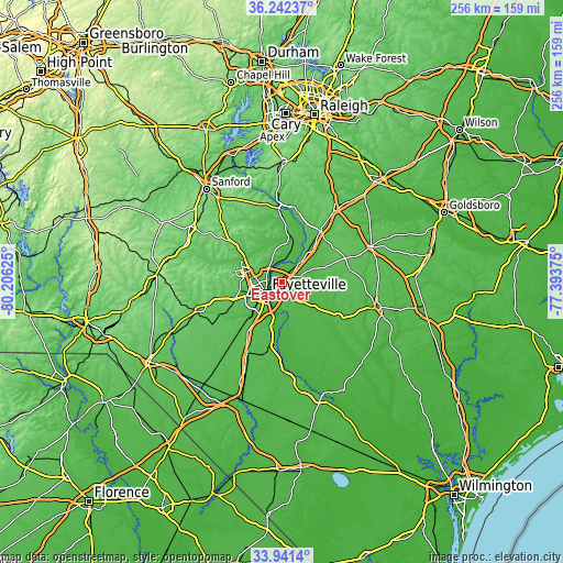
| \ | Map #1 | Map #2 | Topo.Map |
| Scale [m] | 22..55 m | 8..78 m | × |
| Scale [ft] | 72..180 ft | 26..256 ft | × |
| Average | 34.3 m = 113 ft | 37.5 m = 123 ft | × |
| Width | 8 km = 5 mi | 15.99 km = 9.9 mi | 255.8 km = 158.9 mi |
| Height | 8 km = 5 mi | 15.99 km = 9.9 mi | 255.8 km = 158.9 mi |
| ↑Max Latitude | 35.135946° | 35.171876° | 36.24237° |
| Latitude at center | 35.1° | 35.1° | 35.1° |
| ↓Min Latitude | 35.064038° | 35.028061° | 33.9414° |
| ← Min Longitude | -78.843945° | -78.887891° | -80.20625° |
| Longitude center | -78.8° | -78.8° | -78.8° |
| →Max Longitude | -78.756055° | -78.712109° | -77.39375° |
Nearby cities:
Cities around Eastover sort by population:
• Fayetteville elevation 33 m
8.9 km,  233°
233°
• Fort Bragg 104 m
19.2 km,  283°
283°
• Hope Mills 36 m
19.6 km,  222°
222°
• Spring Lake 85 m
17.4 km,  295°
295°
• Dunn 66 m
28.8 km,  37°
37°
• Erwin 60 m
27.6 km,  24°
24°
• Walkertown 64 m
20.7 km,  356°
356°
• Rockfish 68 m
27 km,  243°
243°
• Plain View 65 m
27.7 km,  53°
53°
• Roseboro 43 m
31.2 km,  121°
121°
• Vander 39 m
7.6 km,  176°
176°
• Stedman 39 m
13.6 km,  134°
134°
Multilingual:
 En español:
Eastover elevación 32 m.
 En France:
Eastover élévation 32 m.


Sources and notes:
- [note 1] Map square and city borders are not equal. Map elevation data is calculated only from area inside that square.
- [src 1] Elevation data from geonames database provided with same terms of usage.
- [src 2] The elevation map of Eastover is generated using elevation data from NASA's 3 arcsec (90m) resolution SRTM data.
- [src 3] Base (background) map © OpenStreetMap contributors tiles are generated by Geofabrik and OpenTopoMap.
Copyright & License:
This Eastover Elevation Map is licensed under CC BY-SA. You may reuse any part from this page, if you give a proper credit by linking to this URL:
 More info on terms of use page.