Angier elevation
Angier (North Carolina, Harnett County), United States elevation is 90 meters and Angier elevation in feet is 295 ft above sea level [src 1]. Angier is a populated place (feature code) with elevation that is 189 meters (620 ft) smaller than average city elevation in United States.
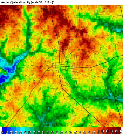
Below is the Elevation map of Angier, which displays elevation range with different colors. Scale of the first map is from 58 to 111 m (190 to 364 ft) with average elevation of 89 meters (=292 ft) [note 1]
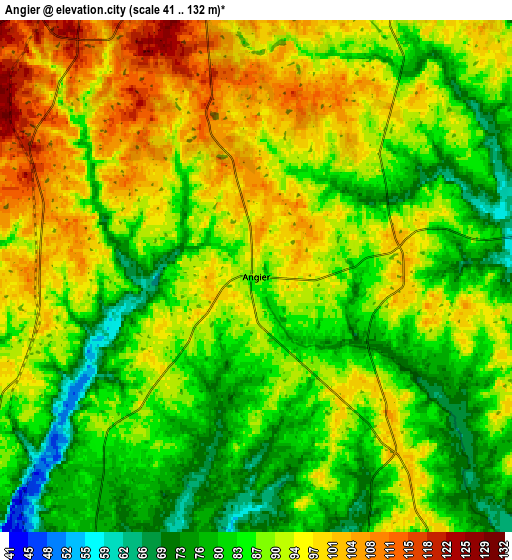
These maps also provides idea of topography and contour of this city, they are displayed at different zoom levels. More info about maps, scale and edge coordinates you can find below images.
| \ | Map #1 | Map #2 | Topo.Map |
| Scale [m] | 58..111 m | 41..132 m | × |
| Scale [ft] | 190..364 ft | 135..433 ft | × |
| Average | 89 m = 292 ft | 88.6 m = 291 ft | × |
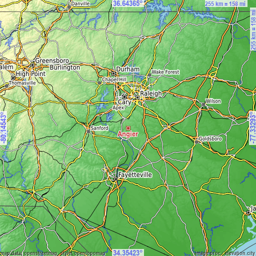
| Width | 7.96 km = 4.9 mi | 15.91 km = 9.9 mi | 254.6 km = 158.2 mi |
| Height | 7.96 km = 4.9 mi | 15.91 km = 9.9 mi | 254.6 km = 158.2 mi |
| ↑Max Latitude | 35.542865° | 35.578615° | 36.64365° |
| Latitude at center | 35.5071° | 35.5071° | 35.5071° |
| ↓Min Latitude | 35.471319° | 35.435521° | 34.35423° |
| ← Min Longitude | -78.783125° | -78.827071° | -80.14543° |
| Longitude center | -78.73918° | -78.73918° | -78.73918° |
| →Max Longitude | -78.695235° | -78.651289° | -77.33293° |
Nearby cities:
Cities around Angier sort by population:
• Apex elevation 153 m
27 km,  338°
338°
• Holly Springs 138 m
18.2 km,  331°
331°
• Garner 113 m
25.4 km,  26°
26°
• Fuquay-Varina 119 m
10.2 km, 327°
• Dunn 66 m
25.3 km,  152°
152°
• Erwin 60 m
20.8 km,  164°
164°
• Walkertown 64 m
25.5 km,  195°
195°
• Benson 74 m
22.2 km,  128°
128°
• Lillington 63 m
13.8 km,  210°
210°
• Buies Creek 69 m
10.4 km,  178°
178°
• Coats 94 m
12.6 km, 151°
• Scotts Mill 106 m
27.7 km, 331°
Multilingual:
 En español:
Angier elevación 90 m.
 En France:
Angier élévation 90 m.


Sources and notes:
- [note 1] Map square and city borders are not equal. Map elevation data is calculated only from area inside that square.
- [src 1] Elevation data from geonames database provided with same terms of usage.
- [src 2] The elevation map of Angier is generated using elevation data from NASA's 3 arcsec (90m) resolution SRTM data.
- [src 3] Base (background) map © OpenStreetMap contributors tiles are generated by Geofabrik and OpenTopoMap.
Copyright & License:
This Angier Elevation Map is licensed under CC BY-SA. You may reuse any part from this page, if you give a proper credit by linking to this URL:
 More info on terms of use page.