Troy elevation
Troy (Missouri, Lincoln County), United States elevation is 163 meters and Troy elevation in feet is 535 ft above sea level [src 1]. Troy is a seat of a second-order administrative division (feature code) with elevation that is 116 meters (381 ft) smaller than average city elevation in United States.
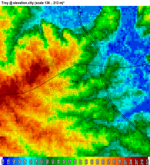
Below is the Elevation map of Troy, which displays elevation range with different colors. Scale of the first map is from 136 to 213 m (446 to 699 ft) with average elevation of 170.4 meters (=559 ft) [note 1]
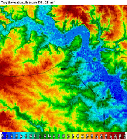
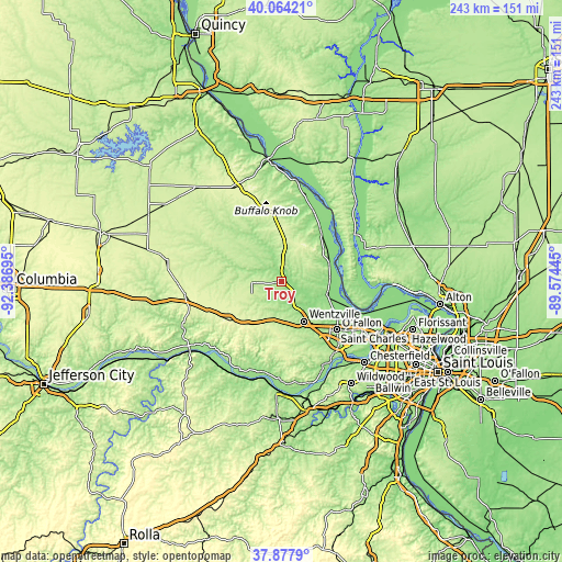
These maps also provides idea of topography and contour of this city, they are displayed at different zoom levels. More info about maps, scale and edge coordinates you can find below images.
| \ | Map #1 | Map #2 | Topo.Map |
| Scale [m] | 136..213 m | 134..221 m | × |
| Scale [ft] | 446..699 ft | 440..725 ft | × |
| Average | 170.4 m = 559 ft | 174.9 m = 574 ft | × |
| Width | 7.6 km = 4.7 mi | 15.19 km = 9.4 mi | 243.1 km = 151.1 mi |
| Height | 7.6 km = 4.7 mi | 15.19 km = 9.4 mi | 243.1 km = 151.1 mi |
| ↑Max Latitude | 39.013644° | 39.047781° | 40.06421° |
| Latitude at center | 38.97949° | 38.97949° | 38.97949° |
| ↓Min Latitude | 38.94532° | 38.911133° | 37.8779° |
| ← Min Longitude | -91.024645° | -91.068591° | -92.38695° |
| Longitude center | -90.9807° | -90.9807° | -90.9807° |
| →Max Longitude | -90.936755° | -90.892809° | -89.57445° |
Nearby cities:
Cities around Troy sort by population:
• O'Fallon elevation 164 m
30.7 km,  127°
127°
• Saint Peters 133 m
36.6 km,  123°
123°
• Wentzville 187 m
21.7 km,  149°
149°
• Lake Saint Louis 170 m
26.3 km,  140°
140°
• Dardenne Prairie 185 m
31.9 km, 136°
• Warrenton 271 m
23.3 km,  216°
216°
• Wright City 222 m
17.2 km,  191°
191°
• Moscow Mills 162 m
6.4 km, 123°
• Elsberry 138 m
27 km,  39°
39°
• Saint Paul 155 m
24.5 km, 122°
• Winfield 138 m
21 km,  84°
84°
• Hardin 134 m
37 km,  57°
57°
Multilingual:
 En español:
Troy elevación 163 m.
 En France:
Troy élévation 163 m.


Sources and notes:
- [note 1] Map square and city borders are not equal. Map elevation data is calculated only from area inside that square.
- [src 1] Elevation data from geonames database provided with same terms of usage.
- [src 2] The elevation map of Troy is generated using elevation data from NASA's 3 arcsec (90m) resolution SRTM data.
- [src 3] Base (background) map © OpenStreetMap contributors tiles are generated by Geofabrik and OpenTopoMap.
Copyright & License:
This Troy Elevation Map is licensed under CC BY-SA. You may reuse any part from this page, if you give a proper credit by linking to this URL:
 More info on terms of use page.