Bonne Terre elevation
Bonne Terre (Missouri, Saint Francois County), United States elevation is 253 meters and Bonne Terre elevation in feet is 830 ft above sea level [src 1]. Bonne Terre is a populated place (feature code) with elevation that is 26 meters (85 ft) smaller than average city elevation in United States.
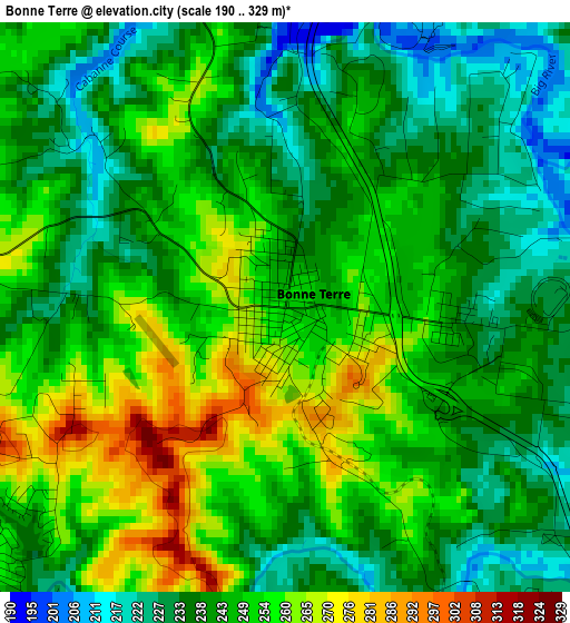
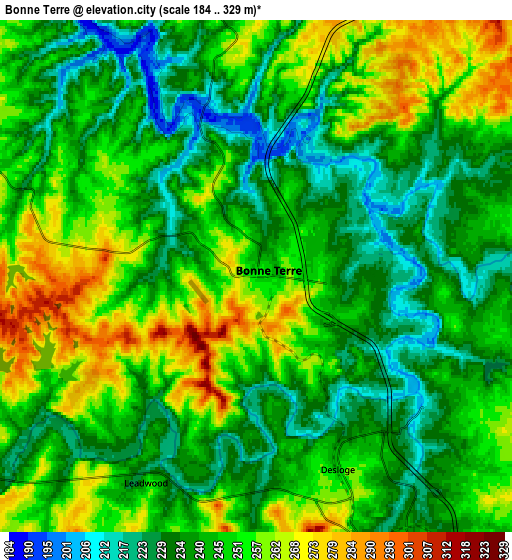
Below is the Elevation map of Bonne Terre, which displays elevation range with different colors. Scale of the first map is from 190 to 329 m (623 to 1079 ft) with average elevation of 245.3 meters (=805 ft) [note 1]
These maps also provides idea of topography and contour of this city, they are displayed at different zoom levels. More info about maps, scale and edge coordinates you can find below images.
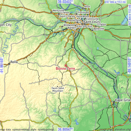
| \ | Map #1 | Map #2 | Topo.Map |
| Scale [m] | 190..329 m | 184..329 m | × |
| Scale [ft] | 623..1079 ft | 604..1079 ft | × |
| Average | 245.3 m = 805 ft | 245 m = 804 ft | × |
| Width | 7.71 km = 4.8 mi | 15.42 km = 9.6 mi | 246.7 km = 153.3 mi |
| Height | 7.71 km = 4.8 mi | 15.42 km = 9.6 mi | 246.7 km = 153.3 mi |
| ↑Max Latitude | 37.957767° | 37.992409° | 39.02402° |
| Latitude at center | 37.92311° | 37.92311° | 37.92311° |
| ↓Min Latitude | 37.888436° | 37.853746° | 36.80547° |
| ← Min Longitude | -90.599345° | -90.643291° | -91.96165° |
| Longitude center | -90.5554° | -90.5554° | -90.5554° |
| →Max Longitude | -90.511455° | -90.467509° | -89.14915° |
Nearby cities:
Cities around Bonne Terre sort by population:
• Farmington elevation 284 m
19.7 km,  143°
143°
• Park Hills 231 m
8.3 km,  156°
156°
• De Soto 166 m
24.1 km,  0°
0°
• Flat River 222 m
8.8 km, 157°
• Desloge 246 m
6.3 km, 157°
• Hillsboro 238 m
34.4 km,  358°
358°
• Potosi 277 m
20.4 km,  274°
274°
• Terre du Lac 300 m
6.3 km,  258°
258°
• Bismarck 314 m
18.2 km,  199°
199°
• Elvins 237 m
9.8 km,  168°
168°
• Leadwood 250 m
7 km,  208°
208°
• Esther 249 m
9.5 km,  148°
148°
Multilingual:
 En español:
Bonne Terre elevación 253 m.
 En France:
Bonne Terre élévation 253 m.
 Auf Deutsch:
Bonne Terre höhe über dem Meeresspiegel ist 253 m.

Sources and notes:
- [note 1] Map square and city borders are not equal. Map elevation data is calculated only from area inside that square.
- [src 1] Elevation data from geonames database provided with same terms of usage.
- [src 2] The elevation map of Bonne Terre is generated using elevation data from NASA's 3 arcsec (90m) resolution SRTM data.
- [src 3] Base (background) map © OpenStreetMap contributors tiles are generated by Geofabrik and OpenTopoMap.
Copyright & License:
This Bonne Terre Elevation Map is licensed under CC BY-SA. You may reuse any part from this page, if you give a proper credit by linking to this URL:
 More info on terms of use page.