Urbana elevation
Urbana (Maryland, Frederick County), United States elevation is 141 meters and Urbana elevation in feet is 463 ft above sea level [src 1]. Urbana is a populated place (feature code) with elevation that is 138 meters (453 ft) smaller than average city elevation in United States.
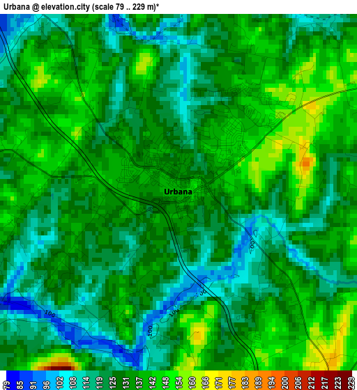
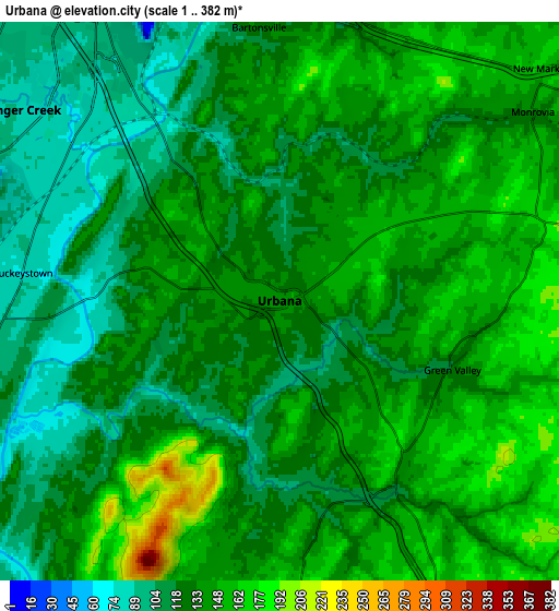
Below is the Elevation map of Urbana, which displays elevation range with different colors. Scale of the first map is from 79 to 229 m (259 to 751 ft) with average elevation of 130.7 meters (=429 ft) [note 1]
These maps also provides idea of topography and contour of this city, they are displayed at different zoom levels. More info about maps, scale and edge coordinates you can find below images.
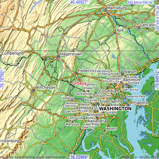
| \ | Map #1 | Map #2 | Topo.Map |
| Scale [m] | 79..229 m | 1..382 m | × |
| Scale [ft] | 259..751 ft | 3..1253 ft | × |
| Average | 130.7 m = 429 ft | 133.7 m = 439 ft | × |
| Width | 7.56 km = 4.7 mi | 15.12 km = 9.4 mi | 241.9 km = 150.3 mi |
| Height | 7.56 km = 4.7 mi | 15.12 km = 9.4 mi | 241.9 km = 150.3 mi |
| ↑Max Latitude | 39.359926° | 39.393895° | 40.40527° |
| Latitude at center | 39.32594° | 39.32594° | 39.32594° |
| ↓Min Latitude | 39.291938° | 39.257919° | 38.22969° |
| ← Min Longitude | -77.395315° | -77.439261° | -78.75762° |
| Longitude center | -77.35137° | -77.35137° | -77.35137° |
| →Max Longitude | -77.307425° | -77.263479° | -75.94512° |
Nearby cities:
Cities around Urbana sort by population:
• Frederick elevation 90 m
11.1 km,  332°
332°
• Ballenger Creek 90 m
8.9 km,  305°
305°
• Damascus 256 m
13.4 km,  108°
108°
• Clarksburg 206 m
11.5 km,  147°
147°
• Green Valley 120 m
5 km, 111°
• Spring Ridge 111 m
8.4 km,  359°
359°
• Clover Hill 111 m
15.9 km,  335°
335°
• Braddock Heights 281 m
16.7 km, 308°
• Adamstown 94 m
10.7 km,  261°
261°
• Jefferson 174 m
16 km,  284°
284°
• Bartonsville 124 m
7.4 km, 355°
• Buckeystown 87 m
7 km, 278°
Multilingual:
 En español:
Urbana elevación 141 m.
 En France:
Urbana élévation 141 m.


Sources and notes:
- [note 1] Map square and city borders are not equal. Map elevation data is calculated only from area inside that square.
- [src 1] Elevation data from geonames database provided with same terms of usage.
- [src 2] The elevation map of Urbana is generated using elevation data from NASA's 3 arcsec (90m) resolution SRTM data.
- [src 3] Base (background) map © OpenStreetMap contributors tiles are generated by Geofabrik and OpenTopoMap.
Copyright & License:
This Urbana Elevation Map is licensed under CC BY-SA. You may reuse any part from this page, if you give a proper credit by linking to this URL:
 More info on terms of use page.