South Bel Air elevation
South Bel Air (Maryland, Harford County), United States elevation is 115 meters and South Bel Air elevation in feet is 377 ft above sea level [src 1]. South Bel Air is a section of populated place (feature code) with elevation that is 164 meters (538 ft) smaller than average city elevation in United States.
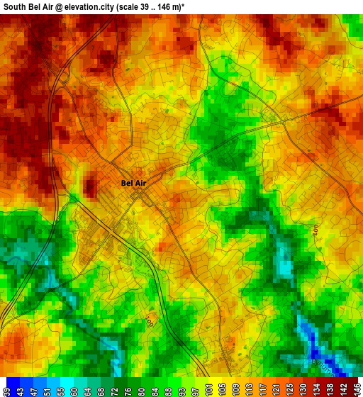
Below is the Elevation map of South Bel Air, which displays elevation range with different colors. Scale of the first map is from 39 to 146 m (128 to 479 ft) with average elevation of 104.7 meters (=344 ft) [note 1]
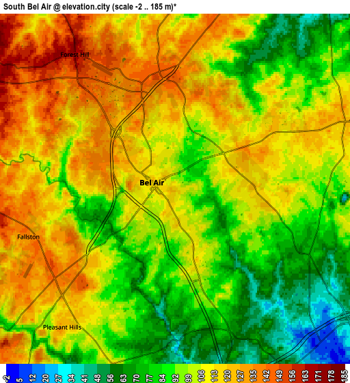
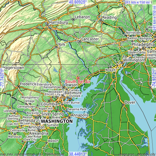
These maps also provides idea of topography and contour of this city, they are displayed at different zoom levels. More info about maps, scale and edge coordinates you can find below images.
| \ | Map #1 | Map #2 | Topo.Map |
| Scale [m] | 39..146 m | -2..185 m | × |
| Scale [ft] | 128..479 ft | -7..607 ft | × |
| Average | 104.7 m = 344 ft | 102.7 m = 337 ft | × |
| Width | 7.54 km = 4.7 mi | 15.07 km = 9.4 mi | 241.2 km = 149.9 mi |
| Height | 7.54 km = 4.7 mi | 15.07 km = 9.4 mi | 241.2 km = 149.9 mi |
| ↑Max Latitude | 39.567045° | 39.600913° | 40.60925° |
| Latitude at center | 39.53316° | 39.53316° | 39.53316° |
| ↓Min Latitude | 39.499259° | 39.465341° | 38.44013° |
| ← Min Longitude | -76.381405° | -76.425351° | -77.74371° |
| Longitude center | -76.33746° | -76.33746° | -76.33746° |
| →Max Longitude | -76.293515° | -76.249569° | -74.93121° |
Nearby cities:
Cities around South Bel Air sort by population:
• Bel Air South elevation 96 m
3.5 km,  154°
154°
• North Bel Air 115 m
1.7 km,  296°
296°
• Bel Air North 136 m
3.9 km,  307°
307°
• Edgewood 16 m
13.3 km,  163°
163°
• Joppatowne 79 m
8.5 km,  190°
190°
• Bel Air 121 m
1 km,  288°
288°
• Fallston 138 m
6.6 km,  251°
251°
• Riverside 22 m
10.6 km,  128°
128°
• Kingsville 83 m
11.6 km,  216°
216°
• Pleasant Hills 125 m
7.7 km, 219°
• Jarrettsville 195 m
14.4 km, 303°
• Perryman 15 m
13.4 km,  121°
121°
Multilingual:
 En español:
South Bel Air elevación 115 m.
 En France:
South Bel Air élévation 115 m.
 Auf Deutsch:
South Bel Air höhe über dem Meeresspiegel ist 115 m.

Sources and notes:
- [note 1] Map square and city borders are not equal. Map elevation data is calculated only from area inside that square.
- [src 1] Elevation data from geonames database provided with same terms of usage.
- [src 2] The elevation map of South Bel Air is generated using elevation data from NASA's 3 arcsec (90m) resolution SRTM data.
- [src 3] Base (background) map © OpenStreetMap contributors tiles are generated by Geofabrik and OpenTopoMap.
Copyright & License:
This South Bel Air Elevation Map is licensed under CC BY-SA. You may reuse any part from this page, if you give a proper credit by linking to this URL:
 More info on terms of use page.