Severn elevation
Severn (Maryland, Anne Arundel County), United States elevation is 49 meters and Severn elevation in feet is 161 ft above sea level [src 1]. Severn is a populated place (feature code) with elevation that is 230 meters (755 ft) smaller than average city elevation in United States.
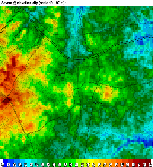
Below is the Elevation map of Severn, which displays elevation range with different colors. Scale of the first map is from 19 to 97 m (62 to 318 ft) with average elevation of 49.7 meters (=163 ft) [note 1]
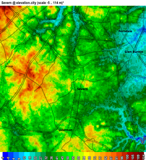
These maps also provides idea of topography and contour of this city, they are displayed at different zoom levels. More info about maps, scale and edge coordinates you can find below images.
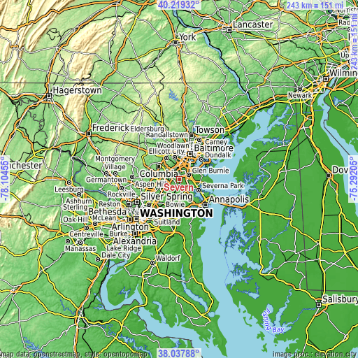
| \ | Map #1 | Map #2 | Topo.Map |
| Scale [m] | 19..97 m | -5..114 m | × |
| Scale [ft] | 62..318 ft | -16..374 ft | × |
| Average | 49.7 m = 163 ft | 46.9 m = 154 ft | × |
| Width | 7.58 km = 4.7 mi | 15.16 km = 9.4 mi | 242.6 km = 150.7 mi |
| Height | 7.58 km = 4.7 mi | 15.16 km = 9.4 mi | 242.5 km = 150.7 mi |
| ↑Max Latitude | 39.171127° | 39.205188° | 40.21932° |
| Latitude at center | 39.13705° | 39.13705° | 39.13705° |
| ↓Min Latitude | 39.102956° | 39.068846° | 38.03788° |
| ← Min Longitude | -76.742245° | -76.786191° | -78.10455° |
| Longitude center | -76.6983° | -76.6983° | -76.6983° |
| →Max Longitude | -76.654355° | -76.610409° | -75.29205° |
Nearby cities:
Cities around Severn sort by population:
• Glen Burnie elevation 19 m
7 km,  65°
65°
• Hanover 32 m
6.6 km,  340°
340°
• Odenton 47 m
5.9 km,  181°
181°
• South Gate 22 m
6.3 km,  98°
98°
• West Elkridge 70 m
8.2 km, 342°
• Ferndale 24 m
7.2 km,  44°
44°
• Elkridge 37 m
8.5 km,  351°
351°
• Linthicum 49 m
8.5 km,  27°
27°
• Fort George G Mead Junction 53 m
7.9 km,  261°
261°
• Fort Meade 57 m
5 km,  230°
230°
• Jessup 70 m
6.8 km,  281°
281°
• Gambrills 47 m
8.3 km,  159°
159°
Multilingual:
 En español:
Severn elevación 49 m.
 En France:
Severn élévation 49 m.


Sources and notes:
- [note 1] Map square and city borders are not equal. Map elevation data is calculated only from area inside that square.
- [src 1] Elevation data from geonames database provided with same terms of usage.
- [src 2] The elevation map of Severn is generated using elevation data from NASA's 3 arcsec (90m) resolution SRTM data.
- [src 3] Base (background) map © OpenStreetMap contributors tiles are generated by Geofabrik and OpenTopoMap.
Copyright & License:
This Severn Elevation Map is licensed under CC BY-SA. You may reuse any part from this page, if you give a proper credit by linking to this URL:
 More info on terms of use page.