Prince Frederick elevation
Prince Frederick (Maryland, Calvert County), United States elevation is 45 meters and Prince Frederick elevation in feet is 148 ft above sea level [src 1]. Prince Frederick is a seat of a second-order administrative division (feature code) with elevation that is 234 meters (768 ft) smaller than average city elevation in United States.
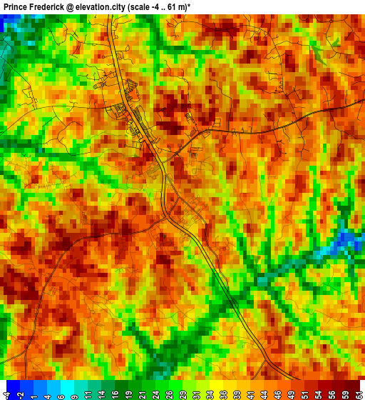
Below is the Elevation map of Prince Frederick, which displays elevation range with different colors. Scale of the first map is from -4 to 61 m (-13 to 200 ft) with average elevation of 38.9 meters (=128 ft) [note 1]
These maps also provides idea of topography and contour of this city, they are displayed at different zoom levels. More info about maps, scale and edge coordinates you can find below images.
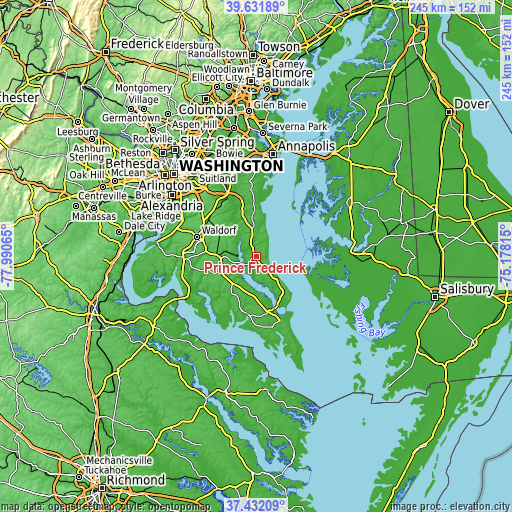
| \ | Map #1 | Topo.Map |
| Scale [m] | -4..61 m | × |
| Scale [ft] | -13..200 ft | × |
| Average | 38.9 m = 128 ft | × |
| Width | 7.64 km = 4.7 mi | 244.6 km = 152 mi |
| Height | 7.64 km = 4.7 mi | 244.6 km = 152 mi |
| ↑Max Latitude | 38.574764° | 39.63189° |
| Latitude at center | 38.5404° | 38.5404° |
| ↓Min Latitude | 38.506019° | 37.43209° |
| ← Min Longitude | -76.628345° | -77.99065° |
| Longitude center | -76.5844° | -76.5844° |
| →Max Longitude | -76.540455° | -75.17815° |
Nearby cities:
Cities around Prince Frederick sort by population:
• Chesapeake Beach elevation 18 m
16.8 km,  14°
14°
• Golden Beach 7 m
10.2 km,  236°
236°
• Huntingtown Town Center 50 m
9.4 km,  342°
342°
• Huntingtown 47 m
8.8 km, 343°
• Dunkirk Town Center 40 m
21 km, 342°
• Hughesville 53 m
17.4 km,  267°
267°
• Owings 25 m
19.8 km,  355°
355°
• North Beach 1 m
19.1 km, 14°
• Lusby 35 m
18.3 km,  142°
142°
• Long Beach 16 m
13.4 km,  131°
131°
• Mechanicsville 55 m
17.6 km,  232°
232°
• Charlotte Hall 54 m
18.1 km,  248°
248°
Multilingual:
 En español:
Prince Frederick elevación 45 m.
 En France:
Prince Frederick élévation 45 m.
 Auf Deutsch:
Prince Frederick höhe über dem Meeresspiegel ist 45 m.

Sources and notes:
- [note 1] Map square and city borders are not equal. Map elevation data is calculated only from area inside that square.
- [src 1] Elevation data from geonames database provided with same terms of usage.
- [src 2] The elevation map of Prince Frederick is generated using elevation data from NASA's 3 arcsec (90m) resolution SRTM data.
- [src 3] Base (background) map © OpenStreetMap contributors tiles are generated by Geofabrik and OpenTopoMap.
Copyright & License:
This Prince Frederick Elevation Map is licensed under CC BY-SA. You may reuse any part from this page, if you give a proper credit by linking to this URL:
 More info on terms of use page.