Middle River elevation
Middle River (Maryland, Baltimore County), United States elevation is 12 meters and Middle River elevation in feet is 39 ft above sea level [src 1]. Middle River is a populated place (feature code) with elevation that is 267 meters (876 ft) smaller than average city elevation in United States.
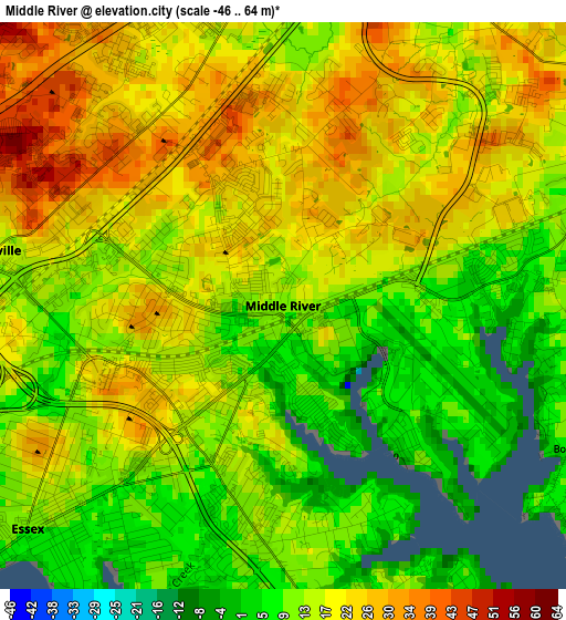
Below is the Elevation map of Middle River, which displays elevation range with different colors. Scale of the first map is from -46 to 64 m (-151 to 210 ft) with average elevation of 17.5 meters (=57 ft) [note 1]
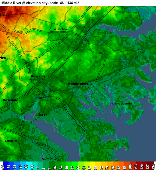
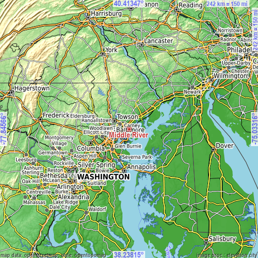
These maps also provides idea of topography and contour of this city, they are displayed at different zoom levels. More info about maps, scale and edge coordinates you can find below images.
| \ | Map #1 | Map #2 | Topo.Map |
| Scale [m] | -46..64 m | -46..134 m | × |
| Scale [ft] | -151..210 ft | -151..440 ft | × |
| Average | 17.5 m = 57 ft | 24.3 m = 80 ft | × |
| Width | 7.56 km = 4.7 mi | 15.12 km = 9.4 mi | 241.9 km = 150.3 mi |
| Height | 7.56 km = 4.7 mi | 15.12 km = 9.4 mi | 241.9 km = 150.3 mi |
| ↑Max Latitude | 39.368252° | 39.402217° | 40.41347° |
| Latitude at center | 39.33427° | 39.33427° | 39.33427° |
| ↓Min Latitude | 39.300272° | 39.266257° | 38.23815° |
| ← Min Longitude | -76.483355° | -76.527301° | -77.84566° |
| Longitude center | -76.43941° | -76.43941° | -76.43941° |
| →Max Longitude | -76.395465° | -76.351519° | -75.03316° |
Nearby cities:
Cities around Middle River sort by population:
• Dundalk elevation 10 m
11.6 km,  216°
216°
• Essex 15 m
4.1 km,  227°
227°
• Parkville 104 m
9.9 km,  299°
299°
• Carney 109 m
9.8 km,  312°
312°
• Perry Hall 77 m
9 km,  346°
346°
• Rosedale 10 m
6.7 km,  256°
256°
• Rossville 11 m
3.5 km,  277°
277°
• Overlea 70 m
7.7 km,  294°
294°
• White Marsh 14 m
5.5 km,  6°
6°
• Edgemere 9 m
10.3 km,  184°
184°
• Bowleys Quarters 20 m
4.2 km,  88°
88°
• Kingsville 83 m
12.9 km, 8°
Multilingual:
 En español:
Middle River elevación 12 m.
 En France:
Middle River élévation 12 m.
 Auf Deutsch:
Middle River höhe über dem Meeresspiegel ist 12 m.

Sources and notes:
- [note 1] Map square and city borders are not equal. Map elevation data is calculated only from area inside that square.
- [src 1] Elevation data from geonames database provided with same terms of usage.
- [src 2] The elevation map of Middle River is generated using elevation data from NASA's 3 arcsec (90m) resolution SRTM data.
- [src 3] Base (background) map © OpenStreetMap contributors tiles are generated by Geofabrik and OpenTopoMap.
Copyright & License:
This Middle River Elevation Map is licensed under CC BY-SA. You may reuse any part from this page, if you give a proper credit by linking to this URL:
 More info on terms of use page.