Landover elevation
Landover (Maryland, Prince George's County), United States elevation is 21 meters and Landover elevation in feet is 69 ft above sea level [src 1]. Landover is a populated place (feature code) with elevation that is 258 meters (846 ft) smaller than average city elevation in United States.
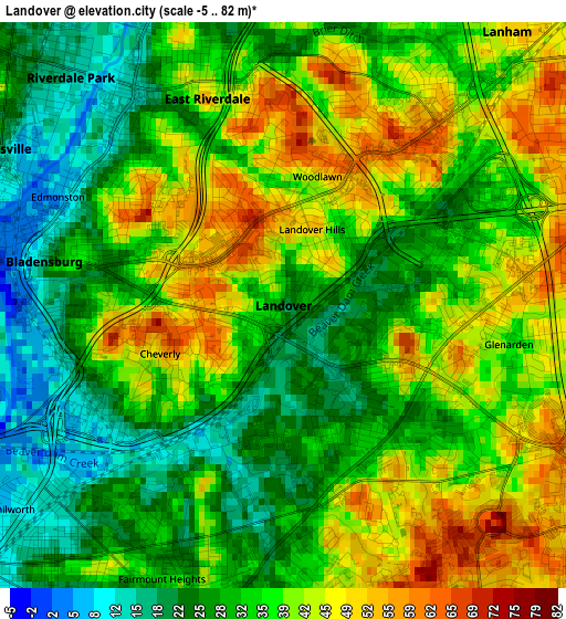
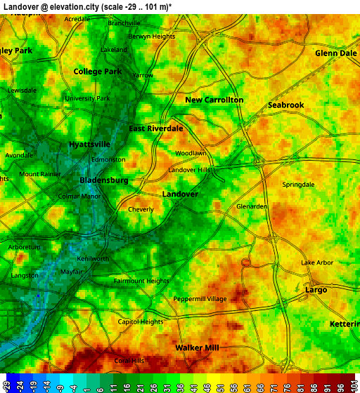
Below is the Elevation map of Landover, which displays elevation range with different colors. Scale of the first map is from -5 to 82 m (-16 to 269 ft) with average elevation of 35.1 meters (=115 ft) [note 1]
These maps also provides idea of topography and contour of this city, they are displayed at different zoom levels. More info about maps, scale and edge coordinates you can find below images.
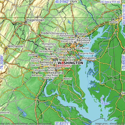
| \ | Map #1 | Map #2 | Topo.Map |
| Scale [m] | -5..82 m | -29..101 m | × |
| Scale [ft] | -16..269 ft | -95..331 ft | × |
| Average | 35.1 m = 115 ft | 40.6 m = 133 ft | × |
| Width | 7.6 km = 4.7 mi | 15.2 km = 9.4 mi | 243.3 km = 151.2 mi |
| Height | 7.6 km = 4.7 mi | 15.2 km = 9.4 mi | 243.2 km = 151.1 mi |
| ↑Max Latitude | 38.968176° | 39.002335° | 40.01942° |
| Latitude at center | 38.934° | 38.934° | 38.934° |
| ↓Min Latitude | 38.899808° | 38.8656° | 37.83171° |
| ← Min Longitude | -76.940585° | -76.984531° | -78.30289° |
| Longitude center | -76.89664° | -76.89664° | -76.89664° |
| →Max Longitude | -76.852695° | -76.808749° | -75.49039° |
Nearby cities:
Cities around Landover sort by population:
• East Riverdale elevation 13 m
3.8 km,  324°
324°
• New Carrollton 29 m
4.2 km,  19°
19°
• Summerfield 64 m
4.1 km,  143°
143°
• Bladensburg 16 m
3.3 km,  280°
280°
• Cheverly 58 m
1.8 km,  248°
248°
• Woodlawn 47 m
1.8 km,  14°
14°
• Glenarden 33 m
3.1 km,  99°
99°
• Seat Pleasant 34 m
4.3 km,  191°
191°
• Landover Hills 54 m
1.1 km, 20°
• Fairmount Heights 33 m
4 km,  203°
203°
• Edmonston 9 m
3.3 km,  295°
295°
• Colmar Manor 11 m
4.3 km,  268°
268°
Multilingual:
 En español:
Landover elevación 21 m.
 En France:
Landover élévation 21 m.


Sources and notes:
- [note 1] Map square and city borders are not equal. Map elevation data is calculated only from area inside that square.
- [src 1] Elevation data from geonames database provided with same terms of usage.
- [src 2] The elevation map of Landover is generated using elevation data from NASA's 3 arcsec (90m) resolution SRTM data.
- [src 3] Base (background) map © OpenStreetMap contributors tiles are generated by Geofabrik and OpenTopoMap.
Copyright & License:
This Landover Elevation Map is licensed under CC BY-SA. You may reuse any part from this page, if you give a proper credit by linking to this URL:
 More info on terms of use page.