Chevy Chase elevation
Chevy Chase (Maryland, Montgomery County), United States elevation is 91 meters and Chevy Chase elevation in feet is 299 ft above sea level [src 1]. Chevy Chase is a populated place (feature code) with elevation that is 188 meters (617 ft) smaller than average city elevation in United States.
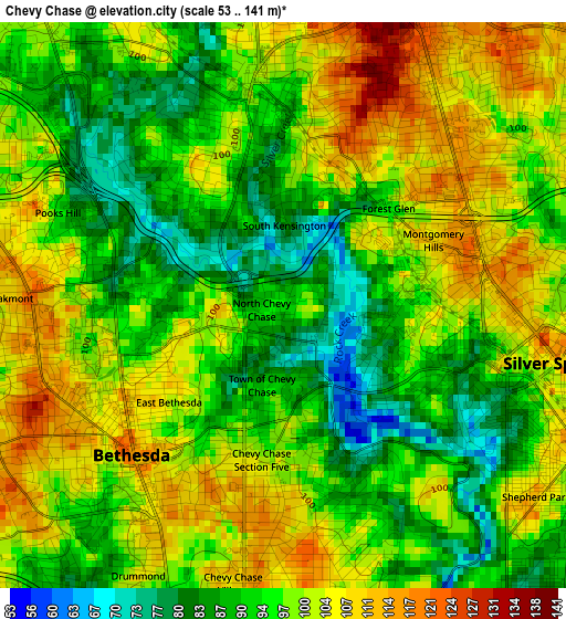
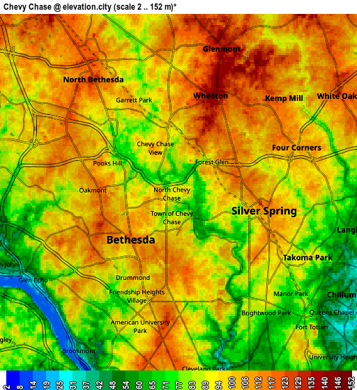
Below is the Elevation map of Chevy Chase, which displays elevation range with different colors. Scale of the first map is from 53 to 141 m (174 to 463 ft) with average elevation of 97.1 meters (=319 ft) [note 1]
These maps also provides idea of topography and contour of this city, they are displayed at different zoom levels. More info about maps, scale and edge coordinates you can find below images.
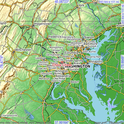
| \ | Map #1 | Map #2 | Topo.Map |
| Scale [m] | 53..141 m | 2..152 m | × |
| Scale [ft] | 174..463 ft | 7..499 ft | × |
| Average | 97.1 m = 319 ft | 93 m = 305 ft | × |
| Width | 7.59 km = 4.7 mi | 15.19 km = 9.4 mi | 243 km = 151 mi |
| Height | 7.59 km = 4.7 mi | 15.19 km = 9.4 mi | 243 km = 151 mi |
| ↑Max Latitude | 39.037012° | 39.071138° | 40.08723° |
| Latitude at center | 39.00287° | 39.00287° | 39.00287° |
| ↓Min Latitude | 38.968711° | 38.934536° | 37.90164° |
| ← Min Longitude | -77.115095° | -77.159041° | -78.4774° |
| Longitude center | -77.07115° | -77.07115° | -77.07115° |
| →Max Longitude | -77.027205° | -76.983259° | -75.6649° |
Nearby cities:
Cities around Chevy Chase sort by population:
• Silver Spring elevation 106 m
4.1 km,  109°
109°
• Bethesda 97 m
3.5 km,  225°
225°
• Wheaton 146 m
4.3 km,  18°
18°
• Chevy Chase 108 m
4.3 km,  176°
176°
• North Kensington 99 m
3.1 km,  357°
357°
• South Kensington 95 m
1.9 km,  336°
336°
• Forest Glen 94 m
1.9 km,  47°
47°
• Friendship Village 105 m
4.7 km,  199°
199°
• Kensington 91 m
2.6 km,  349°
349°
• Chevy Chase Village 108 m
3.8 km,  190°
190°
• Somerset 95 m
4.6 km,  207°
207°
• Garrett Park 96 m
4.4 km,  334°
334°
Multilingual:
 En español:
Chevy Chase elevación 91 m.
 En France:
Chevy Chase élévation 91 m.
 Auf Deutsch:
Chevy Chase höhe über dem Meeresspiegel ist 91 m.

Sources and notes:
- [note 1] Map square and city borders are not equal. Map elevation data is calculated only from area inside that square.
- [src 1] Elevation data from geonames database provided with same terms of usage.
- [src 2] The elevation map of Chevy Chase is generated using elevation data from NASA's 3 arcsec (90m) resolution SRTM data.
- [src 3] Base (background) map © OpenStreetMap contributors tiles are generated by Geofabrik and OpenTopoMap.
Copyright & License:
This Chevy Chase Elevation Map is licensed under CC BY-SA. You may reuse any part from this page, if you give a proper credit by linking to this URL:
 More info on terms of use page.