Calverton elevation
Calverton (Maryland, Prince George's County), United States elevation is 86 meters and Calverton elevation in feet is 282 ft above sea level [src 1]. Calverton is a populated place (feature code) with elevation that is 193 meters (633 ft) smaller than average city elevation in United States.
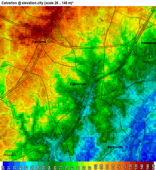
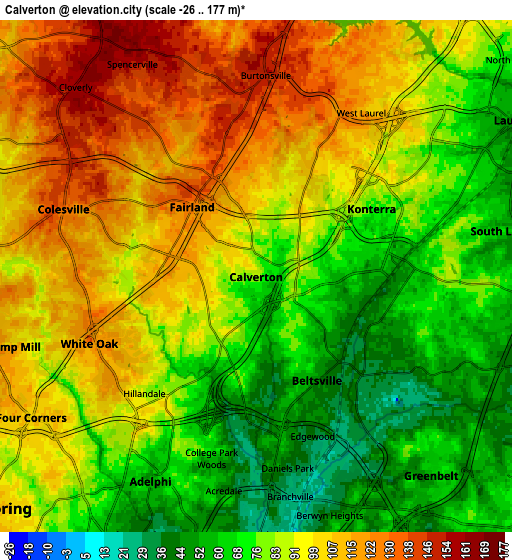
Below is the Elevation map of Calverton, which displays elevation range with different colors. Scale of the first map is from 26 to 149 m (85 to 489 ft) with average elevation of 84.9 meters (=279 ft) [note 1]
These maps also provides idea of topography and contour of this city, they are displayed at different zoom levels. More info about maps, scale and edge coordinates you can find below images.
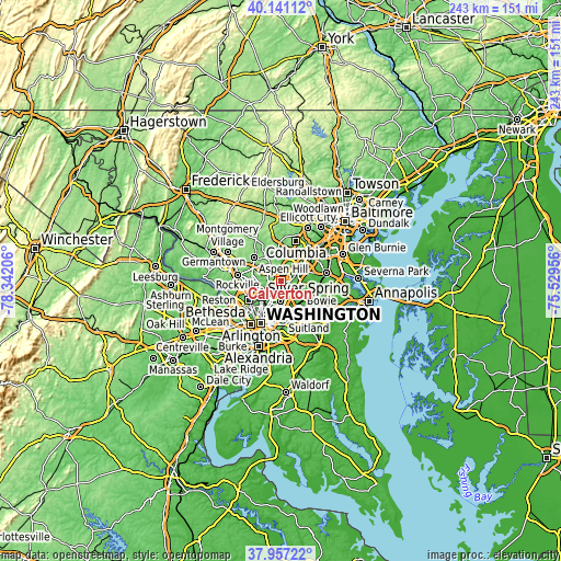
| \ | Map #1 | Map #2 | Topo.Map |
| Scale [m] | 26..149 m | -26..177 m | × |
| Scale [ft] | 85..489 ft | -85..581 ft | × |
| Average | 84.9 m = 279 ft | 88.6 m = 291 ft | × |
| Width | 7.59 km = 4.7 mi | 15.18 km = 9.4 mi | 242.8 km = 150.9 mi |
| Height | 7.59 km = 4.7 mi | 15.18 km = 9.4 mi | 242.8 km = 150.9 mi |
| ↑Max Latitude | 39.091726° | 39.125825° | 40.14112° |
| Latitude at center | 39.05761° | 39.05761° | 39.05761° |
| ↓Min Latitude | 39.023478° | 38.989329° | 37.95722° |
| ← Min Longitude | -76.979755° | -77.023701° | -78.34206° |
| Longitude center | -76.93581° | -76.93581° | -76.93581° |
| →Max Longitude | -76.891865° | -76.847919° | -75.52956° |
Nearby cities:
Cities around Calverton sort by population:
• South Laurel elevation 59 m
7.5 km,  79°
79°
• Fairland 126 m
2.8 km,  317°
317°
• White Oak 134 m
5.3 km,  248°
248°
• Beltsville 43 m
3.5 km,  135°
135°
• Adelphi 56 m
6.8 km,  207°
207°
• Colesville 132 m
6 km,  289°
289°
• Kemp Mill 102 m
7.5 km, 253°
• Burtonsville 150 m
6 km,  2°
2°
• Hillandale 88 m
4.8 km,  223°
223°
• West Laurel 115 m
5.8 km,  32°
32°
• Berwyn Heights 36 m
7.4 km,  162°
162°
• Spencerville 152 m
7.3 km,  329°
329°
Multilingual:
 En español:
Calverton elevación 86 m.
 En France:
Calverton élévation 86 m.
 Auf Deutsch:
Calverton höhe über dem Meeresspiegel ist 86 m.

Sources and notes:
- [note 1] Map square and city borders are not equal. Map elevation data is calculated only from area inside that square.
- [src 1] Elevation data from geonames database provided with same terms of usage.
- [src 2] The elevation map of Calverton is generated using elevation data from NASA's 3 arcsec (90m) resolution SRTM data.
- [src 3] Base (background) map © OpenStreetMap contributors tiles are generated by Geofabrik and OpenTopoMap.
Copyright & License:
This Calverton Elevation Map is licensed under CC BY-SA. You may reuse any part from this page, if you give a proper credit by linking to this URL:
 More info on terms of use page.