Baker elevation
Baker (Louisiana, East Baton Rouge Parish), United States elevation is 28 meters and Baker elevation in feet is 92 ft above sea level [src 1]. Baker is a populated place (feature code) with elevation that is 251 meters (823 ft) smaller than average city elevation in United States.
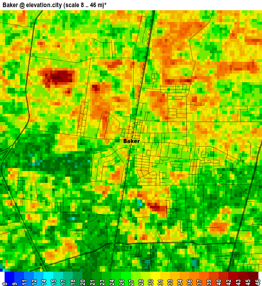
Below is the Elevation map of Baker, which displays elevation range with different colors. Scale of the first map is from 8 to 46 m (26 to 151 ft) with average elevation of 28.4 meters (=93 ft) [note 1]
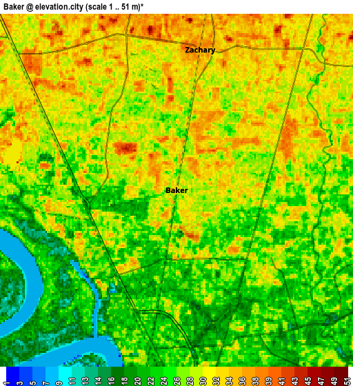
These maps also provides idea of topography and contour of this city, they are displayed at different zoom levels. More info about maps, scale and edge coordinates you can find below images.
| \ | Map #1 | Map #2 | Topo.Map |
| Scale [m] | 8..46 m | 1..51 m | × |
| Scale [ft] | 26..151 ft | 3..167 ft | × |
| Average | 28.4 m = 93 ft | 27.1 m = 89 ft | × |
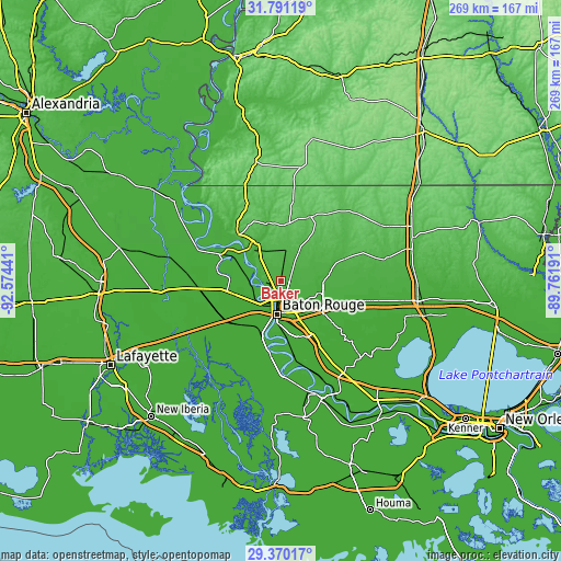
| Width | 8.41 km = 5.2 mi | 16.83 km = 10.5 mi | 269.2 km = 167.3 mi |
| Height | 8.41 km = 5.2 mi | 16.83 km = 10.5 mi | 269.2 km = 167.3 mi |
| ↑Max Latitude | 30.626063° | 30.663871° | 31.79119° |
| Latitude at center | 30.58824° | 30.58824° | 30.58824° |
| ↓Min Latitude | 30.550402° | 30.51255° | 29.37017° |
| ← Min Longitude | -91.212105° | -91.256051° | -92.57441° |
| Longitude center | -91.16816° | -91.16816° | -91.16816° |
| →Max Longitude | -91.124215° | -91.080269° | -89.76191° |
Nearby cities:
Cities around Baker sort by population:
• Baton Rouge elevation 10 m
16.2 km,  186°
186°
• Central 25 m
13.1 km,  106°
106°
• Zachary 34 m
6.8 km,  9°
9°
• Denham Springs 22 m
23.1 km,  119°
119°
• Merrydale 19 m
11.2 km,  149°
149°
• Inniswold 18 m
21.9 km,  158°
158°
• Brownsfield 22 m
6.5 km,  135°
135°
• Monticello 18 m
15.9 km,  133°
133°
• Port Allen 11 m
15.7 km, 194°
• Westminster 17 m
20.9 km, 158°
• Greenwood 22 m
7.6 km, 129°
• Watson 24 m
20.6 km,  93°
93°
Multilingual:
 En español:
Baker elevación 28 m.
 En France:
Baker élévation 28 m.


Sources and notes:
- [note 1] Map square and city borders are not equal. Map elevation data is calculated only from area inside that square.
- [src 1] Elevation data from geonames database provided with same terms of usage.
- [src 2] The elevation map of Baker is generated using elevation data from NASA's 3 arcsec (90m) resolution SRTM data.
- [src 3] Base (background) map © OpenStreetMap contributors tiles are generated by Geofabrik and OpenTopoMap.
Copyright & License:
This Baker Elevation Map is licensed under CC BY-SA. You may reuse any part from this page, if you give a proper credit by linking to this URL:
 More info on terms of use page.