Burlington elevation
Burlington (Kentucky, Boone County), United States elevation is 255 meters and Burlington elevation in feet is 837 ft above sea level [src 1]. Burlington is a seat of a second-order administrative division (feature code) with elevation that is 24 meters (79 ft) smaller than average city elevation in United States.
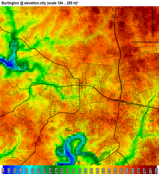
Below is the Elevation map of Burlington, which displays elevation range with different colors. Scale of the first map is from 184 to 285 m (604 to 935 ft) with average elevation of 252.3 meters (=828 ft) [note 1]
These maps also provides idea of topography and contour of this city, they are displayed at different zoom levels. More info about maps, scale and edge coordinates you can find below images.
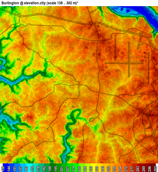
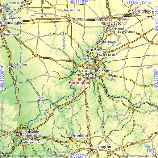
| \ | Map #1 | Map #2 | Topo.Map |
| Scale [m] | 184..285 m | 138..302 m | × |
| Scale [ft] | 604..935 ft | 453..991 ft | × |
| Average | 252.3 m = 828 ft | 247.5 m = 812 ft | × |
| Width | 7.59 km = 4.7 mi | 15.18 km = 9.4 mi | 242.9 km = 150.9 mi |
| Height | 7.59 km = 4.7 mi | 15.18 km = 9.4 mi | 242.9 km = 150.9 mi |
| ↑Max Latitude | 39.06169° | 39.095804° | 40.11153° |
| Latitude at center | 39.02756° | 39.02756° | 39.02756° |
| ↓Min Latitude | 38.993413° | 38.95925° | 37.92671° |
| ← Min Longitude | -84.768055° | -84.812001° | -86.13036° |
| Longitude center | -84.72411° | -84.72411° | -84.72411° |
| →Max Longitude | -84.680165° | -84.636219° | -83.31786° |
Nearby cities:
Cities around Burlington sort by population:
• Florence elevation 282 m
9 km,  110°
110°
• Erlanger 279 m
10.7 km,  96°
96°
• Oakbrook 267 m
4.6 km,  132°
132°
• Edgewood 265 m
12.3 km,  94°
94°
• Elsmere 280 m
10.5 km, 99°
• Francisville 248 m
8.6 km,  359°
359°
• Villa Hills 261 m
12 km,  70°
70°
• Hebron 270 m
4.7 km,  25°
25°
• Union 254 m
9.8 km,  157°
157°
• Delhi Hills 267 m
12 km,  52°
52°
• Crescent Springs 251 m
12.6 km,  77°
77°
• Crestview Hills 263 m
12 km, 90°
Multilingual:
 En español:
Burlington elevación 255 m.
 En France:
Burlington élévation 255 m.
 Auf Deutsch:
Burlington höhe über dem Meeresspiegel ist 255 m.

Sources and notes:
- [note 1] Map square and city borders are not equal. Map elevation data is calculated only from area inside that square.
- [src 1] Elevation data from geonames database provided with same terms of usage.
- [src 2] The elevation map of Burlington is generated using elevation data from NASA's 3 arcsec (90m) resolution SRTM data.
- [src 3] Base (background) map © OpenStreetMap contributors tiles are generated by Geofabrik and OpenTopoMap.
Copyright & License:
This Burlington Elevation Map is licensed under CC BY-SA. You may reuse any part from this page, if you give a proper credit by linking to this URL:
 More info on terms of use page.