Alexandria elevation
Alexandria (Kentucky, Campbell County), United States elevation is 264 meters and Alexandria elevation in feet is 866 ft above sea level [src 1]. Alexandria is a populated place (feature code) with elevation that is 15 meters (49 ft) smaller than average city elevation in United States.
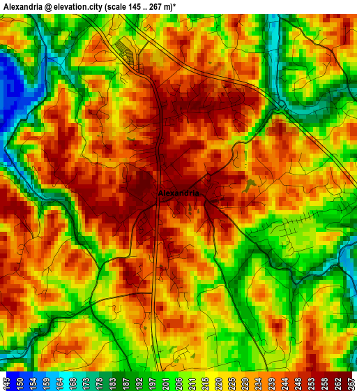
Below is the Elevation map of Alexandria, which displays elevation range with different colors. Scale of the first map is from 145 to 267 m (476 to 876 ft) with average elevation of 222.3 meters (=729 ft) [note 1]
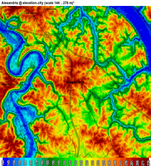
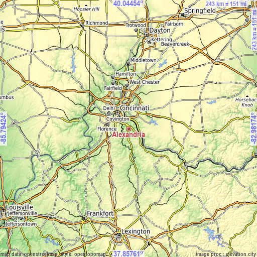
These maps also provides idea of topography and contour of this city, they are displayed at different zoom levels. More info about maps, scale and edge coordinates you can find below images.
| \ | Map #1 | Map #2 | Topo.Map |
| Scale [m] | 145..267 m | 144..276 m | × |
| Scale [ft] | 476..876 ft | 472..906 ft | × |
| Average | 222.3 m = 729 ft | 213.1 m = 699 ft | × |
| Width | 7.6 km = 4.7 mi | 15.2 km = 9.4 mi | 243.2 km = 151.1 mi |
| Height | 7.6 km = 4.7 mi | 15.2 km = 9.4 mi | 243.2 km = 151.1 mi |
| ↑Max Latitude | 38.993673° | 39.02782° | 40.04454° |
| Latitude at center | 38.95951° | 38.95951° | 38.95951° |
| ↓Min Latitude | 38.92533° | 38.891134° | 37.85761° |
| ← Min Longitude | -84.431935° | -84.475881° | -85.79424° |
| Longitude center | -84.38799° | -84.38799° | -84.38799° |
| →Max Longitude | -84.344045° | -84.300099° | -82.98174° |
Nearby cities:
Cities around Alexandria sort by population:
• Independence elevation 274 m
13.6 km,  262°
262°
• Forestville 253 m
13.4 km,  16°
16°
• Highland Heights 260 m
9.9 km,  325°
325°
• Taylor Mill 260 m
10.3 km,  294°
294°
• Cold Spring 262 m
8.2 km, 327°
• Cherry Grove 267 m
13.8 km, 24°
• Salem Heights 229 m
12.5 km,  3°
3°
• Fruit Hill 225 m
13.1 km,  8°
8°
• New Richmond 152 m
9.4 km,  97°
97°
• Claryville 209 m
4.5 km,  188°
188°
• Silver Grove 154 m
8.3 km,  358°
358°
• Ryland Heights 263 m
6.5 km,  268°
268°
Multilingual:
 En español:
Alexandria elevación 264 m.
 En France:
Alexandria élévation 264 m.
 Auf Deutsch:
Alexandria höhe über dem Meeresspiegel ist 264 m.

Sources and notes:
- [note 1] Map square and city borders are not equal. Map elevation data is calculated only from area inside that square.
- [src 1] Elevation data from geonames database provided with same terms of usage.
- [src 2] The elevation map of Alexandria is generated using elevation data from NASA's 3 arcsec (90m) resolution SRTM data.
- [src 3] Base (background) map © OpenStreetMap contributors tiles are generated by Geofabrik and OpenTopoMap.
Copyright & License:
This Alexandria Elevation Map is licensed under CC BY-SA. You may reuse any part from this page, if you give a proper credit by linking to this URL:
 More info on terms of use page.