Topeka elevation
Topeka (Kansas, Shawnee County), United States elevation is 306 meters and Topeka elevation in feet is 1004 ft above sea level [src 1]. Topeka is a seat of a first-order administrative division (feature code) with elevation that is 27 meters (89 ft) bigger than average city elevation in United States.
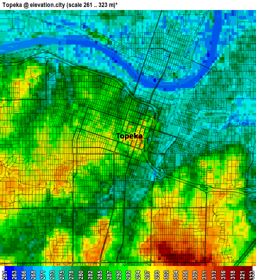
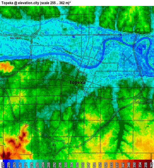
Below is the Elevation map of Topeka, which displays elevation range with different colors. Scale of the first map is from 261 to 323 m (856 to 1060 ft) with average elevation of 284.5 meters (=933 ft) [note 1]
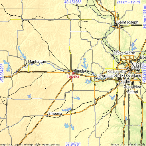
These maps also provides idea of topography and contour of this city, they are displayed at different zoom levels. More info about maps, scale and edge coordinates you can find below images.
| \ | Map #1 | Map #2 | Topo.Map |
| Scale [m] | 261..323 m | 255..362 m | × |
| Scale [ft] | 856..1060 ft | 837..1188 ft | × |
| Average | 284.5 m = 933 ft | 291.8 m = 957 ft | × |
| Width | 7.59 km = 4.7 mi | 15.18 km = 9.4 mi | 242.9 km = 150.9 mi |
| Height | 7.59 km = 4.7 mi | 15.18 km = 9.4 mi | 242.9 km = 150.9 mi |
| ↑Max Latitude | 39.08245° | 39.116554° | 40.13198° |
| Latitude at center | 39.04833° | 39.04833° | 39.04833° |
| ↓Min Latitude | 39.014193° | 38.98004° | 37.9478° |
| ← Min Longitude | -95.721985° | -95.765931° | -97.08429° |
| Longitude center | -95.67804° | -95.67804° | -95.67804° |
| →Max Longitude | -95.634095° | -95.590149° | -94.27179° |
Nearby cities:
Cities around Topeka sort by population:
• Lawrence elevation 267 m
39.2 km,  102°
102°
• Holton 340 m
46.6 km,  353°
353°
• Osage City 332 m
47.8 km,  195°
195°
• Saint Marys 297 m
37.6 km,  295°
295°
• Silver Lake 284 m
16.8 km,  291°
291°
• Carbondale 346 m
25.6 km,  182°
182°
• Auburn 335 m
19.8 km,  217°
217°
• Valley Falls 295 m
37.8 km,  29°
29°
• Rossville 287 m
25.6 km, 292°
• Oskaloosa 346 m
36.6 km,  59°
59°
• Overbrook 372 m
31.6 km,  160°
160°
• Lyndon 320 m
48.7 km, 180°
Multilingual:
 En español:
Topeka elevación 306 m.
 En France:
Topeka élévation 306 m.


Sources and notes:
- [note 1] Map square and city borders are not equal. Map elevation data is calculated only from area inside that square.
- [src 1] Elevation data from geonames database provided with same terms of usage.
- [src 2] The elevation map of Topeka is generated using elevation data from NASA's 3 arcsec (90m) resolution SRTM data.
- [src 3] Base (background) map © OpenStreetMap contributors tiles are generated by Geofabrik and OpenTopoMap.
Copyright & License:
This Topeka Elevation Map is licensed under CC BY-SA. You may reuse any part from this page, if you give a proper credit by linking to this URL:
 More info on terms of use page.