Louisburg elevation
Louisburg (Kansas, Miami County), United States elevation is 340 meters and Louisburg elevation in feet is 1115 ft above sea level [src 1]. Louisburg is a populated place (feature code) with elevation that is 61 meters (200 ft) bigger than average city elevation in United States.
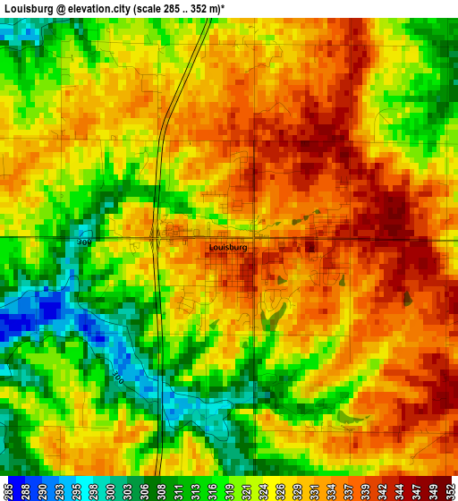
Below is the Elevation map of Louisburg, which displays elevation range with different colors. Scale of the first map is from 285 to 352 m (935 to 1155 ft) with average elevation of 325.3 meters (=1067 ft) [note 1]
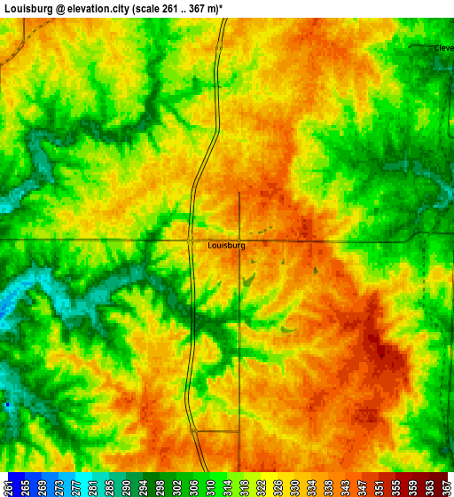
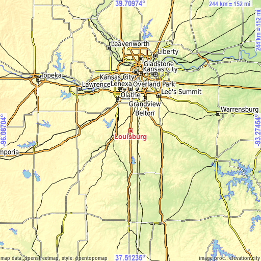
These maps also provides idea of topography and contour of this city, they are displayed at different zoom levels. More info about maps, scale and edge coordinates you can find below images.
| \ | Map #1 | Map #2 | Topo.Map |
| Scale [m] | 285..352 m | 261..367 m | × |
| Scale [ft] | 935..1155 ft | 856..1204 ft | × |
| Average | 325.3 m = 1067 ft | 320.6 m = 1052 ft | × |
| Width | 7.64 km = 4.7 mi | 15.27 km = 9.5 mi | 244.3 km = 151.8 mi |
| Height | 7.64 km = 4.7 mi | 15.27 km = 9.5 mi | 244.3 km = 151.8 mi |
| ↑Max Latitude | 38.653787° | 38.688097° | 39.70974° |
| Latitude at center | 38.61946° | 38.61946° | 38.61946° |
| ↓Min Latitude | 38.585117° | 38.550757° | 37.51235° |
| ← Min Longitude | -94.724735° | -94.768681° | -96.08704° |
| Longitude center | -94.68079° | -94.68079° | -94.68079° |
| →Max Longitude | -94.636845° | -94.592899° | -93.27454° |
Nearby cities:
Cities around Louisburg sort by population:
• Olathe elevation 324 m
31.5 km,  337°
337°
• Grandview 324 m
32.3 km,  23°
23°
• Belton 340 m
25 km,  31°
31°
• Gardner 327 m
30.2 km,  314°
314°
• Raymore 338 m
28.3 km,  44°
44°
• Harrisonville 295 m
29.1 km,  82°
82°
• Spring Hill 331 m
18.6 km,  317°
317°
• Paola 284 m
18 km,  253°
253°
• Peculiar 307 m
22.3 km,  60°
60°
• Osawatomie 268 m
27.1 km,  239°
239°
• La Cygne 260 m
30.8 km,  193°
193°
• New Century, KS 319 m
29.5 km, 319°
Multilingual:
 En español:
Louisburg elevación 340 m.
 En France:
Louisburg élévation 340 m.
 Auf Deutsch:
Louisburg höhe über dem Meeresspiegel ist 340 m.

Sources and notes:
- [note 1] Map square and city borders are not equal. Map elevation data is calculated only from area inside that square.
- [src 1] Elevation data from geonames database provided with same terms of usage.
- [src 2] The elevation map of Louisburg is generated using elevation data from NASA's 3 arcsec (90m) resolution SRTM data.
- [src 3] Base (background) map © OpenStreetMap contributors tiles are generated by Geofabrik and OpenTopoMap.
Copyright & License:
This Louisburg Elevation Map is licensed under CC BY-SA. You may reuse any part from this page, if you give a proper credit by linking to this URL:
 More info on terms of use page.